


- 1973 (MSS) [4.8 MB JPEG]
- 2001 (ASTER) [6.8 MB JPEG]
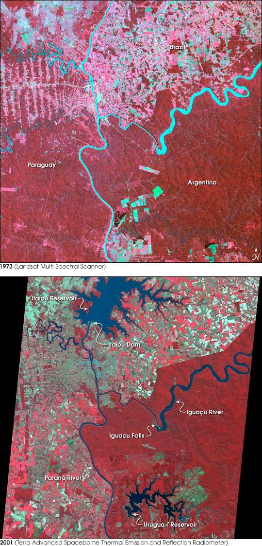
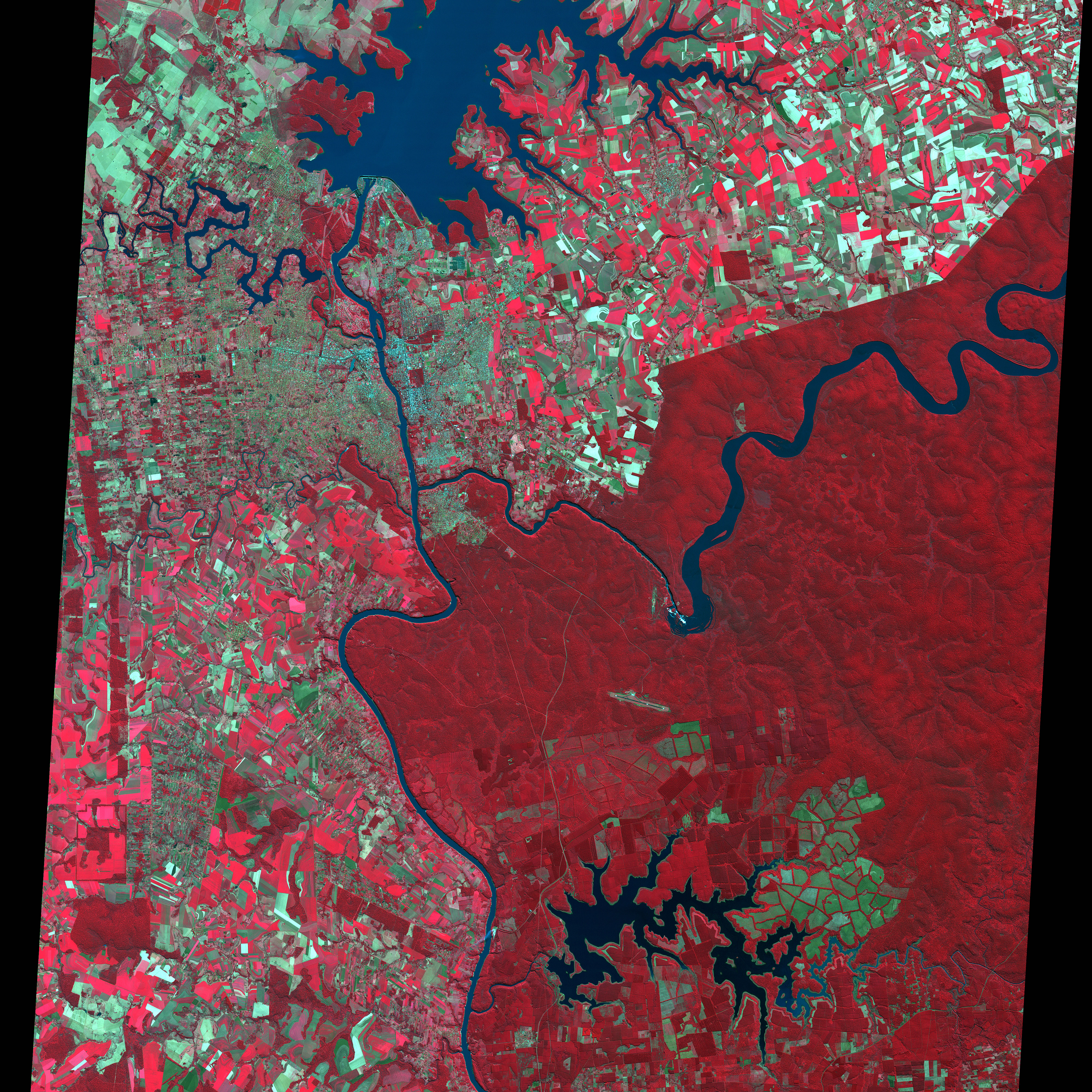
Iguaçu Falls is one of the wonders of the world. After flowing westward through southern Brazil, the Iguaçu River crashes over the rim of the Paraná Plateau in a broad crescent interlaced with tree-covered islets (see large image for details). Some of the falls plunge hundreds of feet straight down to the valley below, while others cascade down in a series of smaller steps. The river then joins the south-flowing Paraná.
The immediate surrounding area of Brazil (upper right), Argentina (bottom right), and Paraguay (left) was once native forest and grasslands, and both Argentina and Brazil have set aside land near the Falls as National Parks. The effect of differing land use policies can be clearly seen by comparing the 1973 Landsat MSS scene with the August 2001 scene from the Advanced Spaceborne Thermal Emission and Reflection Radiometer (ASTER) on the Terra satellite. Both scenes use a combination of infrared and visible wavelength data to contrast vegetation (red), water (blue), and bare ground (greens and whites).
Paraguay has permitted complete development of the land. In 1973, nearly the entire area west of the Paraná River, which runs vertically through the center of the scene, was vegetated; in 2001, nearly all the land appears to be under human development, with a patchwork of cleared and vegetated areas.
In Brazil, a sharp line between solid vegetation and developed lands to the north marks the boundary of the National Park. It's interesting to note that in 1973, there were some cleared areas near the Iguaçu River northeast of the falls that have since regrown. Meanwhile to the north, a huge lake has been created from a dam on the Paraná, and development has grown up all around it.
In the Misiones Province of northeast Argentina, development is considerably more modest than Paraguay, though it too shows a new reservoir. To the northeast of the reservoir, patches of terraced-looking bare ground appear green in this color combination because they are rich with iron, which would appear reddish in a natural-color image. This region of Argentina is home to some of the last remaining tracts of a tropical ecosystem called the Atlantic Forest, a tropical rainforest that is distinct from the Amazon and that once stretched along most of Brazil’s Atlantic Coast and inland several hundred kilometers.
Although they are oriented a bit differently here, and were acquired at two different spatial resolutions, the two scenes show the same region. The ASTER scene has been resampled to 30-meter resolution to reduce the file size. ASTER is one of five sensors aboard NASA’s Terra satellite. ASTER serves as the mission’s “zoom lens,” or high-resolution sensor, acquiring data at up to 15 meters per pixel.
References & Resources
Image courtesy NASA/GSFC/MITI/ERSDAC/JAROS, and U.S./Japan ASTER Science Team


