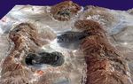
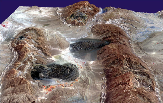
In southern Iran, the collision between the Asian landmass and the Arabian platform has folded rocks and pushed up the rugged Zagros Mountains. In places, underlying deposits of salt have ascended in fluid-like plumes. Some of these plumes have pushed through the rock above, like toothpaste from a tube, and they are now visible as darkish irregular patches. This image shows a few of over 200 similar features—called diapirs, or salt plugs—that are scattered about this part of the Zagros Mountains.
Gravity has caused the salt to flow like glaciers into adjacent valleys. The resulting tongue-shaped bodies are more than 5 kilometers long, with repeating bow-shaped ridges separated by crevasse-like gullies and with steep sides and fronts. The darker tones are due to clays brought up with the salt, as well as the probable accumulation of airborne dust. This ASTER perspective view was created by draping a band 3-2-1 (RGB) image over an ASTER-derived Digital Elevation Model (2x vertical exaggeration), and was acquired on August 10, 2001.
References & Resources
Image courtesy NASA/GSFC/MITI/ERSDAC/JAROS, and U.S./Japan ASTER Science Team