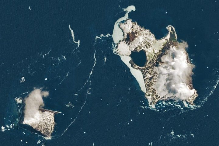


On February 2, 1775, during Captain James Cook’s second Pacific voyage, the explorer laid eyes on two rugged volcanic islands in the South Atlantic Ocean. He named the larger one after the Christian holiday Candlemas, the day of its discovery. The smaller one later gained the moniker Vindication, after a 1930 expedition vindicated Cook’s original, though doubted, report that two closely spaced islands existed there.
The specks of land are part of the South Sandwich Islands—a chain so far-flung that one would have to sail more than 1,600 kilometers (1,000 miles) to reach them from South America or Antarctica. The area is as cloudy as it is remote. This image, acquired with the OLI-2 (Operational Land Imager-2) on Landsat 9 on November 18, 2022, is one of the clearest captured by any Landsat satellite in the past decade. Neighboring Candlemas and Vindication islands appear amid icy waters, their volcanic foundations heavily eroded by snow, ice, and the fitful South Atlantic.
The oddly shaped Candlemas Island initially formed as two separate islands, estimated to have merged several hundred years ago. The larger, southeastern portion is much older and consists of an eroded stratovolcano draped in glacial ice. The northwestern part of the island contains lava flows radiating from cinder cones such as Lucifer Hill. Reports from 1823 and 1911 described dark brown clouds and white steam erupting from this volcanic dome, while sporadic reports throughout the 20th century noted other volcanic activity.
Vindication Island was also built through volcanism, although there are no reports of recent activity there. Instead, erosion appears to be the dominant force shaping the island in modern times. Geologists note it has been “greatly reduced” by the marine environment and is bounded by high cliffs.
The South Sandwich Islands are a string of eleven small volcanic peaks, formed where the South American Plate is subducting beneath the tiny South Sandwich Plate. Although atmospheric activity often hinders clear views of these islands, weather patterns in the area can produce their own spectacles visible to satellites. When conditions are just right, the peaks jutting out of the ocean can disturb passing winds to produce striking bands of wave clouds.
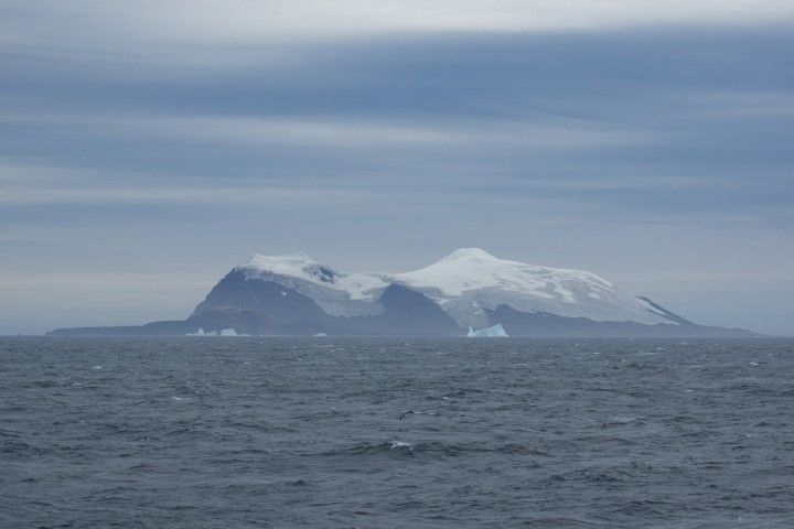
NASA Earth Observatory image by Wanmei Liang, using Landsat data from the U.S. Geological Survey. Photo by Povl Abrahamsen used under the CC BY-NC 2.0 license. Story by Lindsey Doermann.
References & Resources
- Antarctic Place-names Committee Home. Accessed December 4, 2025.
- Baker, P.E. (1978) The South Sandwich Islands: III. Petrology of the Volcanic Rocks. British Antarctic Survey Scientific Reports: No. 93.
- Global Volcanism Program Candlemas Island. Accessed December 4, 2025.
- NASA Earth Observatory (2020, February 27) Sandwiched Wave Clouds. Accessed December 4, 2025.
- Ocean Census (2025, February 25) Fire & Ice: Why explore the Antarctic waters around the South Sandwich Islands? Accessed December 4, 2025.