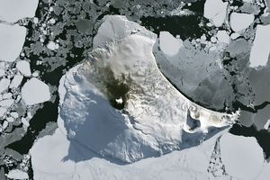


















The South Sandwich Islands are a string of small volcanic peaks in a remote part of the South Atlantic Ocean near Antarctica and South America. The three tallest islands—Saunders, Montagu, and Bristol—approach at least 1000 meters (3,300 feet) above sea level.
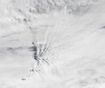
As shown by this natural-color satellite image, that was enough height to disrupt air masses flowing around the islands and to create an interlocking series of mountain-wave clouds. The image was acquired by the Moderate Resolution Imaging Spectroradiometer (MODIS) on NASA’s Terra satellite around 11 a.m. local time on February 5, 2020, as westerly winds blew over the islands.
“Imagine being on a motor boat looking back at triangular, banded patterns forming behind you as wake waves ripple through the water,” said NASA research meteorologist Galina Wind. “This is the same effect, except the mountains are stationary and the surrounding air is rushing by at a good clip. The moving air hits the still mountain in the same way the prow of a moving boat hits still water.”
As air funneled around the islands in February, its temperature and humidity was just right for the crests of the lee waves to rise and cool the air and form clouds. “At the wave crest, you get clouds. At the wave dip, no clouds,” said Wind. “Who knew mountains in the middle of the ocean and motor boats on a lake had so much in common?”
Wave clouds would have formed on the leeward side all of the islands in the image, even though the patterns were not easily visible behind all of them. “For the three northern islands, the wakes are there, but there is another cloud layer on top, partially ruining the view,” said Wind. “Clouds have a habit of being multi-layered.”
You can see more images of islands creating wave clouds here and here. Watch an animation of wave cloud formation by clicking here.
References & Resources
- American Meteorological Society Mountain Wave. Accessed February 27, 2020.
- NASA Earth Observatory (2014, November 2) Wave Clouds behind Amsterdam Island.
- Skybrary Mountain Waves. Accessed February 27, 2020.
NASA Earth Observatory image by Lauren Dauphin, using MODIS data from NASA EOSDIS/LANCE and GIBS/Worldview. Story by Adam Voiland.