


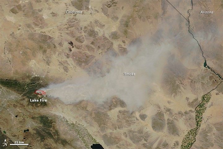
At 11:10 a.m. local time (1810 Universal) on June 18, 2015, the Moderate Resolution Imaging Spectroradiometer (MODIS) aboard the Terra satellite acquired this image of smoke from the Lake fire streaming northeast toward Arizona. The fire was burning in southern California near the San Bernardino National Forest. Red outlines indicate hot spots where MODIS detected unusually warm surface temperatures associated with fire activity.
The Lake fire was reported on the afternoon of June 17, but it expanded rapidly on June 18, growing from about 1,500 acres (600 hectares) in the afternoon to 10,000 acres (4,000 hectares) in the evening. Hot, dry winds have helped fuel the blaze. More than 150 structures, mainly cabins, are threatened by the fire, according to news reports.
References & Resources
- Inciweb (2015, June 19) Lake Fire. Accessed June 19, 2015
- Los Angeles Times (2015, June 18) Wind-driven Lake fire near Big Bear jumps to 10,000 acres; 74-year-old hiker rescued. Accessed June 19, 2015.
- The Desert Sun (2015, June 19) Lake Fire scorches 11,000 acres, 10% contained. Accessed June 19, 2015.
NASA image by Jeff Schmaltz, LANCE/EOSDIS Rapid Response. Caption by Adam Voiland.


