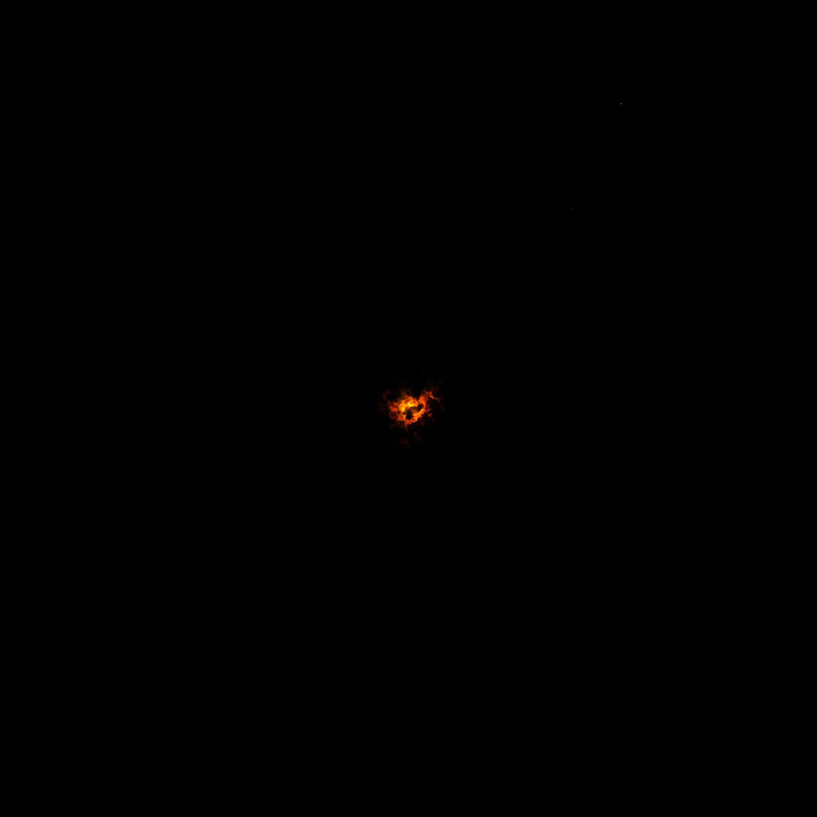
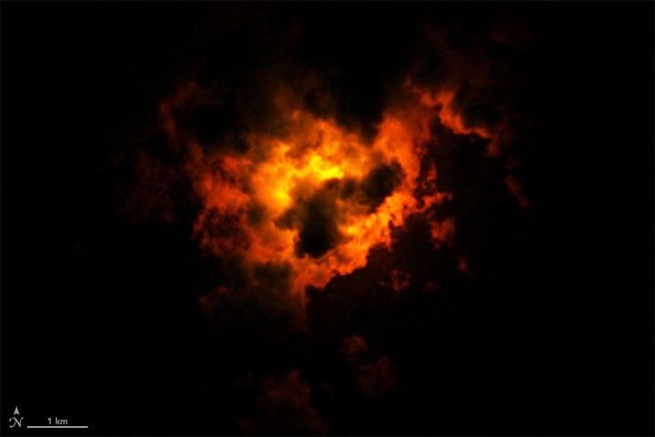
After the start of an eruption near Fagradalsfjall—a shield volcano on Iceland’s Reykjanes peninsula—news reports noted that a river of lava was visible from as far away as the nation’s capital (30 kilometers/20 miles). It could also be seen from a satellite orbiting hundreds of kilometers above the ground.
The Operational Land Imager (OLI) on Landsat 8 acquired this false-color image at 10:25 p.m. local time (22:25 Universal Time) on March 22, 2021, three days after the start of the eruption. The image was made from a combination of shortwave and near-infrared data (bands 7, 6, 5) to reveal how the lava lit up the clouds from below. Extremely hot features, such as lava, can “glow” in the shortwave-infrared part of the spectrum.
While nighttime images like this one might appear ominous, the Icelandic Met Office notes that dangers from this eruption are currently limited to the vicinity of the eruption site and nearby valleys. Unhealthy air from the volcanic gasses was not expected to significantly affect people living elsewhere on the Reykjanes peninsula or in the capital area.
References & Resources
- Icelandic Meteorological Office (2021, March 23) A minor eruption underway. Accessed March 23, 2021.
- NPR (2021, March 19) Volcano Erupts In Southwestern Iceland After Thousands Of Earthquakes. Accessed March 23, 2021.
NASA Earth Observatory image by Joshua Stevens, using Landsat data from the U.S. Geological Survey. Text by Kathryn Hansen.