


April 11, 2014-April 30, 2015
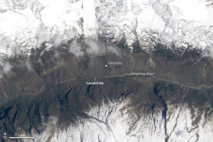
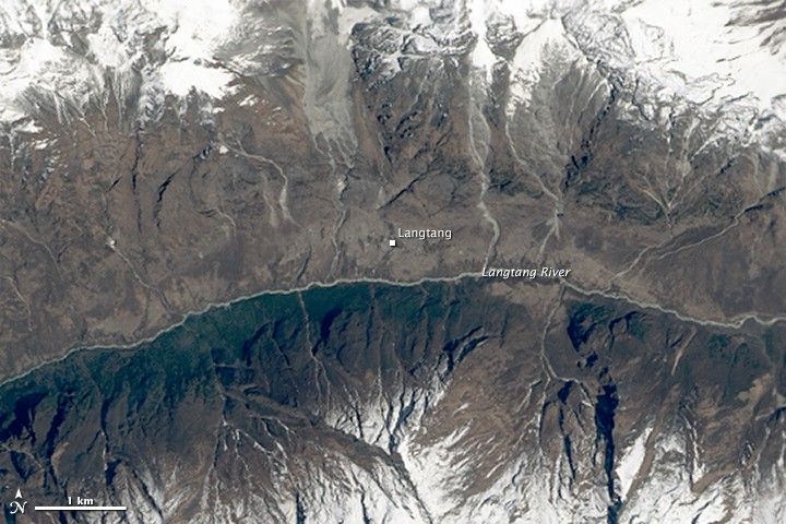
Landslide in Langtang Valley
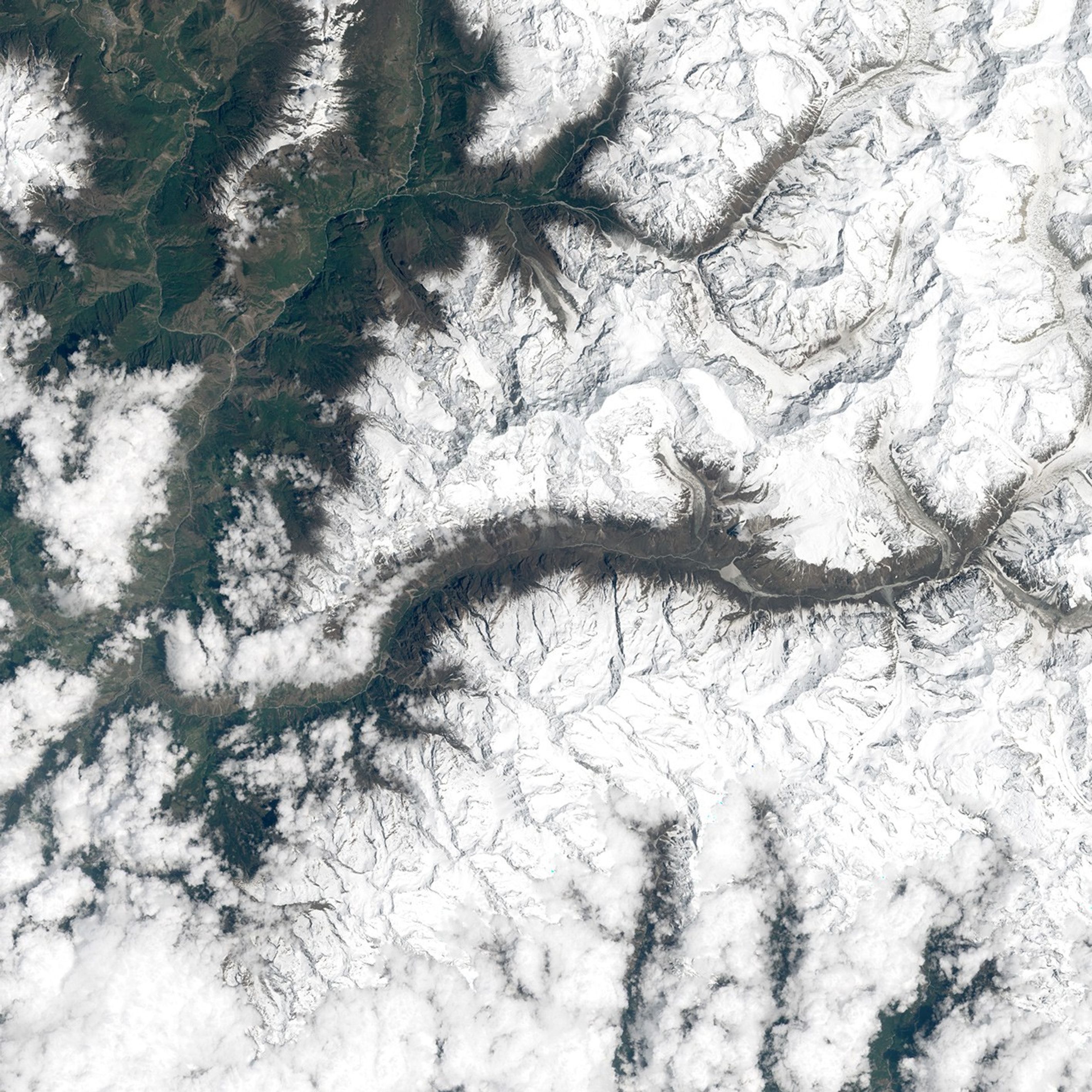
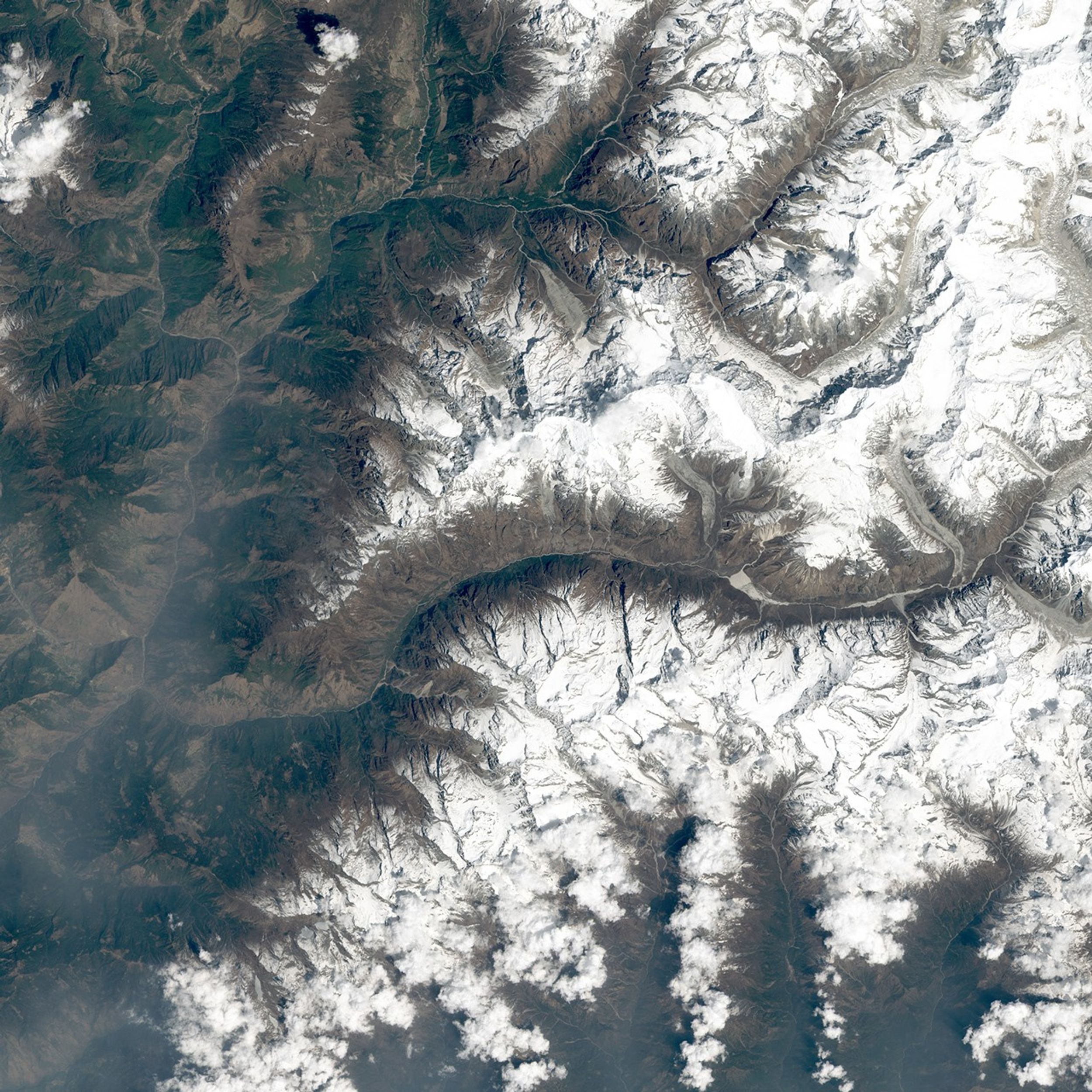
The headline in the Nepali Times said it all: “Langtang is gone.” The small village, which was located along a popular trekking route near the base of Mount Langtang, was completely buried by an avalanche. The ice and rocks were shaken loose by the earthquake that struck central Nepal on April 25, 2015. At least 200 people perished in the disaster.
While cloudy conditions have hampered satellite observations of Nepal since the earthquake, the Operational Land Imager (OLI) on Landsat 8 captured a clear view on April 30, 2015. A mixture of snow, ice, and debris—which originated in snowfields on the slopes above Langtang—slid toward the Langtang River and buried the village.
Walter Immerzeel and Philip Kraaijenbrink, members of a group of volunteer scientists with expertise in remote sensing, were the first to identify and analyze the landslide using Landsat 8. “The Langtang River was completely covered by the deposit that buried Langtang Village, but there is no evidence yet of a lake forming behind the blockage,” the scientists noted on their Mountain Hydrology website. “This may indicate that the water has found its way through the debris, snow, and ice.” This is significant because rivers damned with landslide debris can back up and lead to destructive downstream floods if the natural dam fails.
Turn on the image comparison tool to see the landslide debris cover Langtang and the Langtang River.
References & Resources
- Barnett R. (2015, April 29) Nepal Quake: Report on situation in Langtang, April 28, from Austin Lord. Accessed May 1, 2015.
- Mountain Hydrology Langtang village avalanche. Accessed May 1, 2015.
- Mountain Hydrology Landsat 8 reveals extent of earthquake disaster in Langtang Valley. Accessed May 1, 2015.
- Nepali Times “Langtang is gone.” Accessed May 1, 2015.
- Petley, D. via The Landslide Blog (2015, April 29) Landslides in Langtang during and after the Nepal earthquake. Accessed May 1, 2015.
- Time (2015, April 30) Americans Stranded in Nepal Mountains for 5 Days Tell Their Story of Survival. Accessed May 1, 2015.
NASA Earth Observatory images by Joshua Stevens, using Landsat data from the U.S. Geological Survey . Caption by Adam Voiland. Thanks to Walter Immerzeel and Philip Kraaijenbrink for help in locating the Landsat data.