


![Request for Information – Potential [Placeholder for Prize]](https://assets.science.nasa.gov/dynamicimage/assets/science/psd/solar/2023/09/s/solarsystem_0.jpg?w=1024)


- December 5, 2007 (3.43 MB JPG)
- November 19, 2007 (2.82 MB JPG)
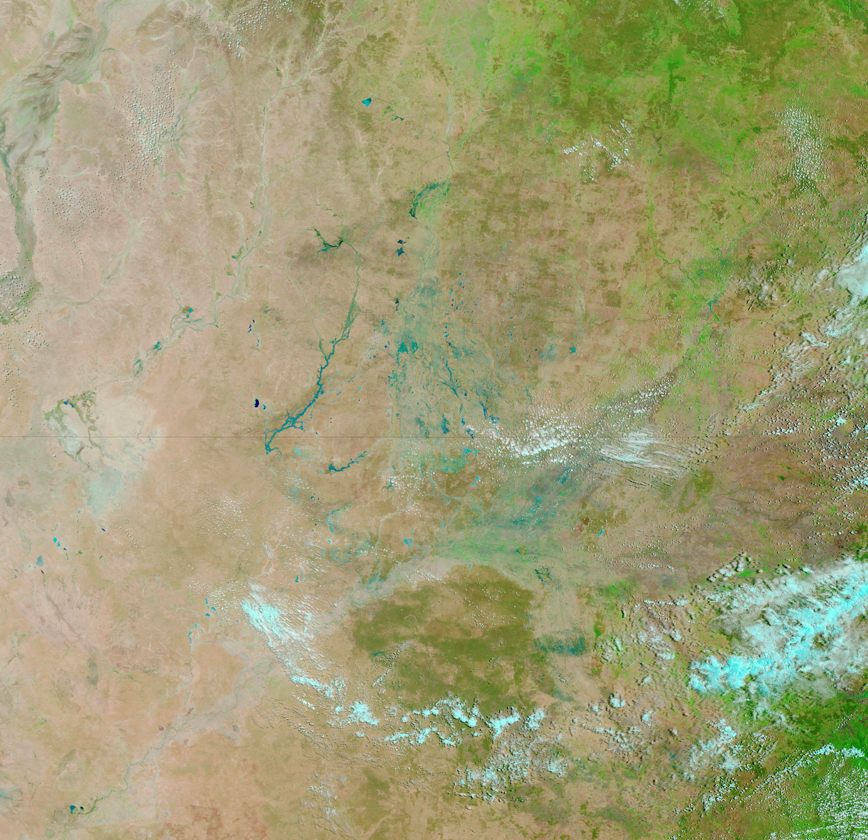
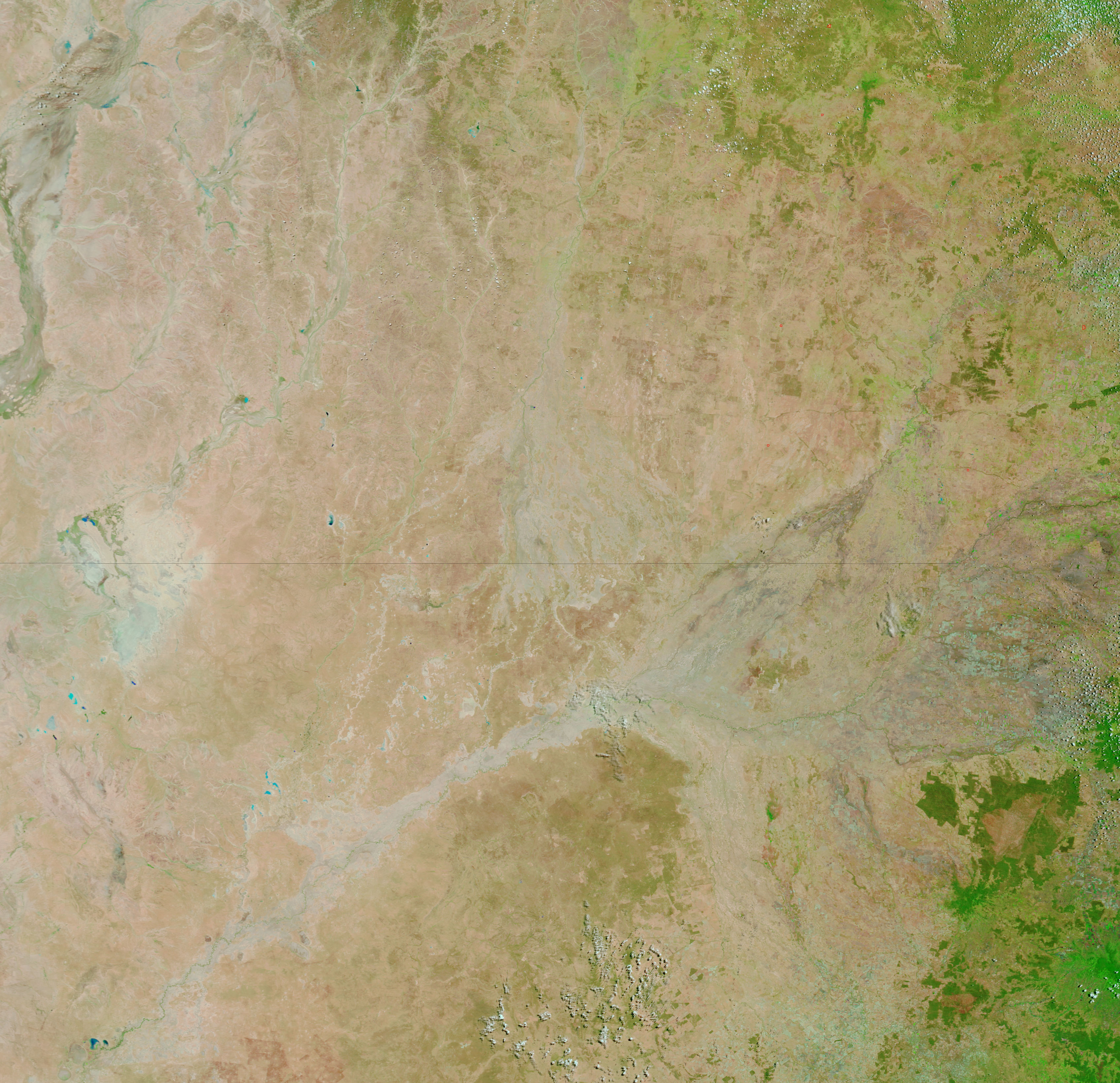
A late spring storm left the interior desert of Australia awash with water in early December 2007. The Moderate Resolution Imaging Spectroradiometer (MODIS) flying on NASA’s Terra satellite captured the top image of southern Queensland and northern New South Wales on December 5, 2007. Terra MODIS took the lower image on November 19, before the storms came through. The turquoise splashed across the desert in the top image is muddy water or water-moistened earth. In this type of image, created with infrared and visible light, water is usually black. In this case, the dirt in the water scatters light, giving the flooded waterways their vibrant blue color. According to the Australian Broadcasting Corporation News, the floods temporarily cut off towns and cities. Spring and summer flooding are common in this part of the Australian Outback.
Daily images of Australia are available from the MODIS Rapid Response System.
References & Resources
NASA images courtesy the MODIS Rapid Response Team at NASA GSFC.


