


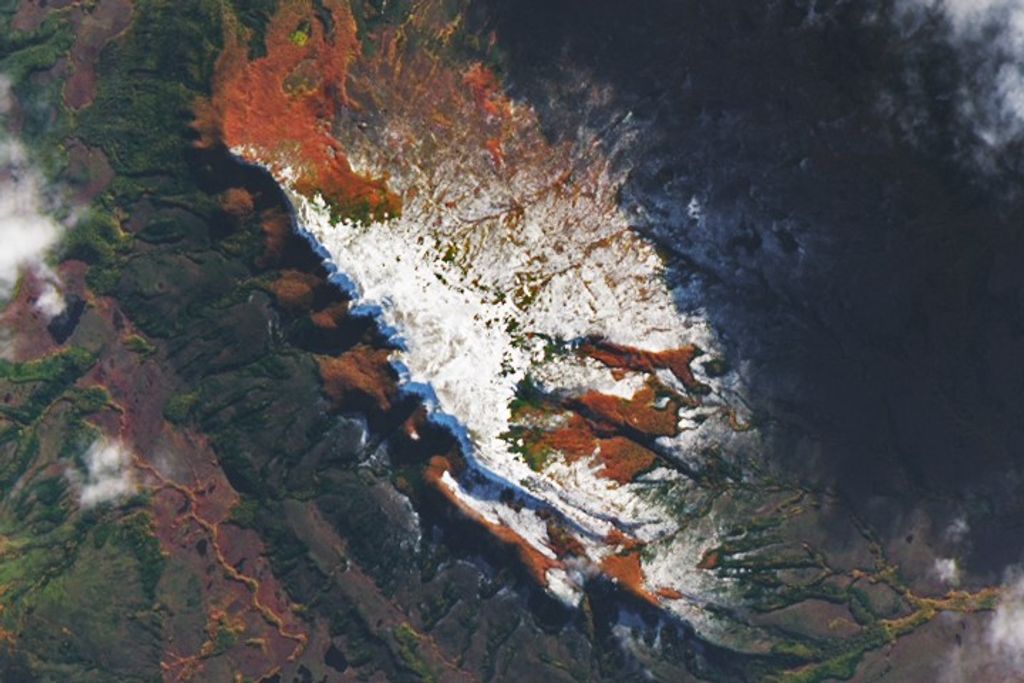


Several wildfires burned in southeastern Montana on August 24, 2011, when the Moderate Resolution Imaging Spectroradiometer (MODIS) on the Terra satellite acquired this image. Lightning ignited all of the fires on August 21 and 22.
The Maverick and the Little Fork Fires are being managed together as the Diamond Complex. Together, they have burned 16,300 acres. To the north, the Mill Fire has burned 6,500 acres of forest and grass after starting on August 22.
The Water Hole and Boss Ribs fires are the largest fires in the Black Springs Complex burning near the community of Lame Deer on the Northern Cheyenne reservation. According to local news reports, the fires have burned an estimated 16,000 and 4,480 acres respectively, forcing temporary evacuations.
These fires and others burning in Montana, Wyoming, and Idaho are sending waves of smoke east. Smoke is visible over Nebraska and Kansas in the large image, which shows a much wider area. The smoke traveled east across the United States and was of aerosols (particles in the atmosphere) as far east as Baltimore.
References & Resources
- Delgado, R. (2011, August 24). Smoke from Rocky Mountain fires yields high AOD and arrives to Baltimore. U.S. Air Quality Smog Blog. Accessed August 25, 2011.
- InciWeb. (2011, August 25). Diamond Complex. Accessed August 25, 2011.
- InciWeb. (2011, August 25). Mill Fire. Accessed August 25, 2011.
- Krotzer, C. (2011, August 25). Crews near Lame Deer create fire lines, face red flag warning. Billings Gazette. Accessed August 25, 2011.
NASA image courtesy Jeff Schmaltz, MODIS Rapid Response Team at NASA GSFC. Caption by Holli Riebeek.


