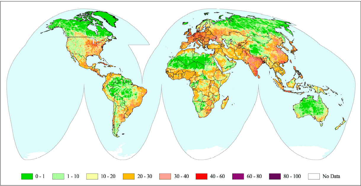
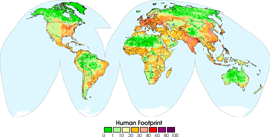
The Human Footprint is a quantitative analysis of human influence across the globe. In this map, human impact is rated on a scale of 0 (minimum) to 100 (maximum) for each terrestrial biome. A score of 1 indicates the least human influence in the given biome. However, because each biome has its own independent scale, a score of 1 in a tropical rainforest might reflect a different level of human activity than in a broadleaf forest.
A collaboration of conservation biologists from the Wildlife Conservation Society, Columbia University researchers and NASA scientists created the map, using geographic information systems to combine global land use and land cover maps with population data. Using these technologies, the collaborators chose four types of data to measure human influence: population density, land transformation, human access, and power infrastructure.
Although increased human population often leads to sharper species and ecosystem declines, the researchers found that land transformation probably poses the single greatest threat to biodiversity, resulting in habitat loss and/or fragmentation. The authors also found that increased human access through roads, rivers, and coastlines can lead to more pollution and invasive species. Both human access and land transformation have been fueled by increased access to fossil fuel and electrical power.
Completion of the human footprint map marks major progress in conservation efforts. A remote sensing researcher remarked, “Each of the supporting data sets used to map the human footprint represents an enormous investment by scientists in that discipline. By bringing those data sets together, the human footprint gives an interesting overview of the regions on Earth where humans have the greatest and the least presence.”
Marc Levy, one of the authors of the human footprint study, said, “The main virtue of the human footprint is that it’s open to improvement. Other researchers can duplicate our results, or substitute improved data.”
For more information and additional maps, read The Human Footprint.
References & Resources
Image courtesy Center for International Earth Science Information Network Last of the Wild Project