


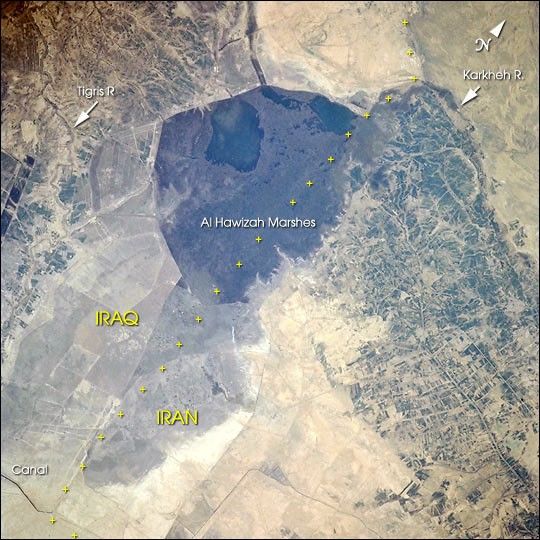
The Al Hawizah Marshes comprise the largest remaining tract of wetlands in the Mesopotamian Marshlands of Iran and Iraq. In the last 10 years, damming and diversion of waters from the Tigris and Euphrates Rivers, and draining of wetlands has led to a loss of 85% of wetlands that once covered about 20,000 square km (7,725 square miles).
This ecological disaster has been studied using Landsat data and summarized in a report by the United Nation Environment Programme’s Division of Early Warning and Assessment, entitledThe Mesopotamian Marshlands: Demise of an Ecosystem. [Print Resolution (13.3 MB)].
This image of the marshes was taken from the International Space Station in March 2001 using a 70 mm camera from 200 nautical miles (370 km) in altitude.
References & Resources
Image ISS001-702-110 was provided by the by the Earth Sciences and Image Analysis Laboratory, Johnson Space Center. Additional images taken by astronauts and cosmonauts can be viewed at the NASA-JSC Gateway to Astronaut Photography of Earth.
None


