


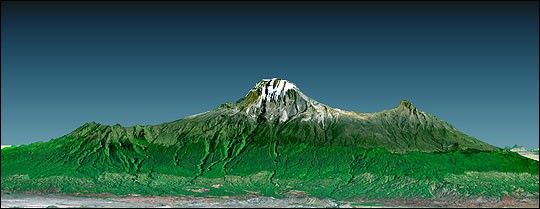
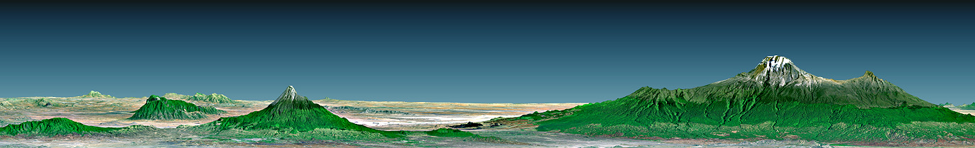
Mount Kilimanjaro (Kilima Njaro or “shining mountain” in Swahili), thehighest point in Africa, reaches 5,895 meters (19,340 feet) above sea level,tall enough to maintain a permanent snow cap despite being just 330 kilometers(210 miles) south of the equator. It is the tallest free-standing mountain onthe Earth’s land surface, rising about 4,600 meters (15,000 feet) above thesurrounding plain. Kilimanjaro is a triple volcano (has three peaks) that lasterupted perhaps more than 100,000 years ago but still exudes volcanic gases. Itis accompanied by about 20 other nearby volcanoes, some of which are seen to thewest (left) in the large image,prominently including Mount Meru, which last eruptedonly about a century ago. The volcanic mountain slopes are commonly fertile andsupport thick forests, while the much drier grasslands of the plains are home toelephants, lions, and other savanna wildlife.
This 3-D perspective view was generated using topographic data from theShuttle Radar Topography Mission (SRTM), a Landsat 7 satellite image, and afalse sky. Topographic expression is vertically exaggerated two times.
Size (large image): View width 124 kilometers (77 miles), View distance 166 kilometers (103miles)
Location: 3 degrees South latitude, 37 degrees East longitude
Orientation: View North, 2 degrees below horizontal, 2 times verticalexaggeration
Image Data: Landsat Bands 3, 2+4, 1 as red, green, blue, respectively.
Original Data Resolution: SRTM 1 arc-second (30 meters or 98 feet), ThematicMapper 30 meters (98 feet)
Date Acquired: February 2000 (SRTM); February 21, 2000 (Landsat 7)
References & Resources
Image Courtesy SRTM Team NASA/JPL/NIMA


