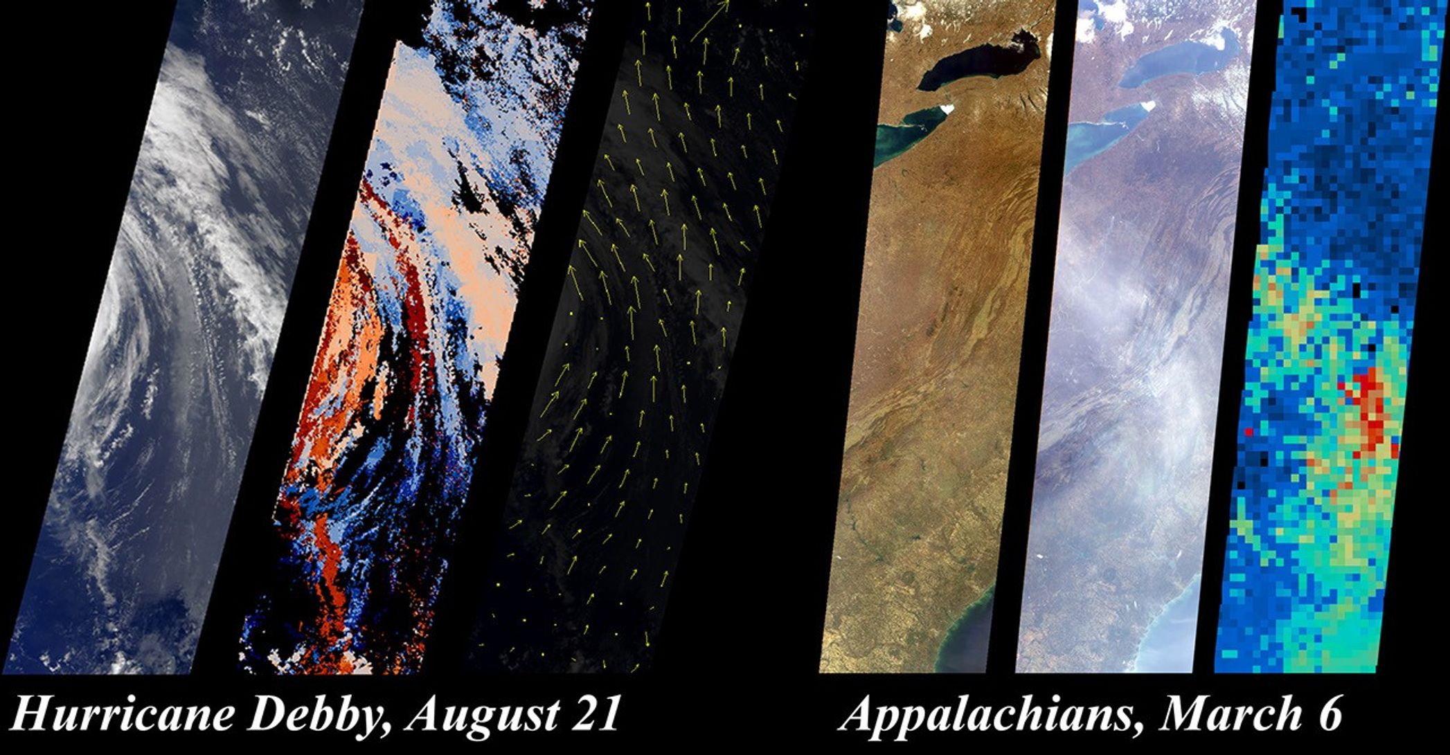
The Multi-angle Imaging Spectroradiometer (MISR) team hasdeveloped new methods for retrieving information aboutclouds, airborne particles, and surface properties that capitalize onthe instrument's unique, multi-angle imaging approach. Thisillustration, based upon results contained in sample products that havejust been publicly released at the Atmospheric Sciences Data Center(ASDC), highlights some of these new capabilities. The ASDC, located atNASA's Langley Research Center, is the primary processing and archivecenter for MISR data (http://eosweb.larc.nasa.gov/).
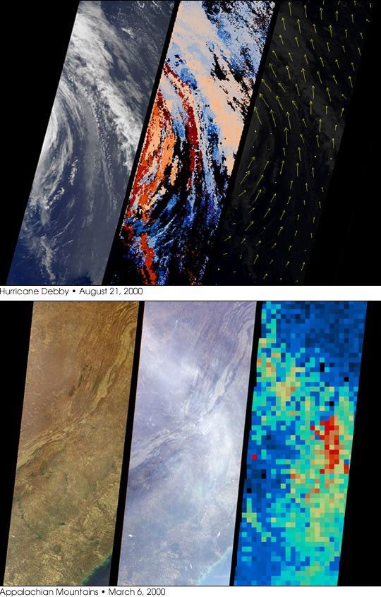
On August 21, 2000 MISR imaged Hurricane Debbyin the Atlantic Ocean. The left panle in the top set is the MISR downward-looking (nadir) view of the storm's eastern edge. The next two panelsshow the results of a new approach that uses MISR's stereoscopicobservations to retrieve cloud heights and winds. In the middle panel ofthis set, gradations from low to high cloud are depicted in shadesranging from blue to red. Since it takes seven minutes for all nine MISRcameras to view any location on Earth, and the clouds moved during thistime, the data also contain information about wind speed and direction.Derived wind vectors, shown in the third panel, reveal Hurricane Debby'scyclonic motion. The highest wind speed measured is nearly 100kilometers/hour. MISR obtains this type of information on a globalbasis, which will help scientists study the relationship between climatechange and the three-dimensional characteristics of clouds.
MISR imaged the eastern United States on March 6, 2000. The first panel in the bottom set is the downward-looking (nadir) view, spanning the Appalachian Mountains. The middle panel is theimage taken by the forward-viewing 70.5-degree camera. At this increasedslant angle, the line-of-sight through the atmosphere is three timeslonger,and a thin haze over the Appalachians is significantly moreapparent. MISR uses this enhanced sensitivity along with the variationof brightness with angle to monitor particulate pollution and to measurehaze properties. The third panel shows the airborne particle (aerosol)amount, derived using new methods that take advantage of MISR'smoderately high spatial resolution at very oblique angles. The aerosolresults are obtained at coarser resolution than the underlying images;gradations from blue to red indicate increasing aerosol abundance. Thesedata indicate how airborne particles are interacting with sunlight, ameasure of their impact on Earth's climate.
References & Resources
Image courtesy NASA/GSFC/JPL, MISR Team