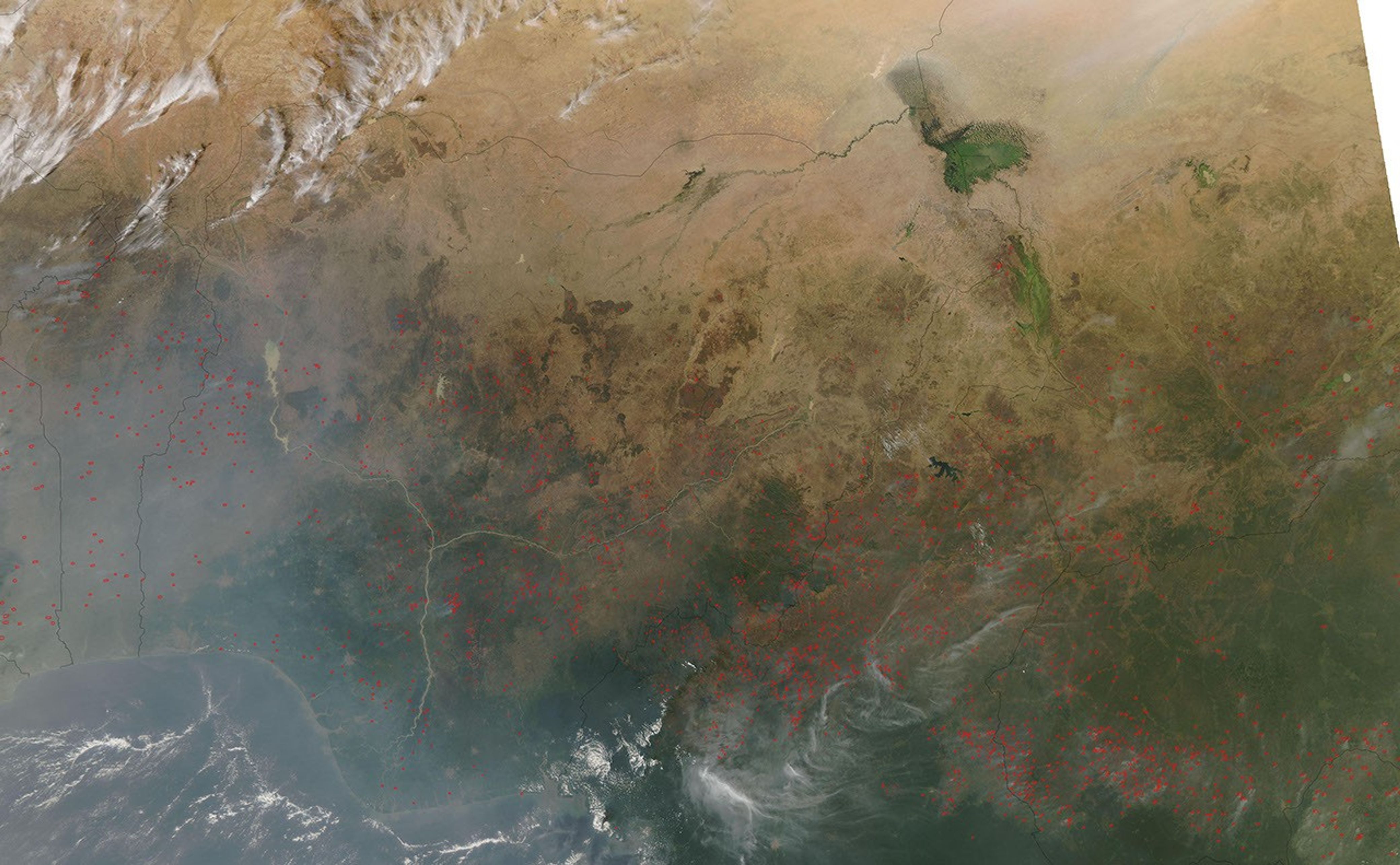


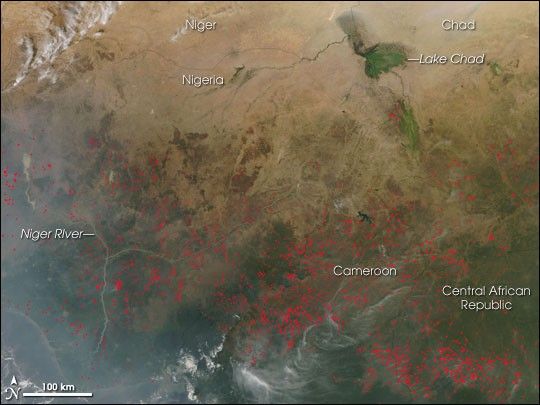
In northern Africa south of the Sahara Desert, the agricultural fire season was clearly underway when the Moderate Resolution Imaging Spectroradiometer (MODIS) on NASA’s Aqua satellite passed overhead on December 4, 2006, and captured this image. Places where MODIS detected actively burning fires are marked with red dots. Hundreds of fires are scattered across Nigeria, Cameroon, and the Central African Republic. People in Africa have been using fire to manage agricultural lands for hundreds, possibly thousands of years, and while the fires may not be immediately hazardous, such large-scale burning can have a strong impact on weather, climate, human health, and natural resources.
The high-resolution image provided above has a spatial resolution of 500 meters per pixel. The MODIS Rapid Response System provides twice-daily images of sub-sections of northern Africa via a clickable map in a variety of resolutions and formats.
References & Resources
NASA image courtesy the MODIS Rapid Response Team, Goddard Space Flight Center