Nyiragongo is an active stratovolcano situated on the Eastern AfricanRift; it is part of Africa’s Virunga Volcanic Chain. In a massiveeruption that occurred on January 17, 2002, Nyiragongo sent a vast plumeof smoke and ash skyward, and three swifly-moving rivers of lavastreaming down its western and eastern flanks. Previous lava flows fromNyiragongo have been observed moving at speeds of up to 40 miles perhour (60 kph). The lava flows from the January 17 eruption destroyedmore than 14 villages in the surrounding countryside, forcing tens ofthousands to flee into the neighboring country of Rwanda.
Within one day the lava ran to the city of Goma, situated onthe northern shore of Lake Kivu about 12 miles (19 km) south ofNyiragongo. The lava cut a 200 foot (60 meter) wide swath right through Goma,setting off many fires, as it ran into Lake Kivu. Goma, the mostheavily populated city in eastern Democratic Republic of Congo, is hometo about 400,000 people. Most of these citizens were forced to flee,while many have begun to return to their homes only to find their homesdestroyed.
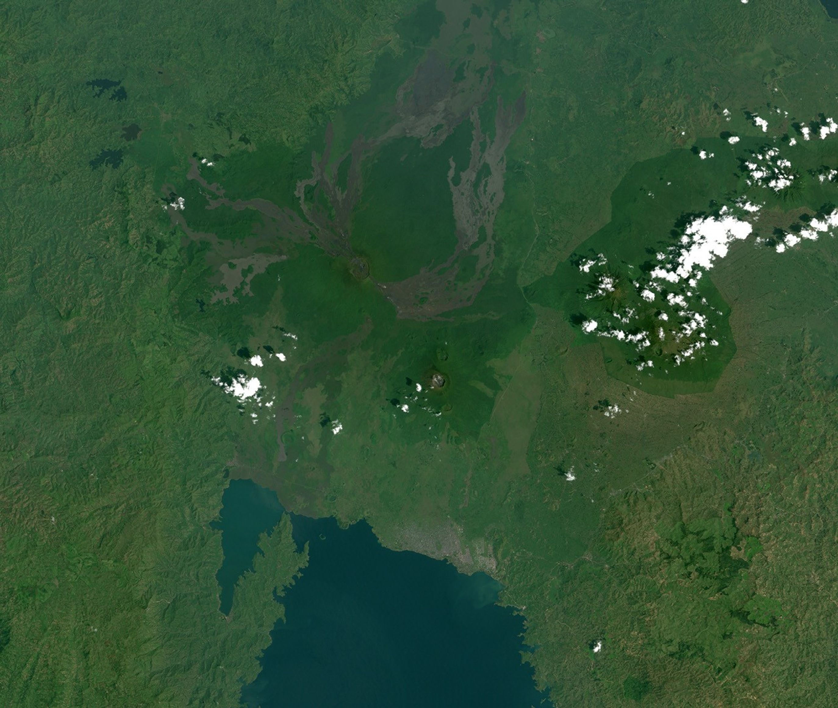
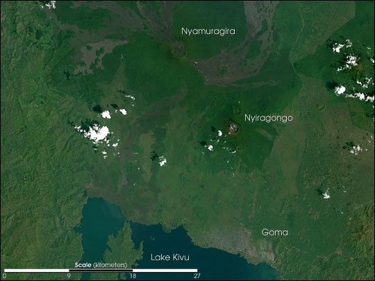
This true-color scene was captured by the Enhanced Thematic MapperPlus (ETM+), flying aboard the Landsat 7 satellite, on December 11,2001, just over a month before the most recent eruption. Nyiragongo’slarge crater is clearly visible in the image. Asrecently as June 1994, there was a large lava lake in the volcano’scrater which had since solidified. The larger Nyamuragira Volcano islocated roughly 13 miles (21 km) to the north of Nyiragongo. Nyamuragira last erupted in February and March 2001. That eruption was also marked by columns of erupted ash and long fluid lavaflows, some of which are apparent in the image as dark greyish swaths radiating away from Nyamuragira. Both peaks are also notorious forreleasing large amounts of sulfur dioxide, which presents another healthhazard to people and animals living in close proximity.
References & Resources
Image by Robert Simmon, based on data supplied by the NASA GSFC Landsat 7 Science Team