


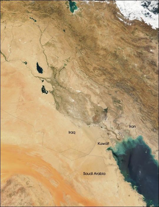
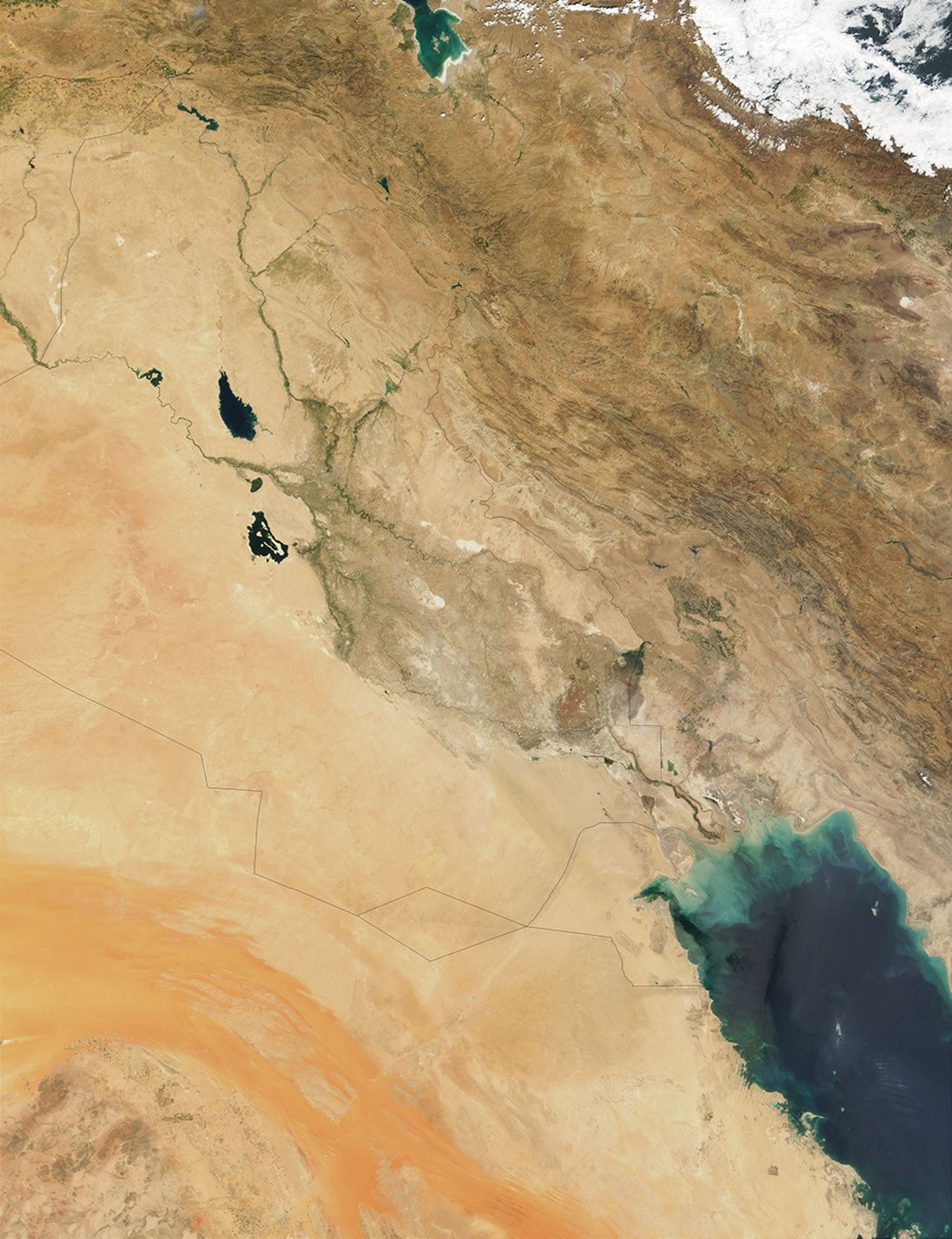
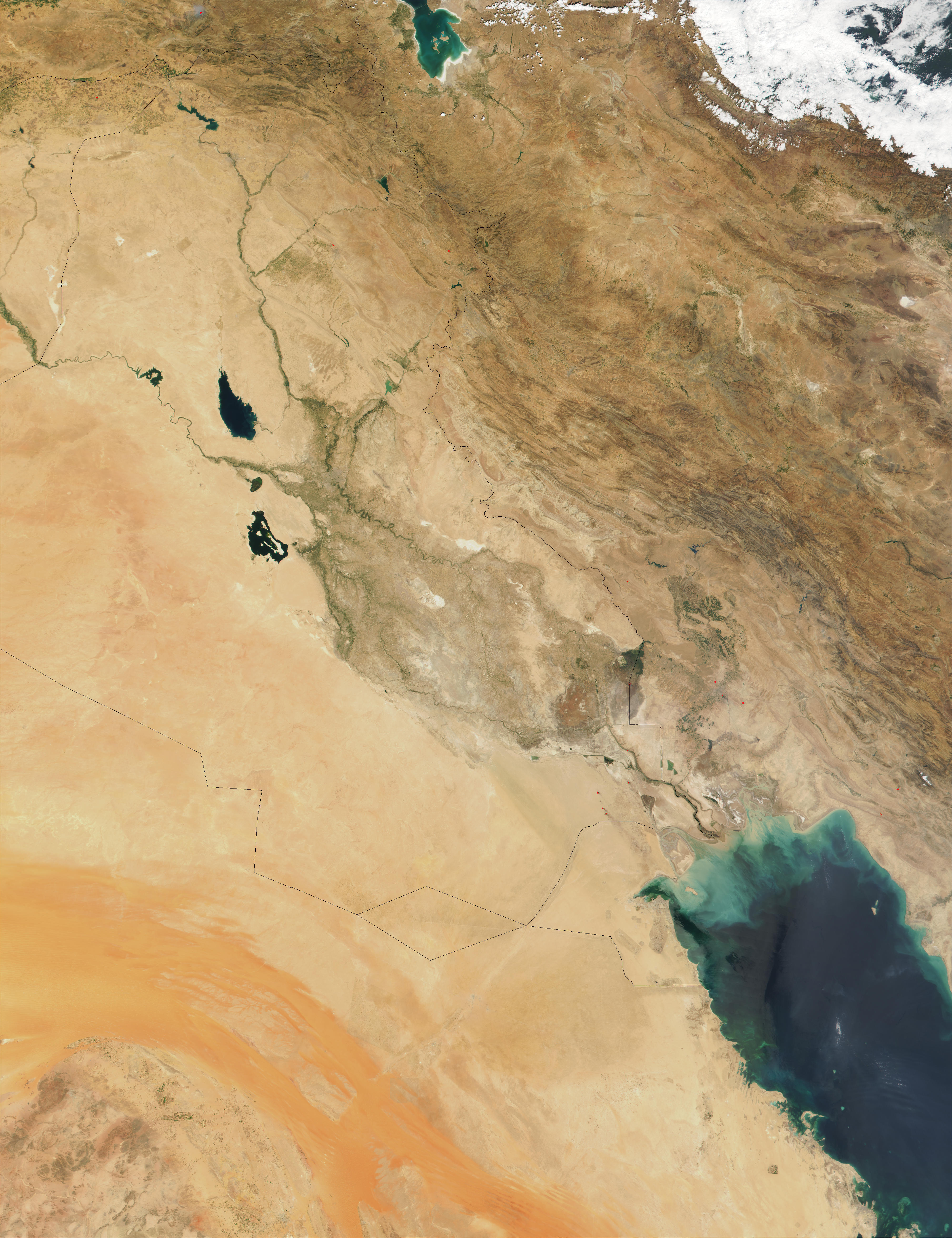
Running through the deserts of Iraq (image center) are the Tigris(right) and Euphrates (left) Rivers. The land between the confluence ofthe two rivers is the culturally, historically, and ecologicallysignificant Mesopotamian Fertile Crescent, situated just southeast ofcenter in this true-color image from NASA’s Moderate-resolutionImaging Spectroradiometer (MODIS), acquired on August 29, 2001. Recent reports estimate that within the pasttwo decades, over 85 percent of the wetlands making up the FertileCrescent have disappeared due to demand for irrigation in theregion.
In the 250-m (full resolution)image, several remarkable features can be seen. Desertsands and sediments are pouring into the Persian Gulf, bottom right,bringing nutrients that have supported a phytoplankton bloom that colorsthe waters of the Gulf bright blue and green. In the upper right, beyond themountainous terrain of northern Iran, the Caspian Sea is banked in byclouds. In the lower left of the image, the reddish-orange sands ofSaudi Arabia’s An Nafud desert stretch eastward and become the AdDahna’, a narrow band of sand mountains also called the River ofSand.
Several manmade features are also apparent. At Iraq’s southeasternborder with Kuwait, burning oil smoke is visible. Crisscrossing thedeserts of southern Iraq and Saudi Arabia are white lines that revealthe location of oil pipelines. The unusual polygonal shapes that appearto the east of the Ad Dahna’ are areas that are protected fromgrazing.
MODIS is one of five sensors flying aboard NASA's Terra satellite.
References & Resources
Image courtesy Jacques Descloitres, MODIS Land Rapid Response Team at NASA GSFC


