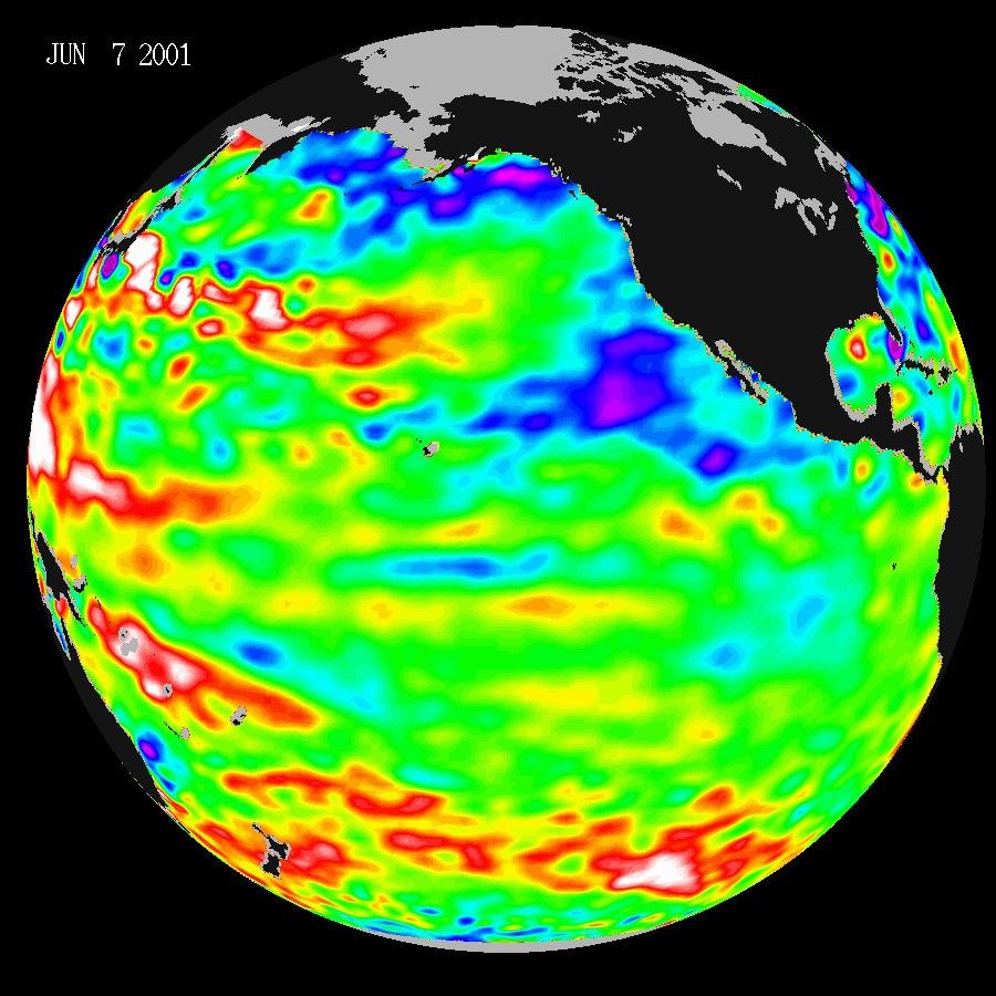
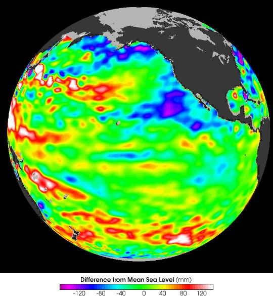
Pacific Decadal OscillationWhile change may be on the way, the Pacific is still dominated by thestrong, larger-than- El Niño/La Niña pattern called the Pacific DecadalOscillation (PDO), according to the latest data from the U.S.-FrenchTOPEX/Poseidon satellite mission, managed by NASA's Jet PropulsionLaboratory, Pasadena, Calif. The PDO is a long-term ocean temperaturefluctuation of the Pacific Ocean that waxes and wanes approximatelyevery 10 to 20 years. "This continuing PDO pattern of the past threeyears signals more of the unusually dry conditions that have afflictedthe North American west coast," said JPL oceanographer Dr. WilliamPatzert.
The data, shown above, were taken during a 10-day collection cycle ending June 11, 2001.Purple and blue indicate lower than normal sea level, green indicates normal sea level, andyellow, red, and white indicate higher than normal sea level.
The new satellite image also shows a pulse ofwarm water traveling toward South America, a reminder that another ElNiño is due in the next year or so. El Niños generally return every twoto seven years; the last one occurred in 1997. This equatorial,eastward-traveling Kelvin wave (a bulge of warm water) is headed towardSouth America at about 140 degrees West longitude. In late July, whenthis wave arrives at the west coast of South America, there should be amodest warming of the eastern Pacific. Kelvin waves, often seen beforean El Niño develops, are triggered by westerly wind bursts (i.e., windsblowing in the opposite direction from the normal easterly trade winds)in the western Pacific. Also, the strength of El Niño's next appearancecould depend on how much the PDO dominates ocean circulation andtemperature patterns over the next few years.
For more information, readPacificRemains Locked in Three-Year-Old Pattern
References & Resources
Image courtesy NASA JPL, based on data from TOPEX/Poseidon