


Today’s story is the answer to the August 2025 puzzler.
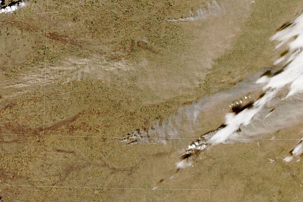
The Rokan River on the Indonesian island of Sumatra flows northeastward for several hundred kilometers from the Barisan Mountains to the Strait of Malacca. Near the river’s mouth, brushstroke-like patterns suggest a tidally active estuary where water and sediment are often in motion.
The OLI (Operational Land Imager) on Landsat 8 captured these images on June 23, 2024. The wide view above shows the northeastern coast of Sumatra along with several islands near the river’s mouth. Particles suspended in the water, such as silt and sand, make the river appear light brown.
Tides and waves are the main factors influencing the distribution of sediment in the estuary. The tidal range here is large, averaging 5 meters (16 feet) around the time of a full Moon, driving powerful currents capable of lifting and moving sediment. The area is also known for its tidal bore—a surge of water that pushes upriver against a current—which can scour the riverbed and carry sediment upstream.
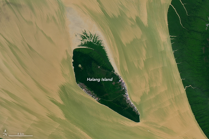
In these images, sediment-laden water appears to be streaming seaward around Halang Island, shown in the detailed image above. Large tidal ranges and tidal bores likely occurred around when these images were acquired, the day after a full Moon.
Over time, this type of tidal activity can change the shape of shorelines. For example, researchers used Landsat images to show that a high rate of accretion along the island’s north side led to the growth of its shoreline.
References & Resources
- Galib, M. and Rifardi (2020) Sedimentation Rate and Sediment Accumulation at the Estuary of Rokan River, Indonesia. ASM Science Journal, 13.
- National Geographic (2023) Tidal Bore. Accessed August 26, 2025.
- Sutikno, S. (2016) Integrated Remote Sensing and GIS for Calculating Shoreline Change in Rokan Estuary. KnE Engineering.
- Wisha, U.J., et al. (2022) Tidal bore generation and transport mechanism in the Rokan River Estuary, Indonesia: Hydro-oceanographic perspectives. Regional Studies in Marine Science, 52, 102309.
NASA Earth Observatory images by Lauren Dauphin, using Landsat data from the U.S. Geological Survey . Story by Kathryn Hansen.


