


The scale and form of many impressive features on Earth’s surface can only be fully appreciated through an overhead view. The astronauts onboard the International Space Station may enjoy the best overhead view of all.
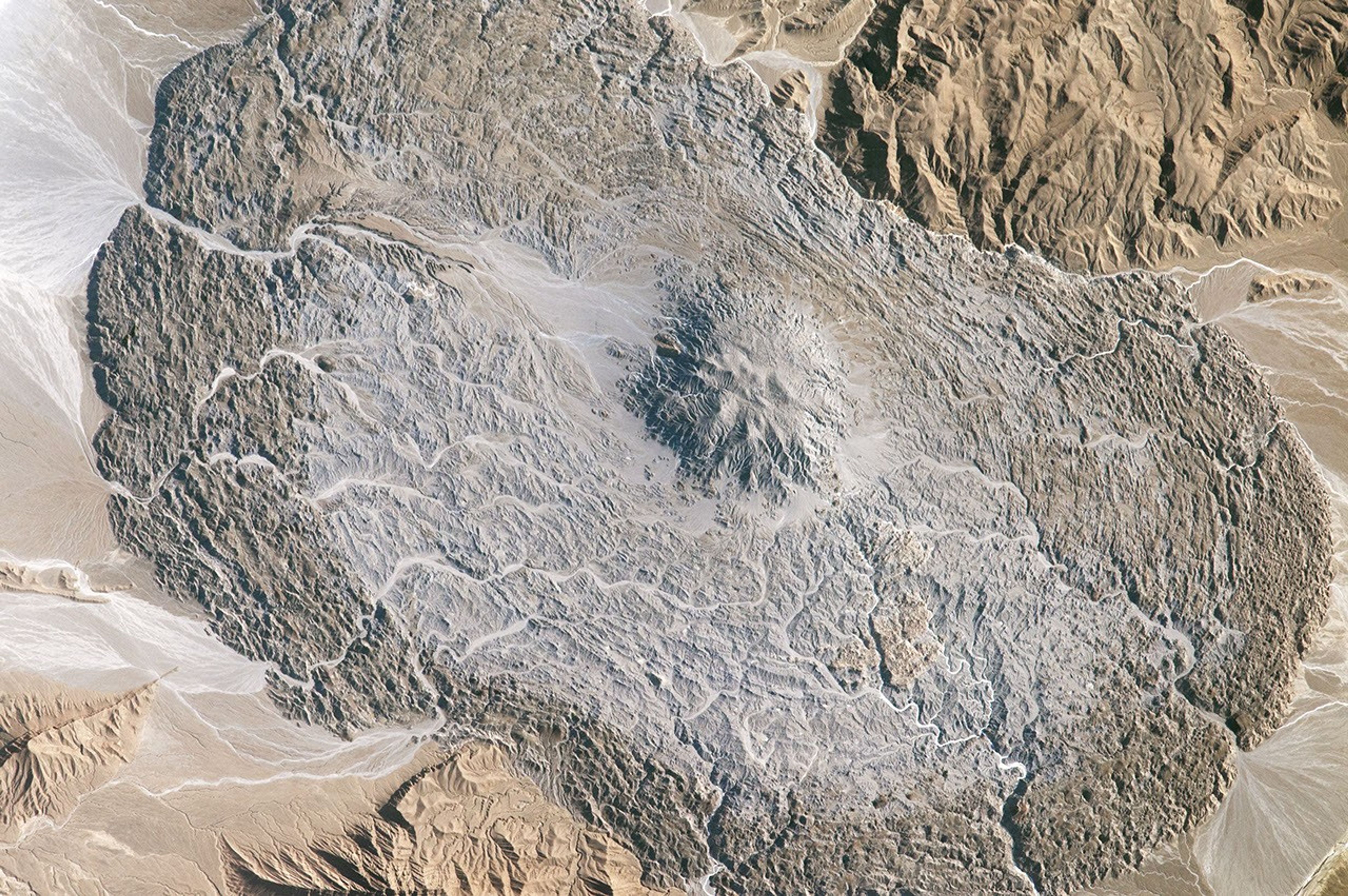
The Zagros Mountains of southeastern Iran are the location of numerous salt domes and salt glaciers, formed as a result of the depositional history and tectonic forces operating in the region. While many of these landscape features are named on maps, the salt glacier in this photograph remains unnamed on global maps and atlases.
The vaguely hourglass (or bowtie) shaped morphology of the salt glacier is due to the central location of the salt dome, which formed within the central Zagros ridge crest (top and lower left). Salt extruded from the dome and then flowed downslope into the adjacent valleys. For a sense of scale, the distance across the salt glacier from northwest to southeast is approximately 14 kilometers (8 miles).
Much like what happens in flowing ice glaciers, concentric transverse ridges have formed in the salt perpendicular to the flow direction. While bright salt materials are visible in stream beds incising the salt glacier, older surfaces—those farther from the central salt dome—appear dark, most likely due to windblown dust deposition over time or entrainment of sediments in the salt during flow.
References & Resources
Astronaut photograph ISS052-E-8401 was acquired on June 24, 2017, with a Nikon D4 digital camera using a, 1150 millimeter lens, and is provided by the ISS Crew Earth Observations Facility and the Earth Science and Remote Sensing Unit, Johnson Space Center. The image was taken by a member of the Expedition 52 crew. The image has been cropped and enhanced to improve contrast, and lens artifacts have been removed. The International Space Station Program supports the laboratory as part of the ISS National Lab to help astronauts take pictures of Earth that will be of the greatest value to scientists and the public, and to make those images freely available on the Internet. Additional images taken by astronauts and cosmonauts can be viewed at the NASA/JSC Gateway to Astronaut Photography of Earth. Caption by William L. Stefanov, NASA-JSC.