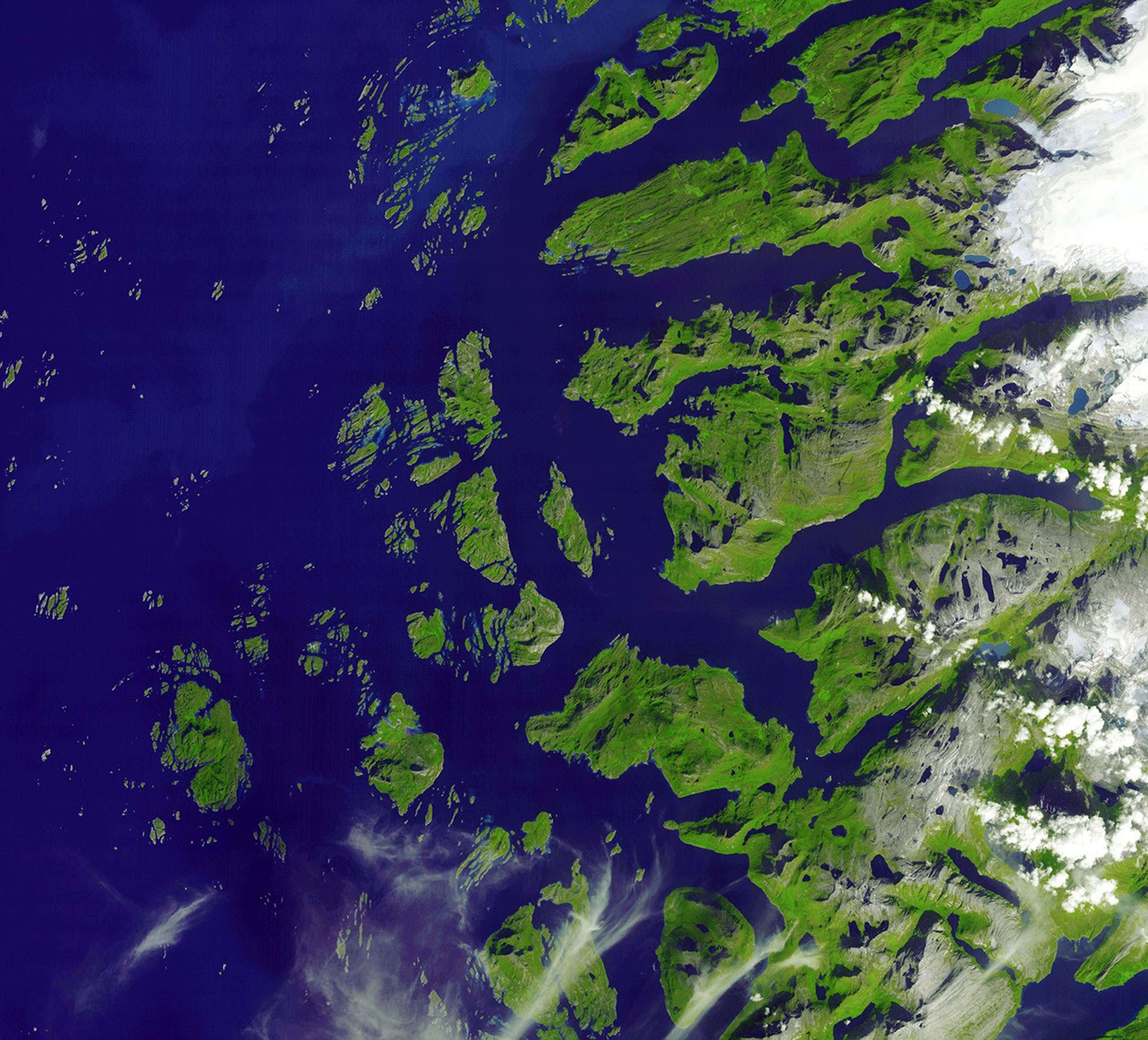

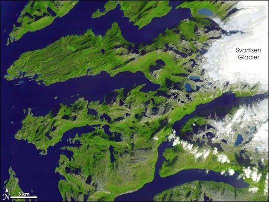
The western margin of northern Scandinavia’s largest ice sheet, Svartisen Glacier, edges into the right-hand part of this image of western Norway. The glacier is part of Saltfjellet-Svartisen National Park, which encompasses the glacier, the coastal fjords, and the mountains and valleys inland of the glacier (not pictured).
This image of the southwestern part of the park shows the diverse topography of the area. In the west, the waters of the Norwegian Sea penetrate the coastline in numerous fjords—steep-sided valleys carved by glaciers and later swallowed by the sea. Although the raked appearance of the ground on the peninsula in the northern part of the image suggests gouging by glaciers, this parallel orientation is actually a feature of the bedrock itself, which contains many aligned bands of gneiss and schist, two types of metamorphic rock.
Numerous lakes are scattered across the image. In the western part of the image the water is darker blue, but in the right hand part of the image, the lakes are brighter. This could be because they are shallower or because they are closer to the ice, where the run-off that fills them would carry finely ground sediment eroded by the glaciers. This image was captured by the Advanced Spaceborne Thermal Emission and Reflection Radiometer (ASTER) on NASA’s Terra satellite on August 23, 2006, near the height of summer. Despite its far northern latitude (the area shown in the image is inside the Arctic Circle), much of the area is lush with vegetation.
References & Resources
NASA image courtesy GSFC/METI/ERSDAC/JAROS, and the U.S./Japan ASTER Science Team. Thanks to Anders Romundset for information on local geology.