August 6, 2022
Scarred Land and Smoky Skies
More than a week after it ignited, the McKinney Fire continued to burn through the Klamath National Forest in Northern California. It was the state’s largest and deadliest wildland fire so far in 2022.
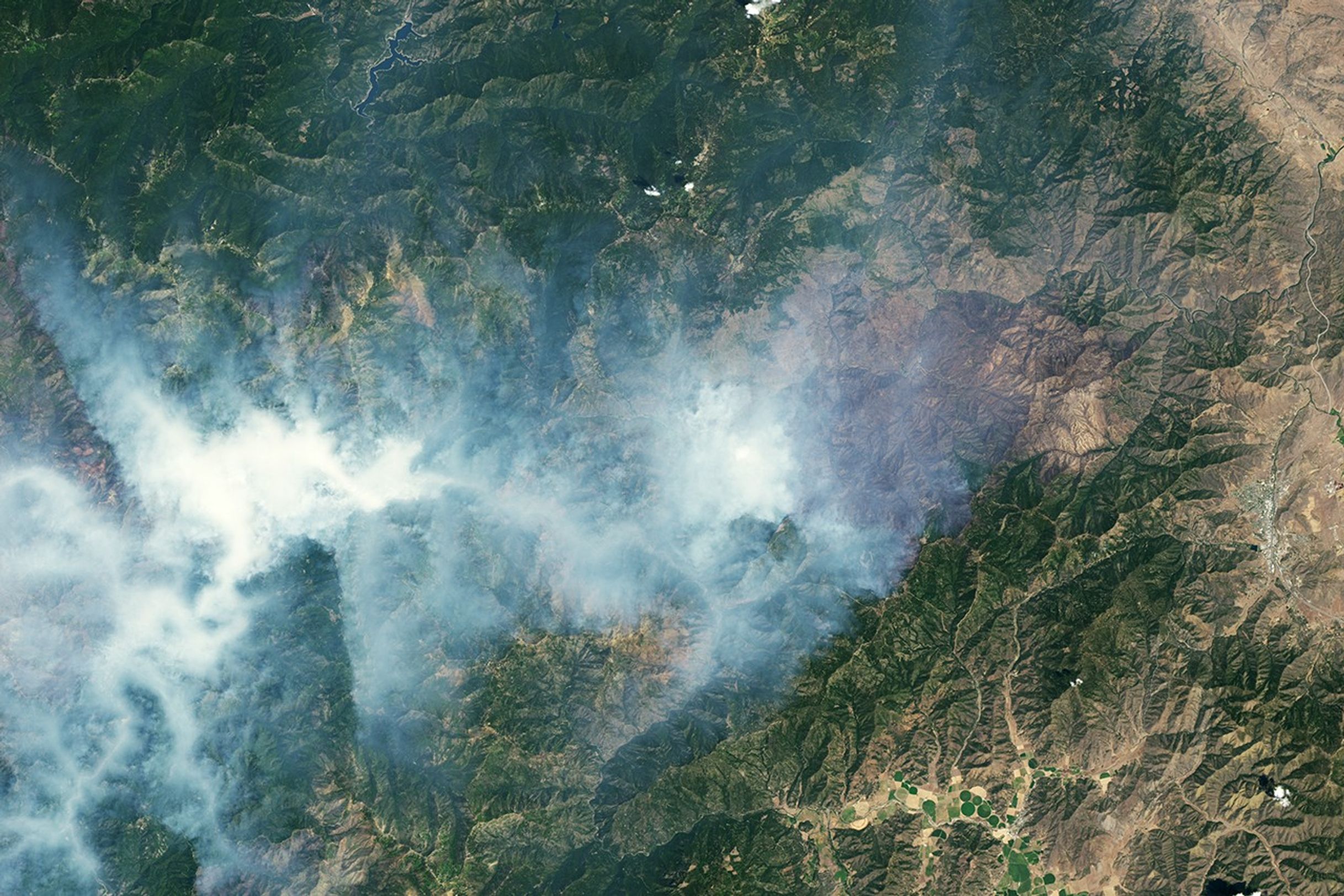
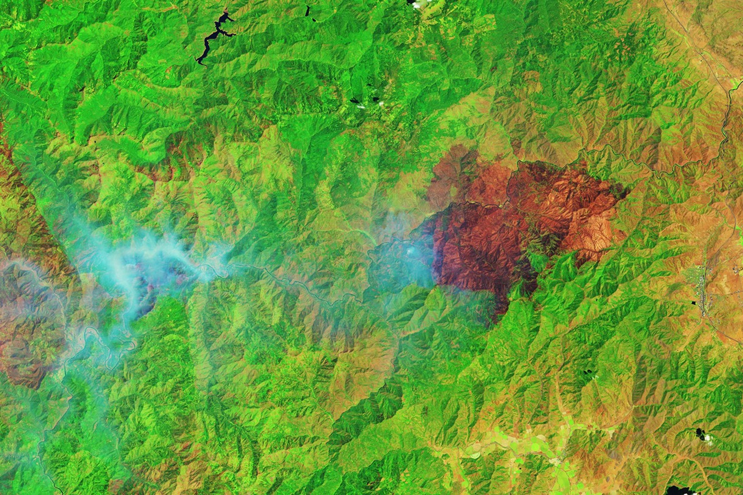
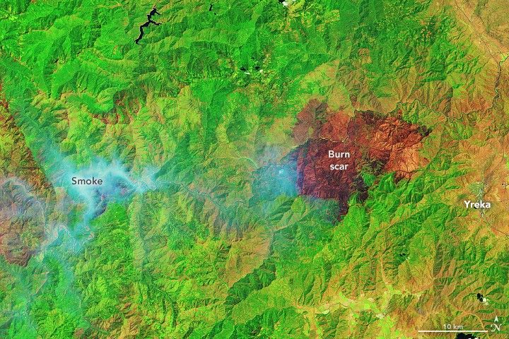
The scarred landscape and smoke from actively burning fires are visible in the images above. The images were acquired on August 6, 2022, by the Operational Land Imager (OLI) on Landsat 8.
The false-color image (right) was composed from shortwave infrared, near-infrared, and green light. This band combination (6-5-3) cuts through the smoke to reveal burn scars (brown). From ignition on July 29 through the time of this image, the McKinney Fire burned more than 60,000 acres (243 square kilometers) of timber, brush, and grass. It was 40 percent contained by midday on August 8.
Notice the smaller burn scar to the west. This land was burned by Yeti Complex fires (Yeti and Alex), which were ignited by lightning in the Klamath National Forest on the same day as the McKinney Fire. By August 6, the Yeti Complex had burned more than 7,000 acres (28 square kilometers) and was not contained on any side.
The natural-color image (left) primarily shows smoke. Some of the smoke that day billowed from the McKinney Fire (east), but a significant amount poured from the Yeti Complex (west). Communities along the Klamath River, including Seiad Valley and Klamath River, saw air quality decline to “very unhealthy” levels.
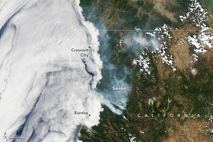
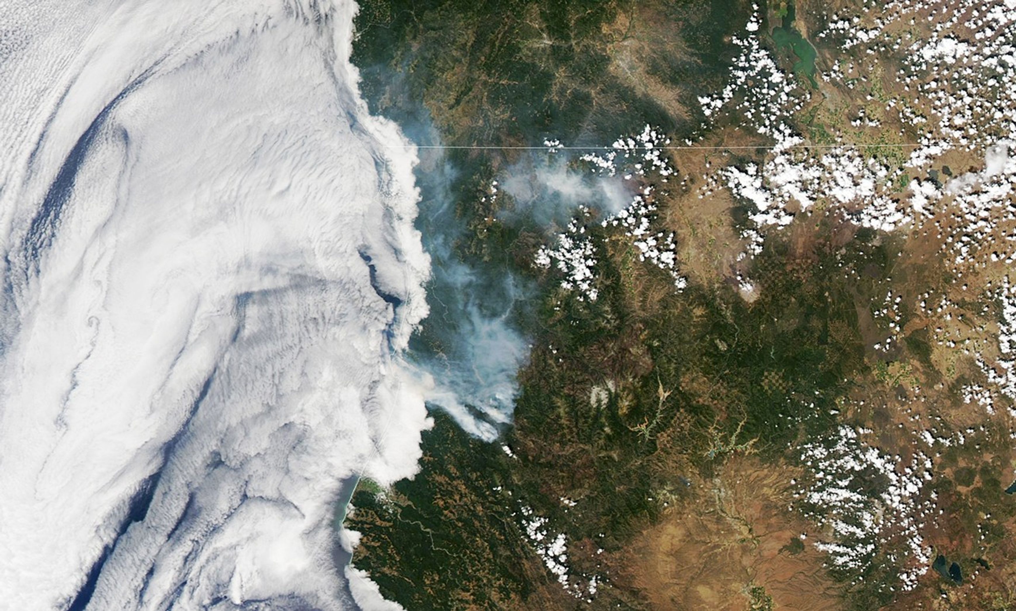
More smoke streamed from newer fires to the southwest of McKinney, visible in this wide view acquired on August 6, 2022, by the Moderate Resolution Imaging Spectroradiometer (MODIS) on NASA’s Aqua satellite. Note that the white patches close to the coast are marine stratus clouds.
Fires within the Six Rivers Lightning Complex ignited on August 5, when thunderstorms passed over the forest. Of the 12 original fires, eight were still burning on August 6 and had consumed more than 1,000 acres (4 square kilometers). With little wind movement, smoke from the fires was expected to accumulate in valleys. Air quality at Willow Creek, located about 45 kilometers (28 miles) northeast of Eureka, had already reached unhealthy levels and was expected to worsen.
Gusty winds were expected in the vicinity of the McKinney Fire on August 8, and a red flag warning was in effect through the evening. News reports indicate that nearly 90 homes have been destroyed and five people have died. In early August, heavy rain slowed the fire but spurred flooding and debris flows on the newly burned ground. Biologists think a debris flow that entered the Kalamath River likely cut oxygen levels in the water, which likely led to the death of tens of thousands of fish. The cause of the McKinney Fire was still under investigation.
References & Resources
- CAL FIRE (2022, August 8) McKinney Fire Incident. Accessed August 8, 2022.
- California Smoke Information (2022, August 6) Saturday, August 6, 2022 - Klamath Basin Smoke Outlook for the #Yeti Fire. Accessed August 8, 2022.
- California Smoke Information (2022, August 6) Saturday, August 6, 2022 - Smoke Outlook for Northern California - Yreka #McKinney Fire. Accessed August 8, 2022.
- CNN (2022, August 7) Californiaâs McKinney fire has destroyed nearly 90 homes and is only 40% contained. Accessed August 8, 2022.
- InciWeb (2022, August 8) McKinney Fire. Accessed August 8, 2022.
- InciWeb (2022, August 8) Six Rivers Lightning Complex. Accessed August 8, 2022.
- InciWeb (2022, August 8) Yeti and Alex Fires. Accessed August 8, 2022.
- The Washington Post (2022, August 3) Fire and rain: As McKinney blaze rages, floods hit Northern California. Accessed August 8, 2022.
NASA Earth Observatory images by Lauren Dauphin, using Landsat data from the U.S. Geological Survey and MODIS data from NASA EOSDIS LANCE and GIBS/Worldview . Story by Kathryn Hansen