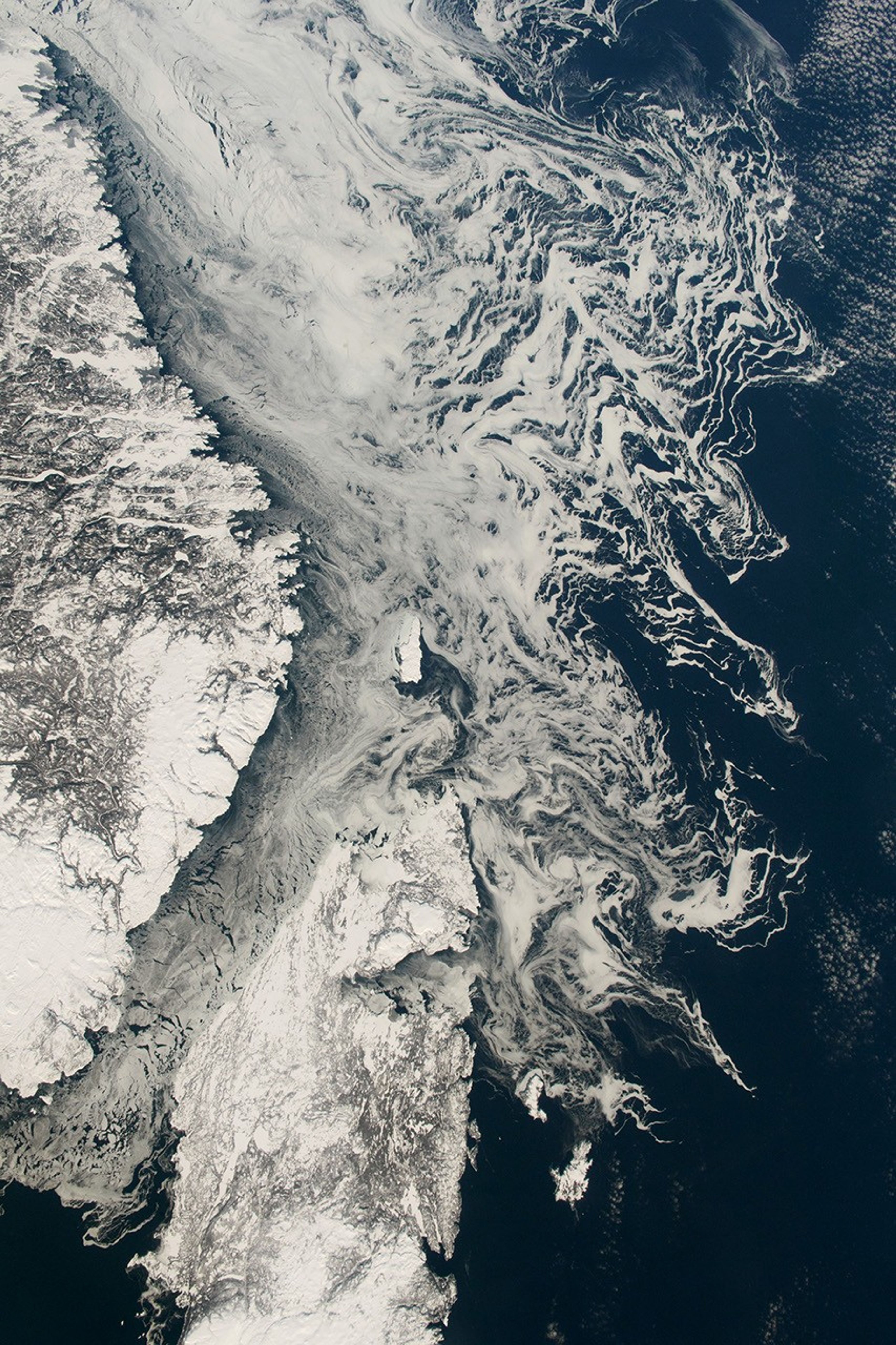
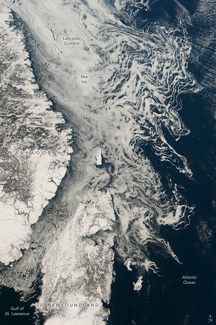
An astronaut aboard the International Space Station captured this image of sea ice in the waters around Canada’s Newfoundland and Labrador province. The sea ice appears as a dense white mass at the top left and thins out where it meets the warmer ice-free water of the Atlantic Ocean. The crenulated boundary between sea ice and open ocean extends down the right side of the image. The ice originates 1,500 kilometers (930 miles) to the north, near the Arctic Circle between Greenland and Baffin Island. It is carried southward by the Labrador Current.
The narrow Strait of Belle Isle, named for the small island in the center of the image, guides some of the sea ice to the Gulf of St. Lawrence (lower left). Along the way, it flows past Newfoundland, Labrador, and Belle Isle, all snow-covered in this image. For scale, Belle Isle is 18 kilometers (11 miles) long. This sea ice melts as it encounters warmer water, in this case in the Gulf of St. Lawrence, which receives outflow from the Great Lakes. A more detailed astronaut image from January 2006 shows water circulation patterns around Belle Isle.
References & Resources
Astronaut photograph ISS068-E-47135 was acquired on February 7, 2023, with a Nikon D5 digital camera using a focal length of 50 millimeters. It is provided by the ISS Crew Earth Observations Facility and the Earth Science and Remote Sensing Unit, Johnson Space Center. The image was taken by a member of the Expedition 68 crew . The image has been cropped and enhanced to improve contrast, and lens artifacts have been removed. The International Space Station Program supports the laboratory as part of the ISS National Lab to help astronauts take pictures of Earth that will be of the greatest value to scientists and the public, and to make those images freely available on the Internet. Additional images taken by astronauts and cosmonauts can be viewed at the NASA/JSC Gateway to Astronaut Photography of Earth . Caption by Justin Wilkinson, Texas State University, JETS Contract at NASA-JSC.