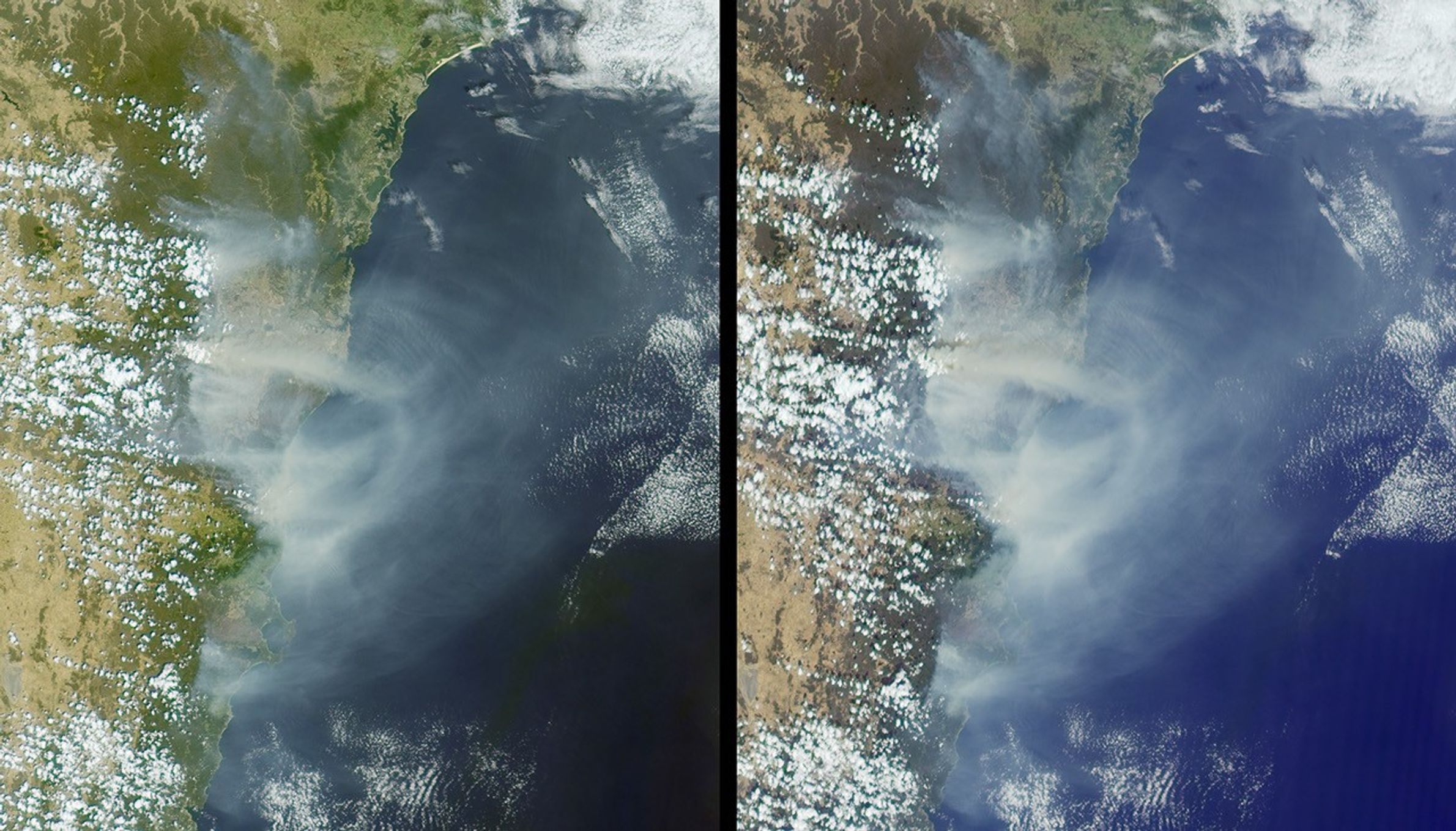
Australia’s largest city of Sydney was clouded with smoke when more than70 wildfires raged across the state of New South Wales. These imageswere captured on the morning of December 30, 2001, by the Multi-angleImaging SpectroRadiometer (MISR) instrument aboard NASA’s Terraspacecraft. The left-hand image is from the instrument’s 26-degreeforward-viewing camera, and the right-hand image is from the 60-degreeforward-viewing camera. The vast extent of smoke from numerous fires isvisible, particularly in the more oblique view. Sydney is located justabove image center.
Dubbed the “black Christmas” fires, the blazes destroyed more than150 homes and blackened over 5000 square kilometers (about 1.24 millionacres) of farmland and wilderness between December 23, 2001 and January3, 2002. Many of the fires are believed to have been caused byarsonists, with only one fire linked to natural causes. The fires wereaggravated by gusty winds and hot dry weather conditions. Approximately20,000 people have worked to contain the blazes. No people have losttheir lives or been seriously injured. Nevertheless, the fires areconsidered to be the most prolonged and destructive of any in Australiasince the Ash Wednesday conflagration of 1983 that claimed 72 lives.
The images represent an area 322 kilometers x 374 kilometers.
References & Resources
Image courtesy NASA/GSFC/LaRC/JPL, MISR Team.