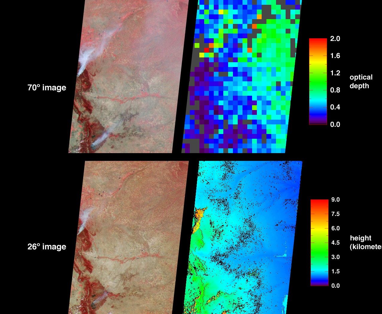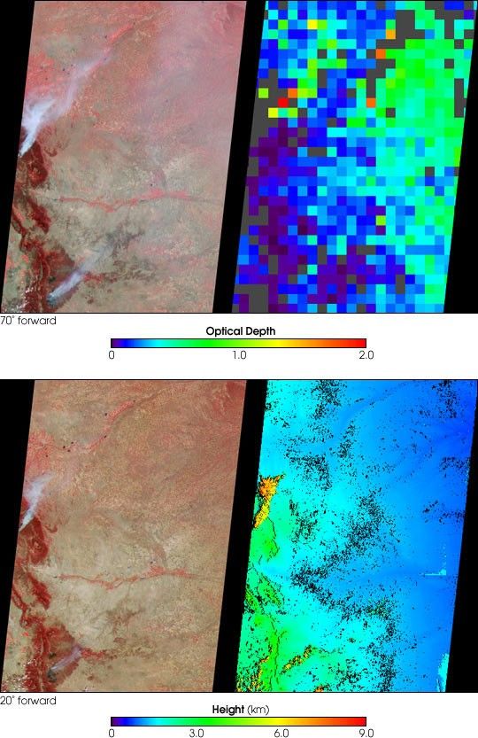
The Hayman fire, situated about 65 kilometers southwest of Denver, Colorado, isthe largest fire ever recorded in that state. The amount and distribution ofsmoke from the Hayman fire and from the Ponil Complex fires south of the NewMexico-Colorado border are portrayed in these views from the Multi-angle ImagingSpectroRadiometer (MISR). The images were captured on June 9, 2002, on thesecond day of the Hayman fire, when only about 13 percent of the total 137,000acres eventually consumed had been scorched.
The image at top-left was acquired by MISR’s most oblique (70-degree)forward-viewing camera, and the view at bottom-left was captured by MISR’s26-degree forward-viewing camera. Both left-hand panels are "false color" views,utilizing near-infrared, red, and blue spectral bands displayed as red, greenand blue respectively. With this spectral combination, highly vegetated areasappear red. At top right is a map of aerosol optical depth. This map utilizesthe capability of the oblique view angles to measure the abundance of particlesin the atmosphere. Haze distributed across the eastern part of the state isindicated by a large number of green pixels, and areas where no retrievaloccurred are shown in dark grey. The more oblique perspective utilized withinthe top panels enhances the appearance of smoke and reveals the haze. In thelower left-hand panel the view is closer to nadir (downward-looking). Here thesmoke plumes appear more compact and the haze across eastern Colorado is notdetected. The lower right-hand panel is a stereoscopically derived height fieldthat echoes the compact shape of the smoke plumes in the near-nadir image.Results indicate that the smoke plumes reached altitudes of a few kilometersabove the surface terrain, or about the same height as the small clouds thatappear orange along the bottom edge to the left of center.
Data used in these visualizations were generated as part of operationalprocessing at the Atmospheric Sciences Data Center at NASA Langley ResearchCenter. The images cover an area of about 400 kilometers x 565 kilometers.
References & Resources
Image courtesy NASA/GSFC/LaRC/JPL, MISR Team.