


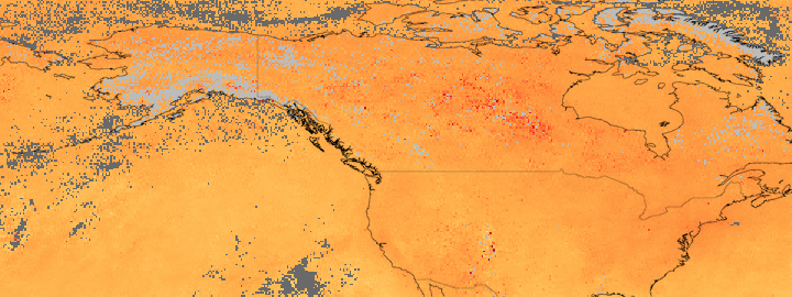
Throughout July 2010, fires burned in the forests of central Canada. The large fires sent plumes of smoke across the country at various times throughout the month. This image shows the cumulative distribution of carbon monoxide, one component of smoke, throughout July.
The highest levels of carbon monoxide are shown in red, while lower levels are yellow. Gray covers regions where the sensor did not collect data during the period. The highest levels of carbon monoxide are in central Canada, over the large fires that burned for much of July. The carbon monoxide extends south and east from central Canada. The image was made with measurements collected by the Measurements of Pollution in the Troposphere (MOPITT) sensor on NASA’s Terra satellite.
References & Resources
NASA Earth Observatory image created by Jesse Allen, using data provided by the National Center for Atmospheric Research (NCAR) and the University of Toronto MOPITT Teams . Caption by Holli Riebeek.
None


