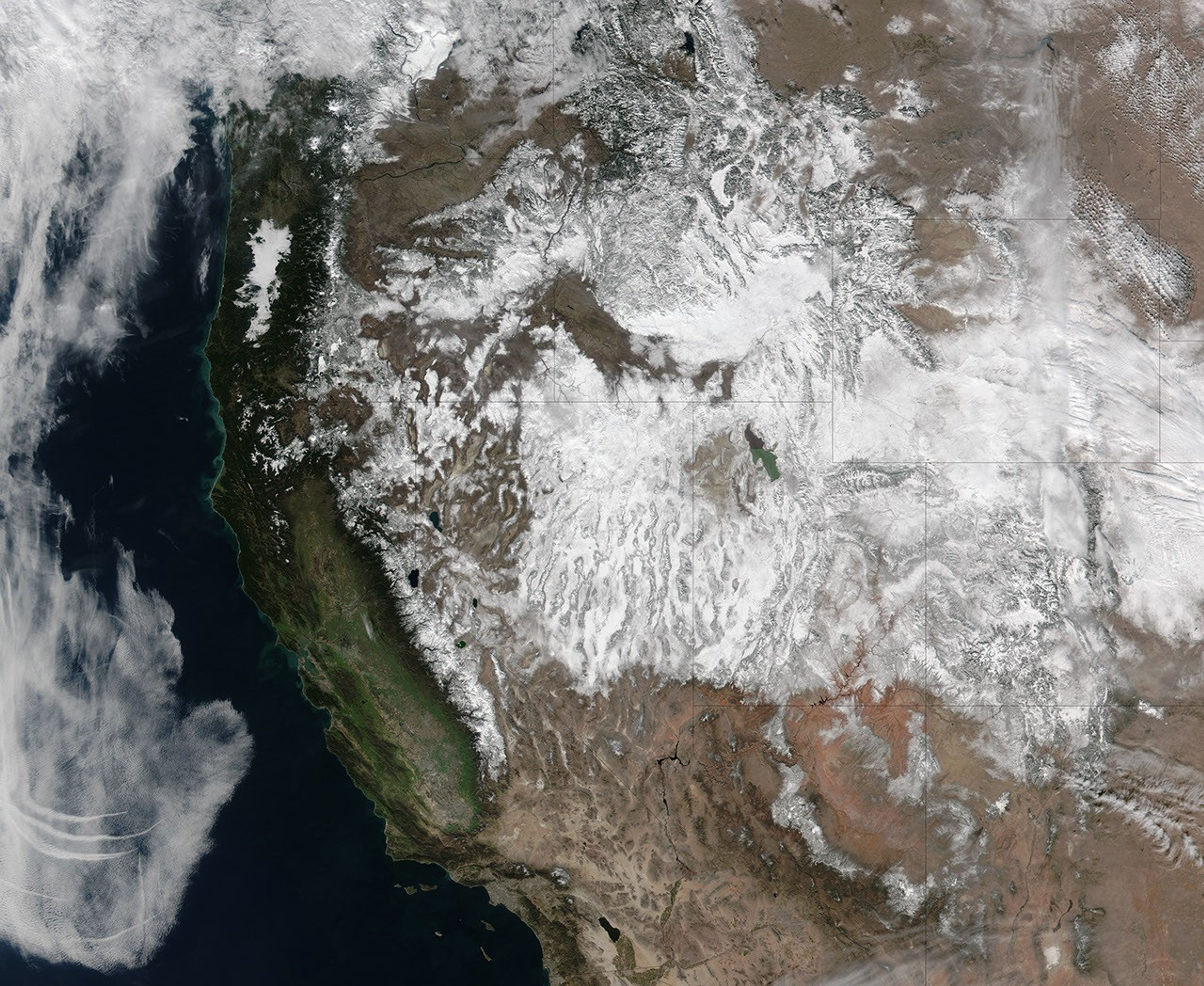
On February 7, 2016, the Visible Imaging Radiometer Suite (VIIRS) on the Suomi NPP satellite acquired this image of snow across most of the western United States.
According to the National Weather Service’s regional snow analysis for that day, the Sierra Nevada region was 54 percent covered, with an average depth of 49 centimeters (19 inches). The Great Basin region, which spans most of Nevada, was 79 percent covered, with an average depth of 24 centimeters (9 inches); the Central Rockies region was 93 percent covered with an average depth of 53 centimeters (21 inches). Some of the white areas in this image are clouds and fog, most notably over the Pacific Ocean and running north-south through Wyoming.
Overall, the extent of snow cover across the entire contiguous United States during January 2016 was the seventh-largest on record, according to NOAA’s State of the Climate report. A series of storms that brought precipitation to the U.S. West slightly improved the region’s long-term drought, according to NOAA.
References & Resources
- National Weather Service, National Operational Hydrologic Remote Sensing Center National Snow Analysis. Accessed February 10, 2016.
- NOAA National Centers for Environmental Information National Overview–January 2016. Accessed February 10, 2016.
NASA image by Jeff Schmaltz, LANCE/EOSDIS Rapid Response. Caption by Kathryn Hansen.