


- True Color (1.48 Mb)
- Visible and Short Wave Infrared (1.84 Mb)
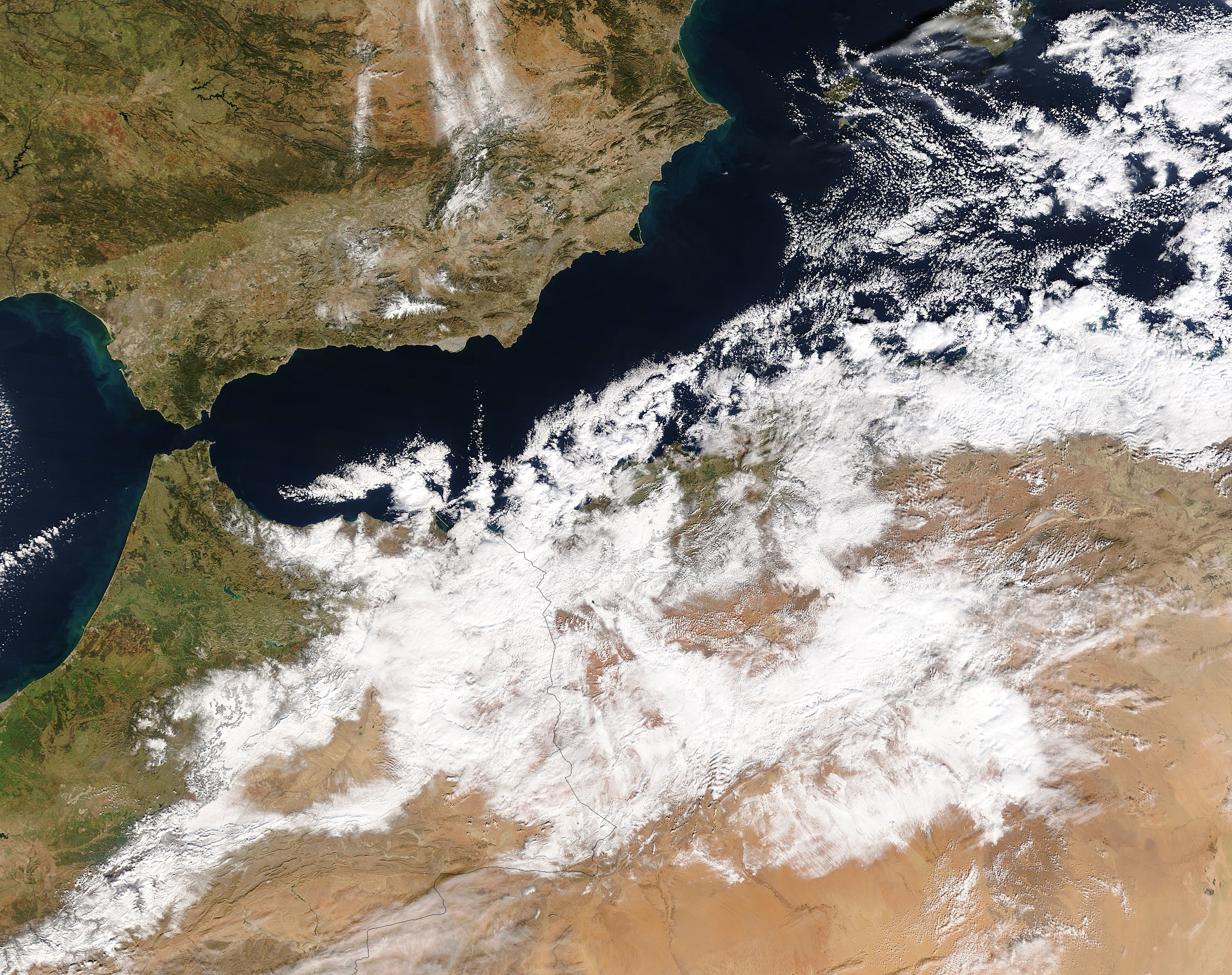
Winter weather descended on Northern Africa on January 26 and 27, 2005, leaving parts of Algeria and Morroco white with snow. This rare storm—the worst in over 50 years—brought chaos to the roadways of the normally arid region. As the clouds began to move away on January 28, the Moderate Resolution Imaging Spectroradiometer (MODIS) on NASA’s Terra satellite captured these images of the snow. The top image shows the region in true color, as the human eye would see it. In this image, light clouds blend with the snow-covered ground, making it difficult to tell how much snow is present. The lower image shows the same scene in both visible and short wave infrared light. The infrared bands separate cloud and ice, with cloud appearing peach and orange, and ice and snow appearing dark red. Vegetation is a dark green, while the bare desert is turquoise. In this image, the snow extends from the Mediterranean Coast in the north to the northern reaches of the Sahara Desert in the south.
References & Resources
NASA images courtesy Jacques Descloitres, MODIS Rapid Response Team at NASA GSFC. Both the true and false color images are available in additional resolutions.


