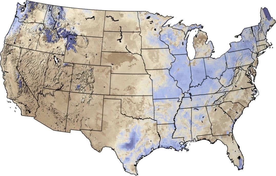

NASA and partnering agencies are going to provide United States Bureau of Reclamation water resource managers with high resolution satellite data, allowing them to analyze up-to-date water-related information over large areas all at once. Land Surface Models and satellite data from NASA and others can be used to determine snowpack, amounts of soil moisture, and the loss of water into the atmosphere from plants and the soil. Understanding these variables in the water cycle is a key to managing water in the arid American West.
The image above shows the data provided by one of NASA’s soil moisture models on July 1, 2003. The animation runs through July 15th. Dry soils are brown, while blue soil are moist.
For more information, read: NASA Helping to Understand Water Flow in The West
References & Resources
Image and animations by Robert Simmon, based on data provided by Kristi Arsenault, NASA GSFC Laboratory for Hydrospheric Processes