

Today’s Image of the Day includes excerpts from our recent feature: Flying for Science, Finding Beauty.
After a few hours flying over the Southern Ocean and the sea ice fields around Antarctica, the first sign of land can be startling. The vast expanse of water and ice is suddenly broken by gray and brown rocky mountaintops. Ice pours down the slopes and fills hidden valleys. This is the Antarctic Peninsula, and the ice here is anything but static.
Unlike sea ice, the land ice of Antarctica has the potential to raise sea level. Most of the continent’s recent ice losses have been occurring on its western side, including the Antarctic Peninsula—the strip of land that reaches like an arm toward South America. Research has shown that the southern part of the peninsula is particularly vulnerable, as the glaciers and ice shelves there have destabilized.
To know how much and how fast changes are occurring, scientists must make regular measurements. NASA’s Operation IceBridge airborne mission has been doing just that since 2009.
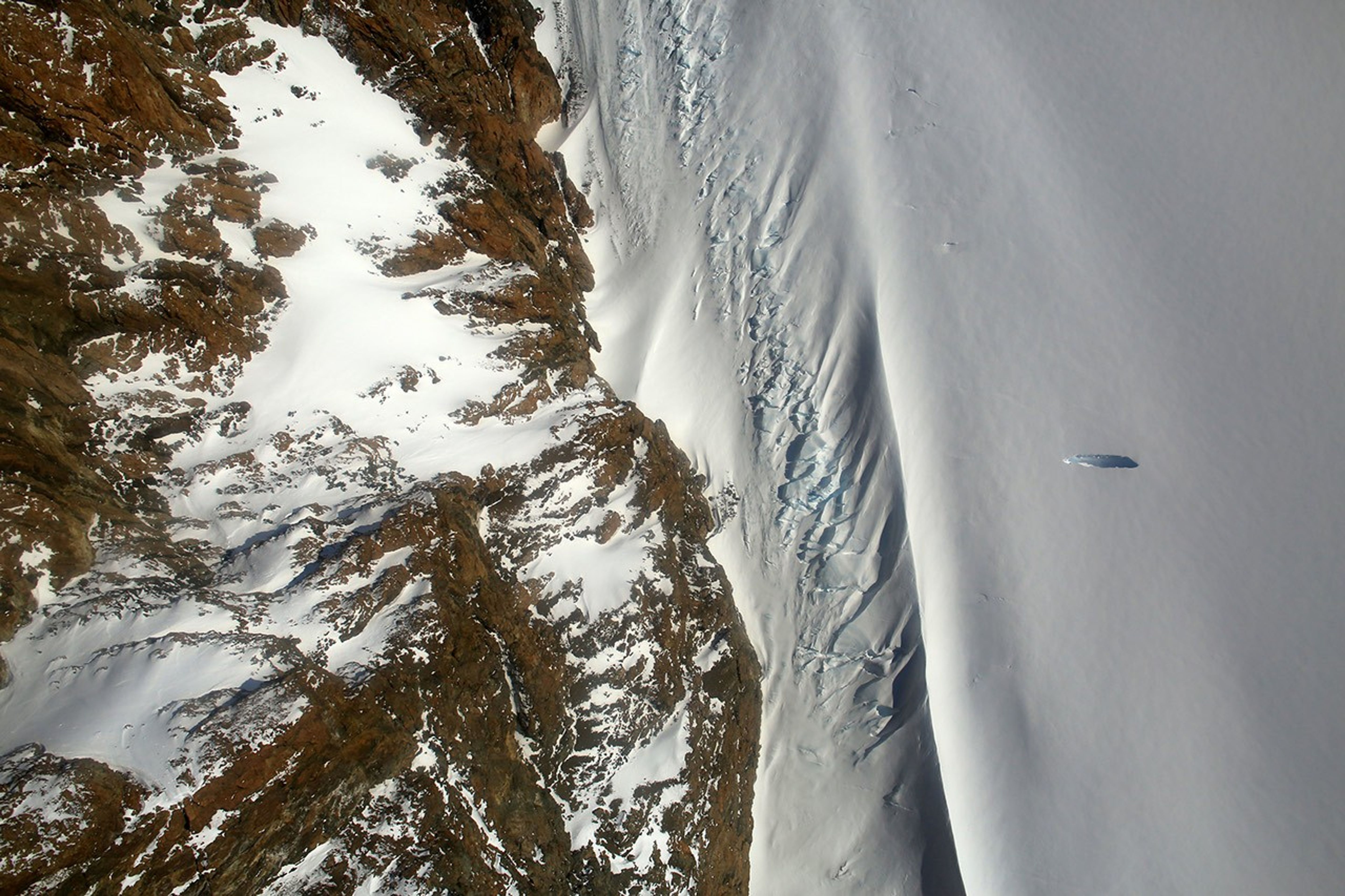
These photographs were acquired on November 3, 2017, during an IceBridge flight over the southern Antarctic Peninsula. The top photograph, shot by IceBridge project scientist Nathan Kurtz, shows the Creswick Peaks, which jut from the peninsula’s southwestern side, just east of George VI Sound.
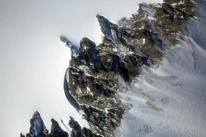

The rest of the photographs were acquired that day by the Digital Mapping System (DMS), a camera mounted on the belly of a research plane. The photos show some of the places on the peninsula where ice flows around mountains, and where mountain tops and edges stand out in stark contrast from the snow and ice.
References & Resources
- NASA Earth Observatory (2016, June 22) Pervasive Ice Retreat in West Antarctica.
- NASA Missions (2017) Operation IceBridge.
- USGS Geographic Names Information System (2017) Antarctica Detail. Accessed December 22, 2017.
- Wouters, B. et al. (2015) Dynamic thinning of glaciers on the Southern Antarctic Peninsula. Science, 348 (6237), 899-903.
- YouTube (2017, December 19) Antarctica from Above.
NASA photograph courtesy of NASA/Nathan Kurtz (top) and IceBridge Digital Mapping System (middle and bottom). Story by Kathryn Hansen.