


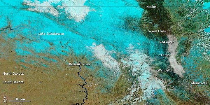
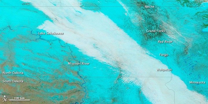
Spring flooding affected multiple cities along the North Dakota-Minnesota border in early April 2011, as winter snow continued to melt. The Advanced Hydrological Prediction Service (AHPS) of the U.S. National Weather Service reported major flooding at Wahpeton, Fargo, and Grand Forks, among others. Major flooding also occurred along the Pembina River at Neche, the AHPS stated. The Associated Press reported that, after April 9, 2011, flood-mitigation efforts shifted north of Fargo, to rural areas along the north-flowing Red River.
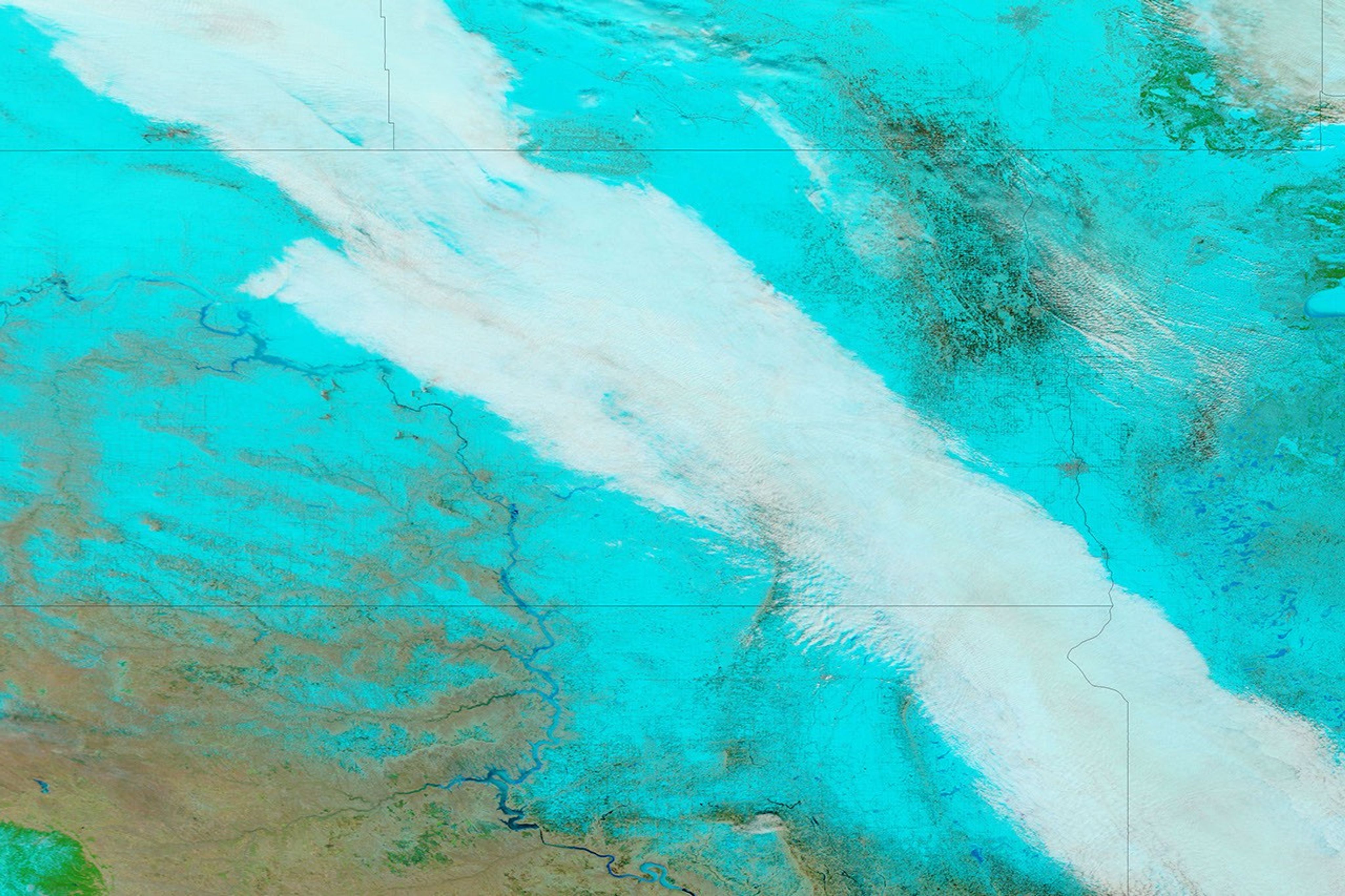
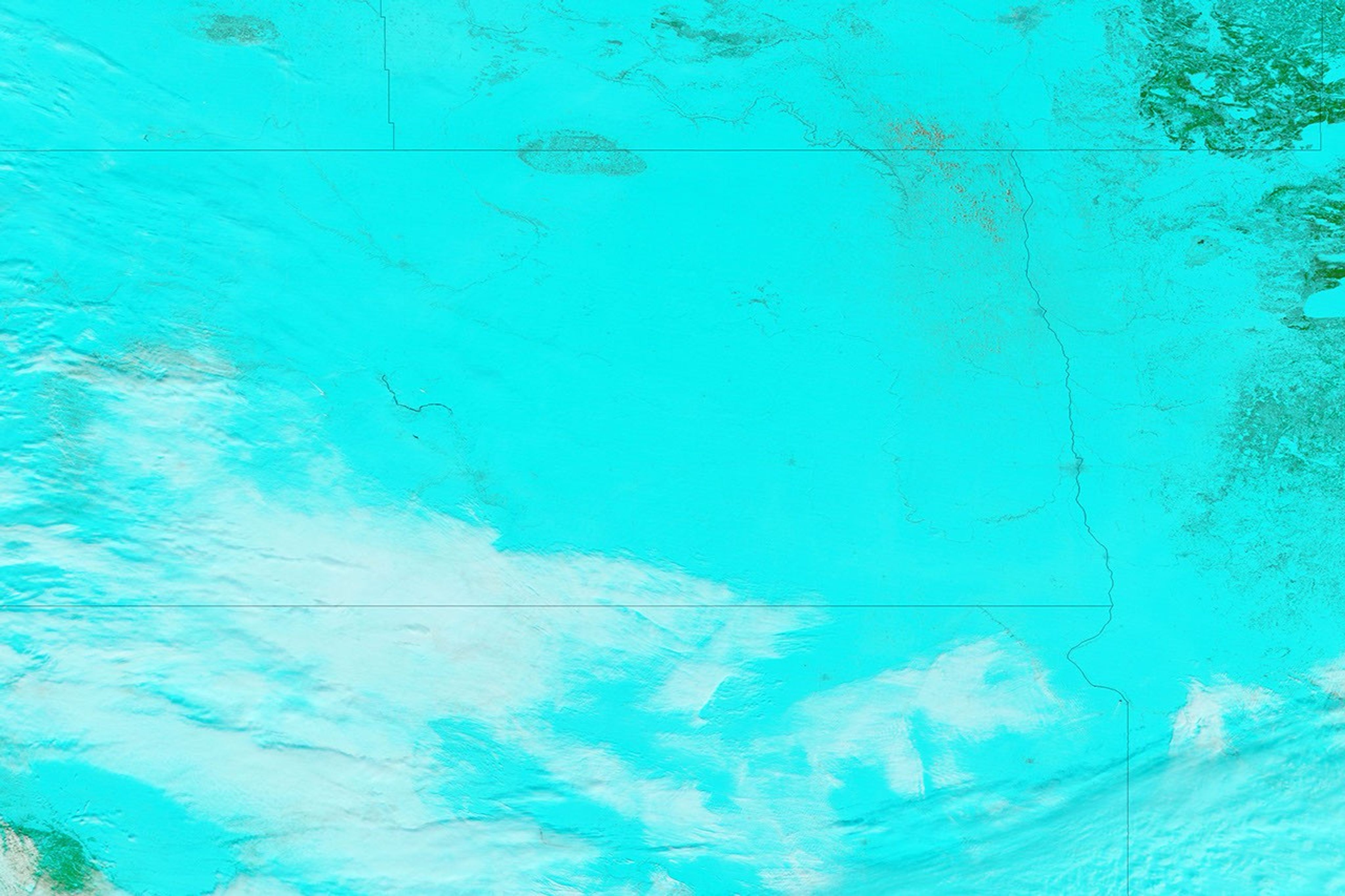
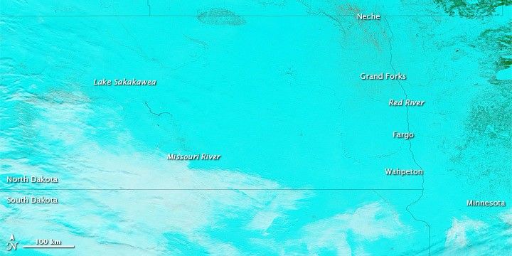
The Moderate Resolution Imaging Spectroradiometer (MODIS) on NASA’s Terra satellite acquired these images on April 6, 2011 (top), March 18, 2011 (middle), and March 7, 2011 (bottom). The images use a combination of infrared and visible light to increase the contrast between water and land. Snow is bright turquoise. Water is navy. Ice-covered water bodies are bright blue. Vegetation is green. Soil is earth-toned. Clouds are nearly white.
A snowy blanket covers most of the region in early March, with just a few curves of the Missouri River interrupting the snow. By mid-March, the snow has begun a significant retreat. By early April, the snow has retreated to north of the North-South Dakota border.
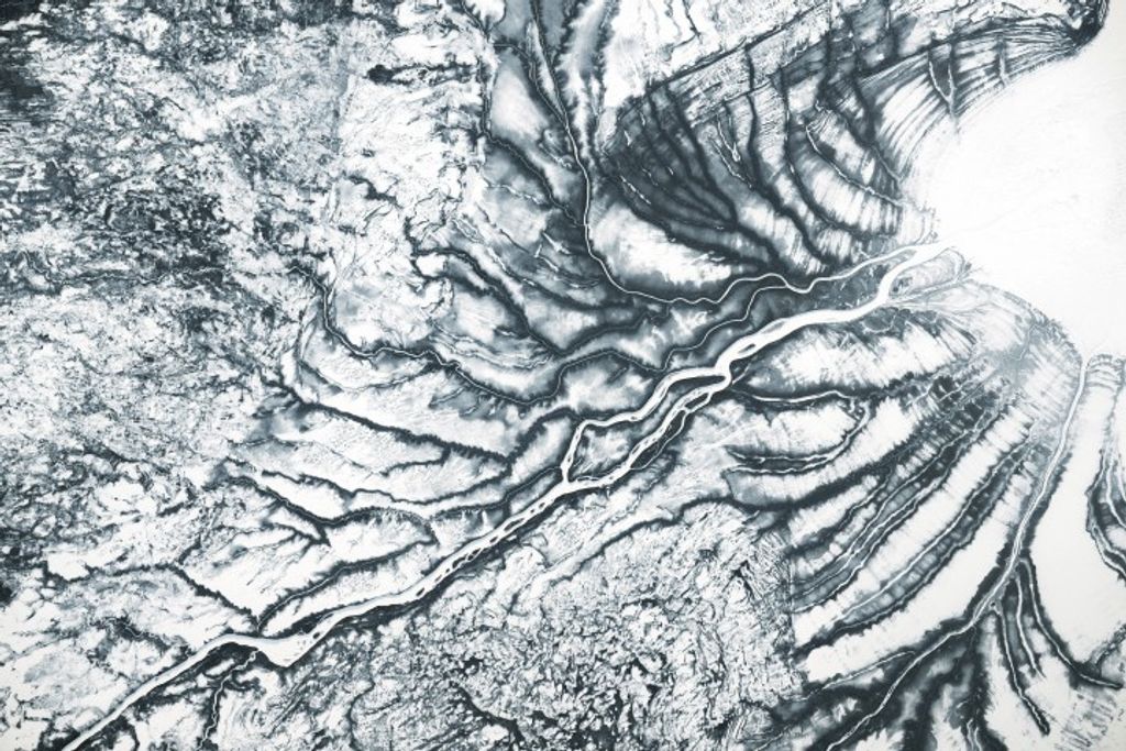
The Red River partially delineates the boundary between North Dakota and Minnesota. Along the river valley (including Grand Forks, Fargo, and Wahpeton), the ground is mostly a dull green-brown in early April. The dark tones may result from saturated soils and/or standing water. (A high-resolution image sequence documents rising waters around Fargo between late March and early April.)
In the west, ice lingers on Lake Sakakawea and part of the Missouri River. Well north of the North-South Dakota border, however, the river appears ice-free.
References & Resources
- U.S. National Oceanic and Atmospheric Administration. National Weather Service. Advanced Hydrologic Prediction Service. Accessed April 11, 2011.
- Associated Press. (2011, April 10). Red River Valley Flood Fight Shifts North of Fargo. National Public Radio. Accessed April 11, 2011.
NASA images courtesy MODIS Rapid Response Team, Goddard Space Flight Center. Caption by Michon Scott.