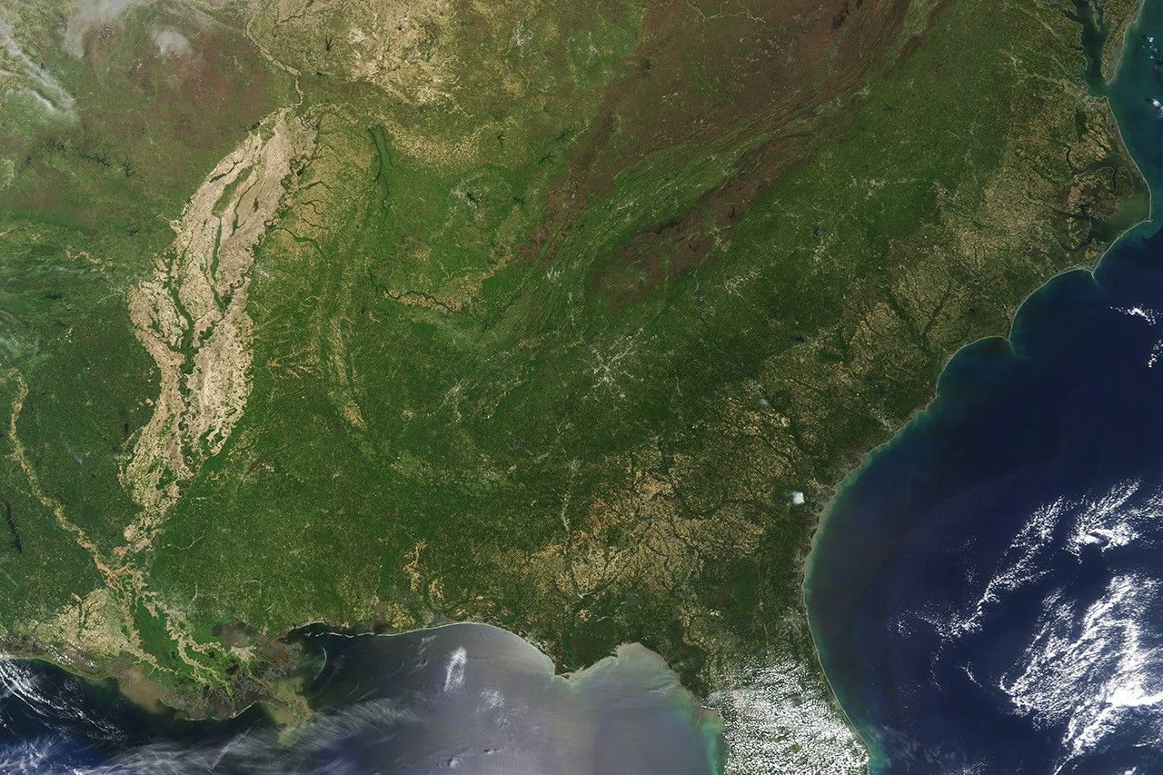
From a satellite’s vantage point, the wash of green that appears across the forests of the eastern United States is one of the most noticeable signs of winter’s passing.
The Moderate Resolution Imaging Spectroradiometer (MODIS) instrument on NASA’s Terra satellite collected this image of spring greening in the Southeast on April 30, 2018. The deepest greens of lush foliage are visible throughout the Piedmont, a forested plateau between the Appalachians and the lower elevation plains along the Atlantic coast.
The Appalachians appear brown because cooler temperatures at higher elevations cause a lag in the greening. The trees at the higher elevations were likely still in bloom and had not started to produce leaves. The speckles of tan and yellow throughout the coastal plain and the Mississippi River Valley are farmland; fields often stay bare or filled with dry crop stubble until late spring planting.
References & Resources
- U.S. Geological Survey Piedmont. Accessed May 2, 2018.
- U.S. Geological Survey Central Appalachians. Accessed May 2, 2018.
- U.S. Geological Survey Southeastern Plains. Accessed May 2, 2018.
- U.S. Geological Survey Middle Atlantic Coast. Accessed May 2, 2018.
NASA Earth Observatory image by Adam Voiland, using MODIS data from LANCE/EOSDIS Rapid Response . Caption by Adam Voiland.