


full resolution images:
color coded shaded relief (1.6 MB)
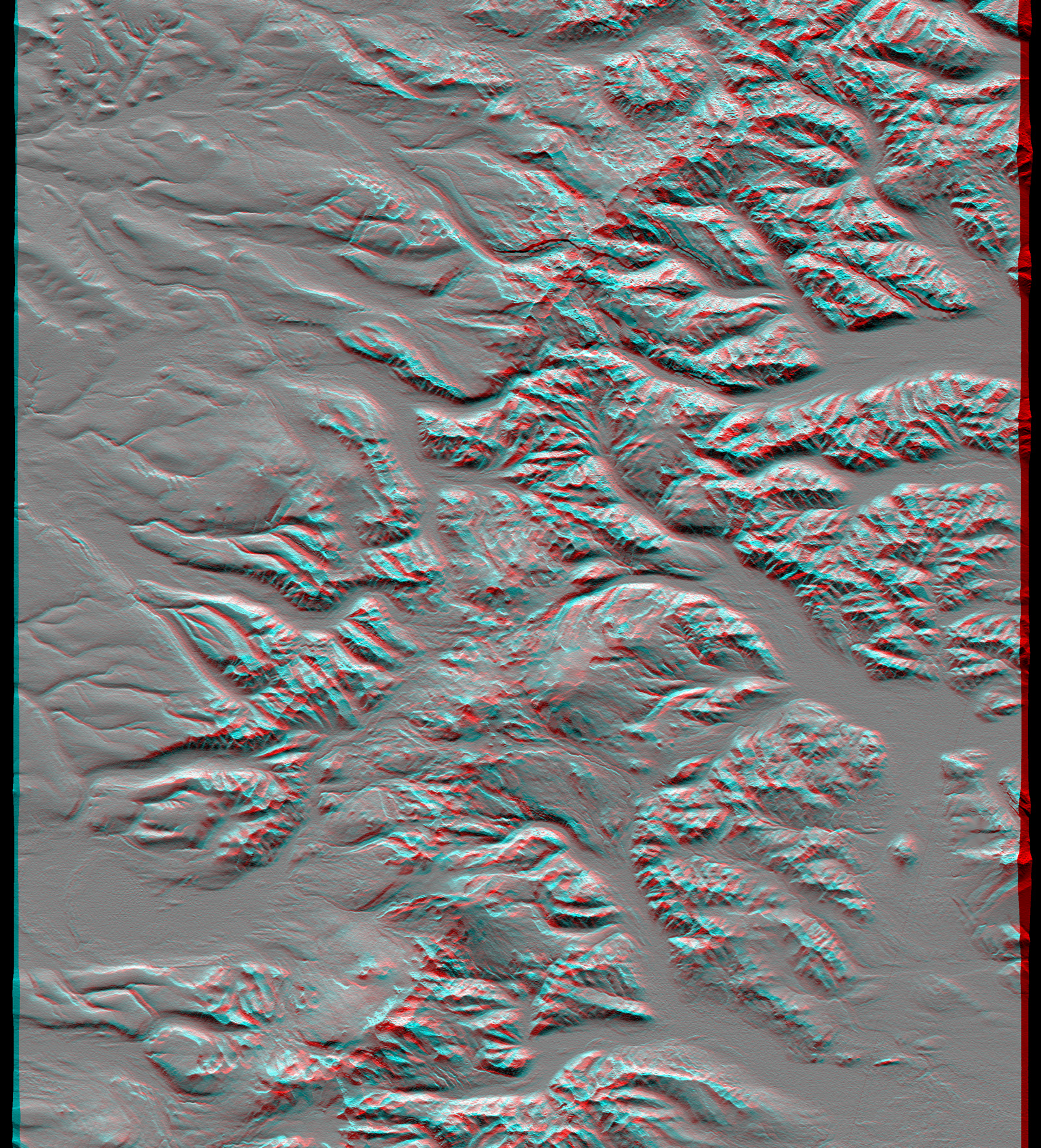
3D anaglyph (1.8 MB)
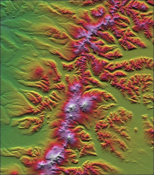
The Kamchatka Peninsula in eastern Russia is shown in this scene createdfrom a preliminary elevation model derived from the first data collectedduring the Shuttle Radar Topography Mission (SRTM) on February12, 2000. Sredinnyy Khrebet, the mountain range that makes up the spineof the peninsula, is a chain of active volcanic peaks. Pleistocene andrecent glaciers have carved the broad valleys and jagged ridges that arecommon here. The relative youth of the volcanism is revealed by thetopography as infilling and smoothing of the otherwise rugged terrain bylava, ash, and pyroclastic flows, particularly surrounding the highpeaks in the south central part of the image. Elevations here rangefrom near sea level up to 2,618 meters (8,590 feet).
Two visualization methods were combined to produce this image:shading and color coding of topographic height. The shade image wasderived by computing topographic slope in the north-south direction.Northern slopes appear bright and southern slopes appear dark. Colorcoding is directly related to topographic height, with green at thelower elevations, rising through yellow, red, and magenta, to white atthe highest elevations.
Elevation data used in this image were acquired by the Shuttle RadarTopography Mission (SRTM) aboard Space Shuttle Endeavour, launched onFebruary 11, 2000. SRTM used the same radar instrument that comprisedthe Spaceborne Imaging Radar-C/X-Band Synthetic Aperture Radar(SIR-C/X-SAR) that flew twice on Space Shuttle Endeavour in 1994. SRTMwas designed to collect three-dimensional measurements of Earth'ssurface. To collect the 3-D data, engineers added a 60-meter-long(200-foot) mast, installed additional C-band and X-band antennas, andimproved tracking and navigation devices. The mission is a cooperativeproject between the National Aeronautics and Space Administration(NASA), the National Imagery and Mapping Agency (NIMA) of the U.S.Department of Defense, and the German and Italian space agencies. It ismanaged by NASA's Jet Propulsion Laboratory, Pasadena, CA, for NASA'sEarth Science Enterprise, Washington, DC.
Size: 93.0 x 105.7 kilometers ( 57.7 x 65.6 miles)
Location:58.3 deg. North lat., 160.9 deg. East lon.
Orientation: North towardthe top
Image Data: Shaded and colored SRTM elevation model
Date Acquired: February 12, 2000
References & Resources
Image courtesy NASA/JPL/NIMA
None


