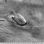
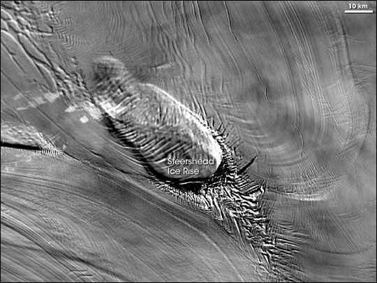
The MODIS Mosaic of Antarctica (MOA) has offered a new view of the frozen continent with unprecedented detail. Released in the fall of 2005, the map has been compiled from 260 images of Antarctica acquired by the Moderate Resolution Imaging Spectroradiometer (MODIS) sensors on NASA’s Terra and Aqua satellites. MOA includes all land areas covered by the Antarctic Treaty, based on imagery collected between November 20, 2003, and February 29, 2004. This MOA image shows the Steershead Ice Rise.
For decades, navy pilots have made long flights between McMurdo Station, on Ross Island just off the eastern edge of the Ross Ice Sheet, and Byrd Station, in West Antarctica. Pilots knew they were halfway there when they saw Steershead Ice Rise on the Ross Ice Shelf. This ice rise actually got its name due to the ice features at the base of the ice rise; the pilots saw a foreshortened view of the crevasses to the lower right of the ice rise and thought they looked like the head of a longhorn steer. Although they also take pictures from above, satellites provide a completely different perspective than aerial flights. In this image, the ice rise looks vaguely like a giant trilobite (an extinct marine arthropod).
- Further Reading:
- Mosaic of Antarctica from the Earth Observatory
- Mosaic of Antarctica imagery download and documentation from the National Snow and Ice Data Center
- State of the Cryosphere from the National Snow and Ice Data Center
References & Resources
Image courtesy the National Snow and Ice Data Center, based on data from NASA’s Aqua and Terra MODIS sensors.