
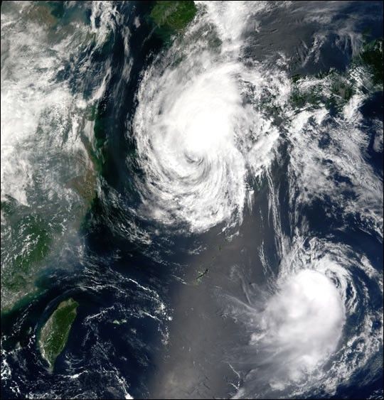
Both Tropical Storm Fengshen and Tropical Storm Fung-Wong can be seen nearing China in this rare true color image taken on July 26, 2002, by the Moderate Resolution Imaging Spectroradiometer (MODIS), flying aboard NASA’s Terra spacecraft.
Tropical Storm Fengshen, which was a raging super typhoon six days ago, can be seen in the upper portion of the image off the coast of China. As of 12:00 UTC, the tropical storm was packing winds of over 83 kilometers (52 miles) per hour. It is expected to hit come aground in China over the next 18 hours, diminish into a tropical depression, and head towards Beijing.
Tropical Storm Fung-Wong can be seen at the bottom portion of the image due south of Japan. As of 12:00 UTC, the storm was also packing winds of over 83 kilometers (52 miles) per hour. It is expected to move north and skirt the southern edge of Japan before following Fengshen into China.
References & Resources
Image courtesy Jesse Allen, NASA Earth Observatory; data provided by the MODIS Land Rapid Response Team at NASA GSFC