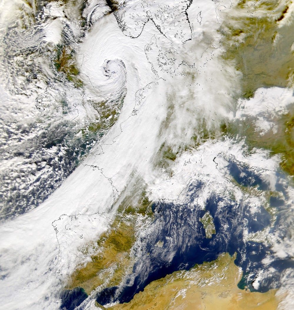
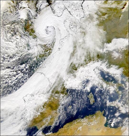
A large, low-pressure system swept across the United Kingdom on Monday, spawning at least three tornadoes there before continuing on toward Scandanavia. This image, acquired on October 30, by the Sea-viewing Wide Field-of-view Sensor (SeaWiFS), shows the storm after it brought torrential rain and hurricane-strength winds to Britain in perhaps the worst storm to hit the country since 1987.
High seas nearing 23 feet (7 meters) and winds gusting up to 109 mph wreaked havoc on sea traffic, causing delays or cancelled ferries across the English Channel and necessitating the rescue of crews from stranded ships, including a Norwegian freighter and an Italian cargo ship.
References & Resources
Image provided by the SeaWiFS Project, NASA/Goddard Space Flight Center, and ORBIMAGE