


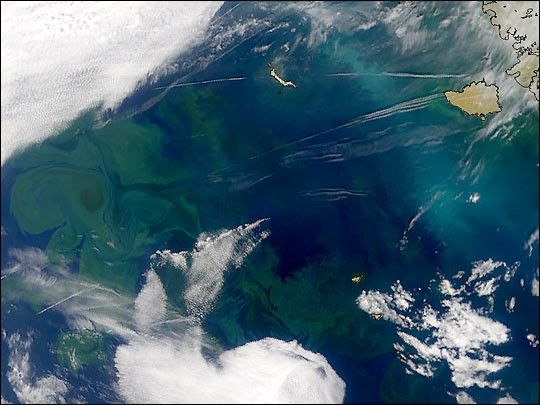
The Gulf Stream is one of the strong ocean currentsthat carries warm water from the sunny tropics to higherlatitudes. The current stretches from the Gulf of Mexico up the East Coastof the United States, departs from North America south of theChesapeake Bay, and heads across the Atlantic to the British Isles.The water within the Gulf Stream moves at the stately pace of 4 milesper hour. Even though the current cools as the water travels thousands ofmiles, it remains strong enough to moderate the NorthernEuropean climate.
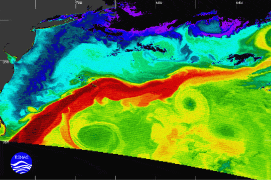
The image above was derived from the infrared measurements of theModerate-resolution Imaging Spectroradiometer (MODIS) on a nearlycloud-free day over the east coast of the United States. The coldest waters areshown as purple, with blue, green, yellow, and red representingprogressively warmer water. Temperatures range from about 7 to 22degrees Celsius.
The core of the Gulf Stream is veryapparent as the warmest water, dark red. It departs from the coast at CapeHatteras, North Carolina. The cool, shelf water from the north entrainsthe warmer outflows from the Chesapeake and Delaware Bays. The northwall of the Gulf Stream reveals very complex structure associated withfrontal instabilities that lead to exchanges between the Gulf Stream andinshore waters. Several clockwise-rotating warm core eddies are evidentnorth of the core of the Gulf Stream, which enhance the exchange of heatand water between the coastal and deep ocean. Cold core eddies, whichrotate counter clockwise, are seen south of the Gulf Stream. The oneclosest to Cape Hatteras is entraining very warm Gulf Stream waters onits northwest circumference. Near the coast, shallower waters have warmed dueto solar heating, while the deeper waters offshore are markedly cooler(dark blue). MODIS made this observation on May 8, 2000,at 11:45 a.m. EDT.
For more information, see the MODIS-Ocean web page.
References & Resources
The sea surface temperature image was created at the University of Miami using the 11- and 12-micron bands, by Bob Evans, Peter Minnett, and co-workers.


