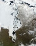
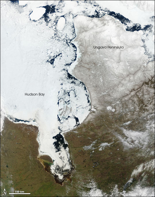
With the coming of spring, the ice on Canada’s Hudson Bay has begun to break up. Large chunks of ice float near the eastern shore of the bay, while to the west, the center of the bay remains frozen. In the upper right corner is the Ungava Peninsula, the northern part of the Canadian province of Quebec. With its sub-arctic climate, the snow-covered peninsula is home to the Inuit and Cree Nations. To the south green vegetation slowly blends into the winter-brown landscape, another sign that spring is creeping north. Ontario borders the Hudson Bay in the southwest, the lower left corner of the image, while Quebec forms the southeastern border, lower right. The Moderate Resolution Imaging Spectroradiometer (MODIS) on NASA’s Terra satellite captured this true-color image on May 21, 2005.
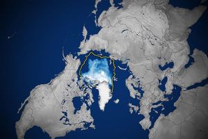
All over the world, the timing of the spring thaw in high northern latitudes has attracted the attention of scientists monitoring climate change. In the Hudson Bay itself, a 2004 study in the journal Arctic reported that between between 1971 and 2003, the length of the ice-free season in the southwestern part of the Hudson Bay—always the last area to thaw—had increased by about 3 days. Across the entire Arctic, sea ice has reached record lows.
References & Resources
NASA image courtesy Jeff Schmaltz MODIS Rapid Response Team , NASA-GSFC