![Request for Information – Potential [Placeholder for Prize]](https://assets.science.nasa.gov/dynamicimage/assets/science/psd/solar/2023/09/s/solarsystem_0.jpg?w=1024)


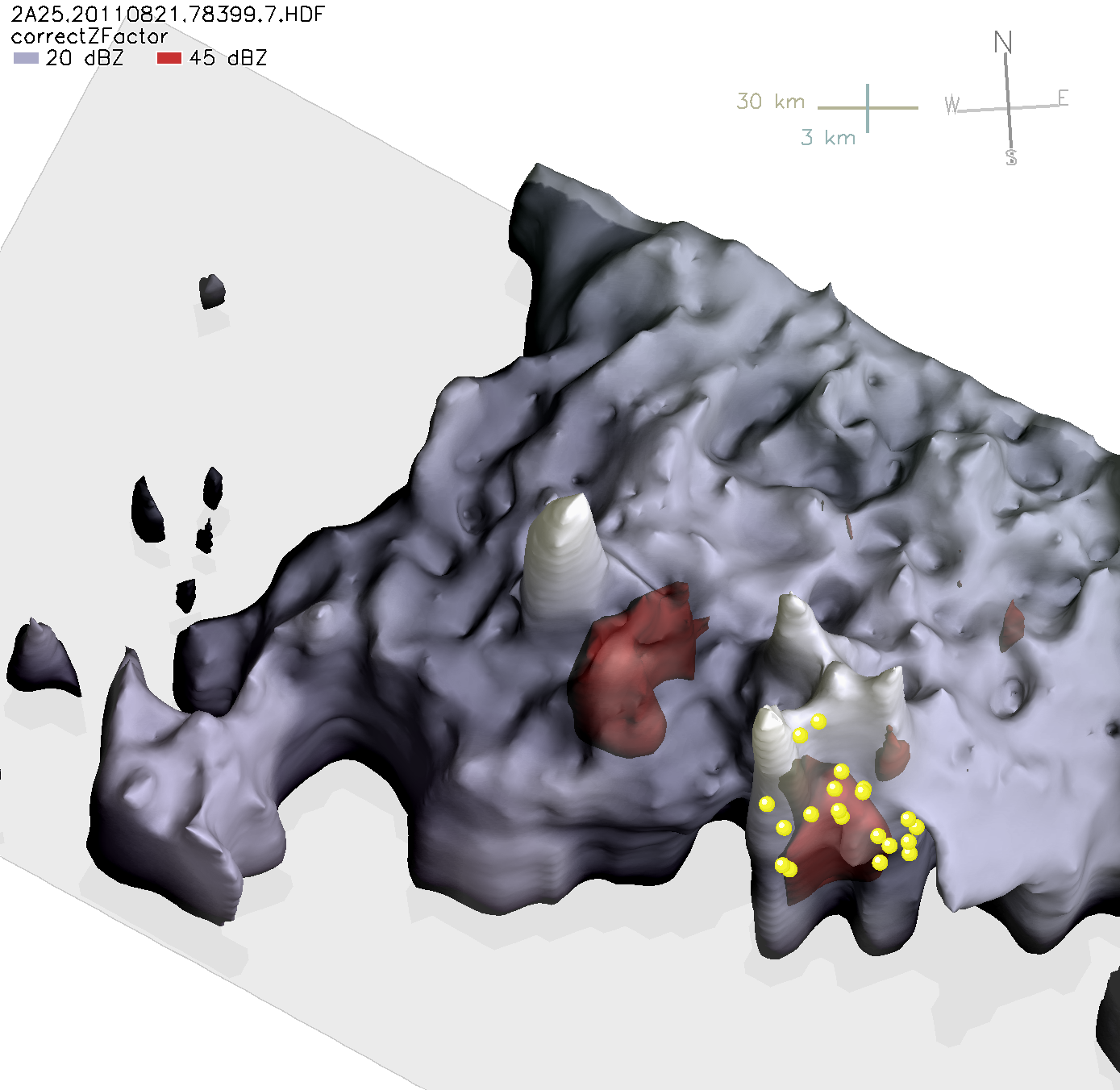
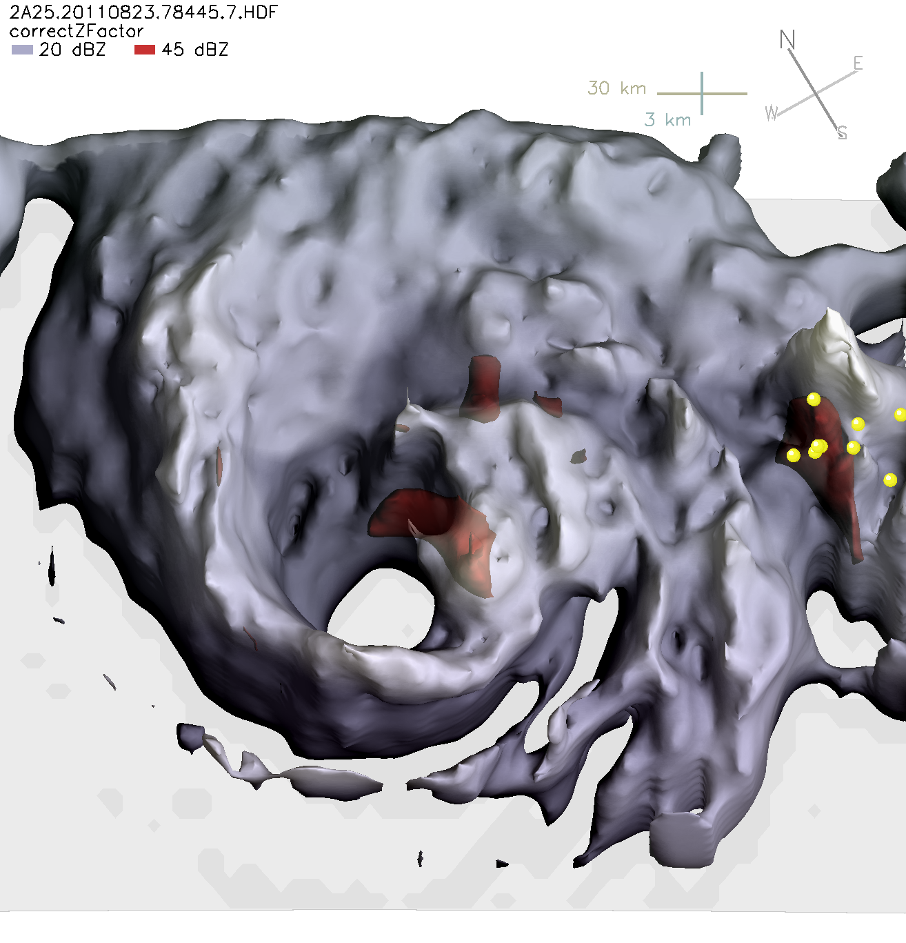
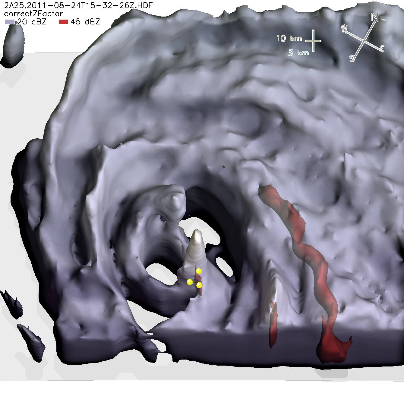
The typical view of a hurricane shows cloud structure, but these unique images show the three-dimensional distribution of rainfall within Hurricane Irene. Made from data from the radar on the Tropical Rainfall Measuring Mission (TRMM) satellite, the images cover Irene’s development from a tropical storm on August 21 to a Category 3 hurricane on August 24. The images also show the locations of TRMM-observed lightning flashes, which are indicated with yellow circles. These views of the storm’s inner core provide insight into the hurricane’s structure, which can help forecasters predict how the storm will develop.
For example, lightning in the inner core generally suggests the presenceof strong updrafts and large ice particles. By implication,lightning suggests that convective cells are pumping a lot oflatent heat energy into the tropical cyclone’s central vortex,which is favorable for intensification. Hurricane eyewallsoften are devoid of lightning, as is the case for Irene on August 23, 2011 (center image).Category 3 Irene on August 24 (lower image) did have lightning flashes in theeyewall, and there were many flashes during Irene’s tropicalstorm phase on August 21 (top image).
On Sunday, August 21, Irene was only a tropical storm, and the TRMMPrecipitation Radar reveals that it had an impressive hot towerthat reached over 9.5 miles high (15.75 km). Strong radarsignals, perhaps from large ice particles are shown in red atthe base of the hot towers, which suggests strong updrafts werepresent in order for the ice particles to have time to grow large.Strong rain had yet to completely encircle the eye, as is typicalof tropical storms. Because such towering clouds feed energy into the storm, they are a sign that the storm is likely to intensify.
On Tuesday, August 23, (center) Irene was a category 1 hurricane, in theprocess of intensifying to category 3 in less than 12 hours.Consistent with intensification, the TRMM radar showed that Irenehad a complete eyewall circling its eye along with a region ofintense convection on the eastern side of the eyewall (rightside of image). Some studies suggest that bursts of convectionin one portion of a hurricane’s eyewall may help to pump latentheat into a hurricane and thereby assist with intensification.
By mid-day Wednesday (lower image), Irene had reached the status of a “major” hurricane, at Category 3 strength. The observations of the TRMMradar show a compact eyewall, with the possibility that an outereyewall is forming. Double eyewalls can be part of an eyewallreplacement cycle associated with changes in hurricane intensity,either increases or decreases that are difficult to predict.Lightning was detected in the eyewall, further evidence of theenergy that convection is pumping up from the ocean into theatmosphere.
References & Resources
Images and caption by Owen Kelley, TRMM Science Team at NASA Goddard Space Flight Center.