
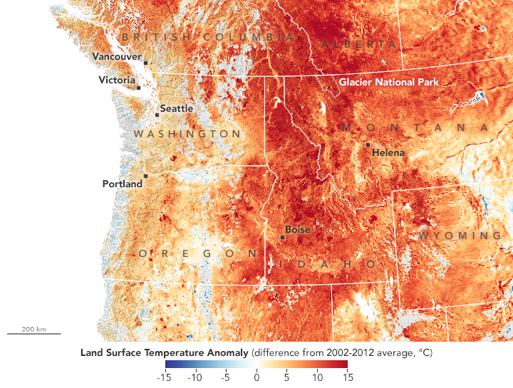
In August 2018, temperature records have fallen across the northwestern United States. On August 11, West Glacier, Montana, recorded its hottest air temperature on record—38 degrees Celsius or 100 degrees Fahrenheit—as did Pierce, Idaho (41°C or 105°F). Seattle and Portland have seen scores of days this summer with temperatures above 90°F.
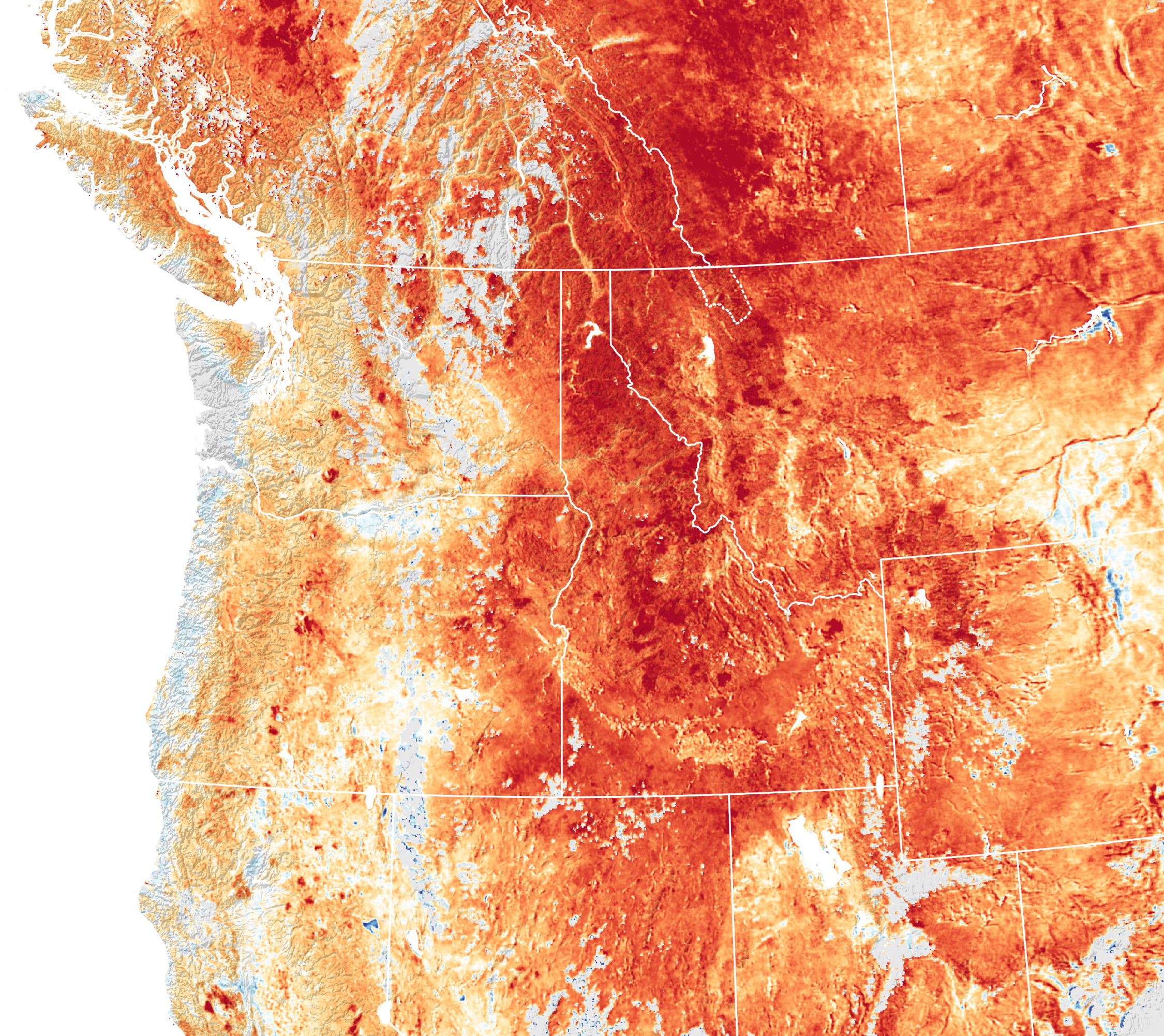
The region’s widespread warmth is clear in this temperature anomaly map, which is based on data from the Moderate Resolution Imaging Spectroradiometer (MODIS) on NASA’s Aqua satellite. It shows land surface temperatures (LSTs) for August 10, 2018, compared to the 2002-2012 average for August 5-15. Shades of red depict areas that were hotter than average; blues were cooler than average. White pixels were normal, and gray pixels did not have enough data, most likely due to excessive cloud cover.
Note that this map represents land surface temperatures (LSTs), not air temperatures. LSTs reflect how hot the surface of the Earth would feel to the touch in a particular location. They can sometimes be significantly hotter or cooler than air temperatures.
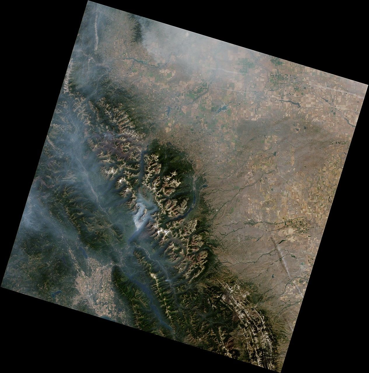
The heat, combined with dry conditions, contributed to fire activity in several states. For example, the rapid spread of the Howe Ridge fire in Montana’s Glacier National Park led to closures and evacuations.
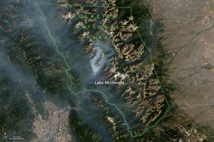
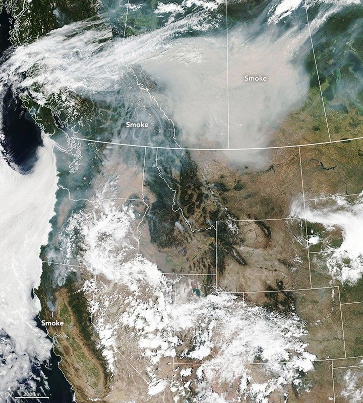
On August 15, the Operational Land Imager (OLI) on Landsat 8 passed over Glacier National Park and acquired the natural-color image above. Several fires are emitting plumes of smoke on the northwestern edge of Lake McDonald. The topography of the park caused the thickest smoke to be found at lower elevations, as the mountains block wind that would otherwise disperse it. A number of fires to the west have lofted large, wide-reaching plumes across the Western U.S. and Canada.
References & Resources
- Glacier National Park, Montana (2018, August) Current Conditions. Accessed August 14, 2018.
- InciWeb (2018, August 14) Howe Ridge Fire. Accessed August 14, 2018.
- KATU (2018, July 30) Portland on track to tie record for consecutive 90-degree days. Accessed August 14, 2018.
- KOMO News (2018, August 9) Seattle sizzles to 10th 90-degree day this year; ties other all-time heat record. Accessed August 14, 2018.
- Seattle PI (2018, August 13) Fire threatens historic Glacier lodge after first 100-degree day in park history. Accessed August 14, 2018.
NASA Earth Observatory image by Joshua Stevens, using data from the Level 1 and Atmospheres Active Distribution System (LAADS) and Land Atmosphere Near real-time Capability for EOS (LANCE), and Landsat data from the U.S. Geological Survey . Story by Kathryn Hansen.