


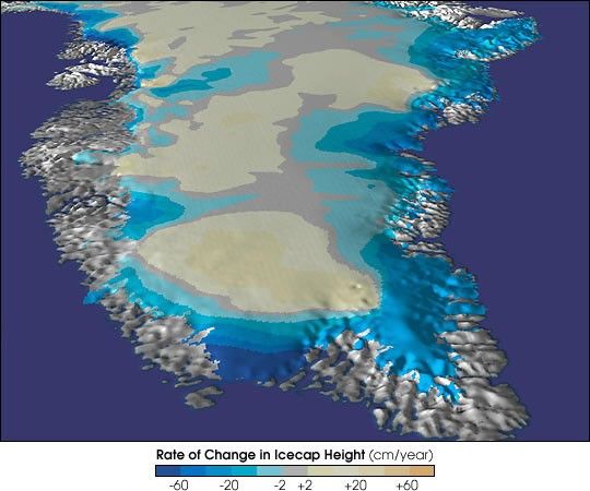
Scientists who want to monitor the state of our global climate may haveto look no farther than the coastal ice that surrounds the Earth’slargest island.
A NASA study of Greenland’s ice sheet reveals that it is rapidlythinning. In an article published in the July 21 issue of Science, BillKrabill, project scientist at the NASA Goddard Space Flight Center’sWallops Flight Facility, Wallops Island, VA, reports that the frozenarea around Greenland is thinning, in some places, at a rate of morethan three feet per year. Any change is important since a smaller icesheet could result in higher sea levels.
“A conservative estimate, based on our data, indicates a net loss ofapproximately 51 cubic kilometers of ice per year from the entire icesheet, sufficient to raise global sea level by 0.005 inches per year, orapproximately seven percent of the observed rise,” Krabill said.
“This amount of sea level rise does not threaten coastal regions, butthese results provide evidence that the margins of the ice sheet are ina process of change,” Krabill said. “The thinning cannot be accountedfor by increased melting alone. It appears that ice must be flowing morequickly into the sea through glaciers.”
For further information on the Greenland mapping project,including the technology behind the science, visit the AirborneTopographic Mapper site.
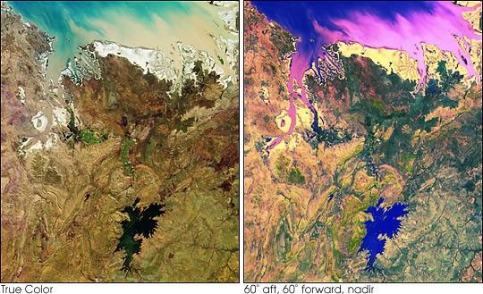
To see more images of Greenland’s icecap, visit the GoddardScientific Visualization Studio.
References & Resources
NASA GSFC Scientific Visualization Studio
None


