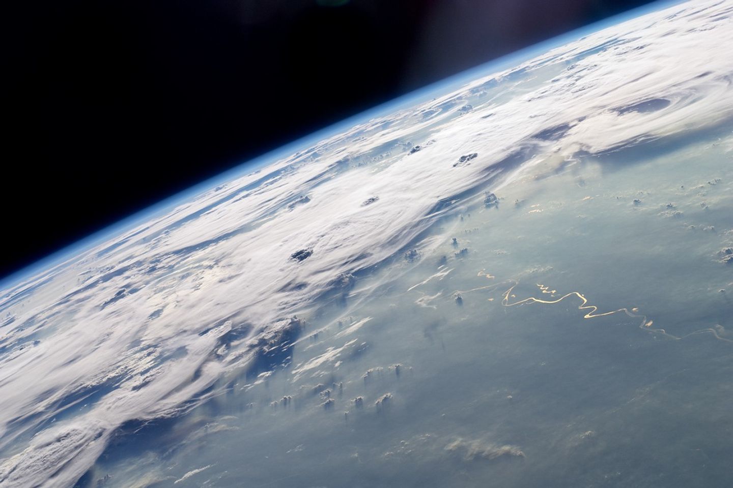

A picturesque line of thunderstorms and numerous circular cloud patterns filled the view as the International Space Station (ISS) Expedition 20 crew members looked out at the limb (blue line on the horizon) of the Earth. The region shown in the astronaut photograph (top image) includes an unstable, active atmosphere forming a large area of cumulonimbus clouds in various stages of development. The crew was looking west-southwest from the Amazon Basin, along the Rio Madeira toward Bolivia when the image was taken.
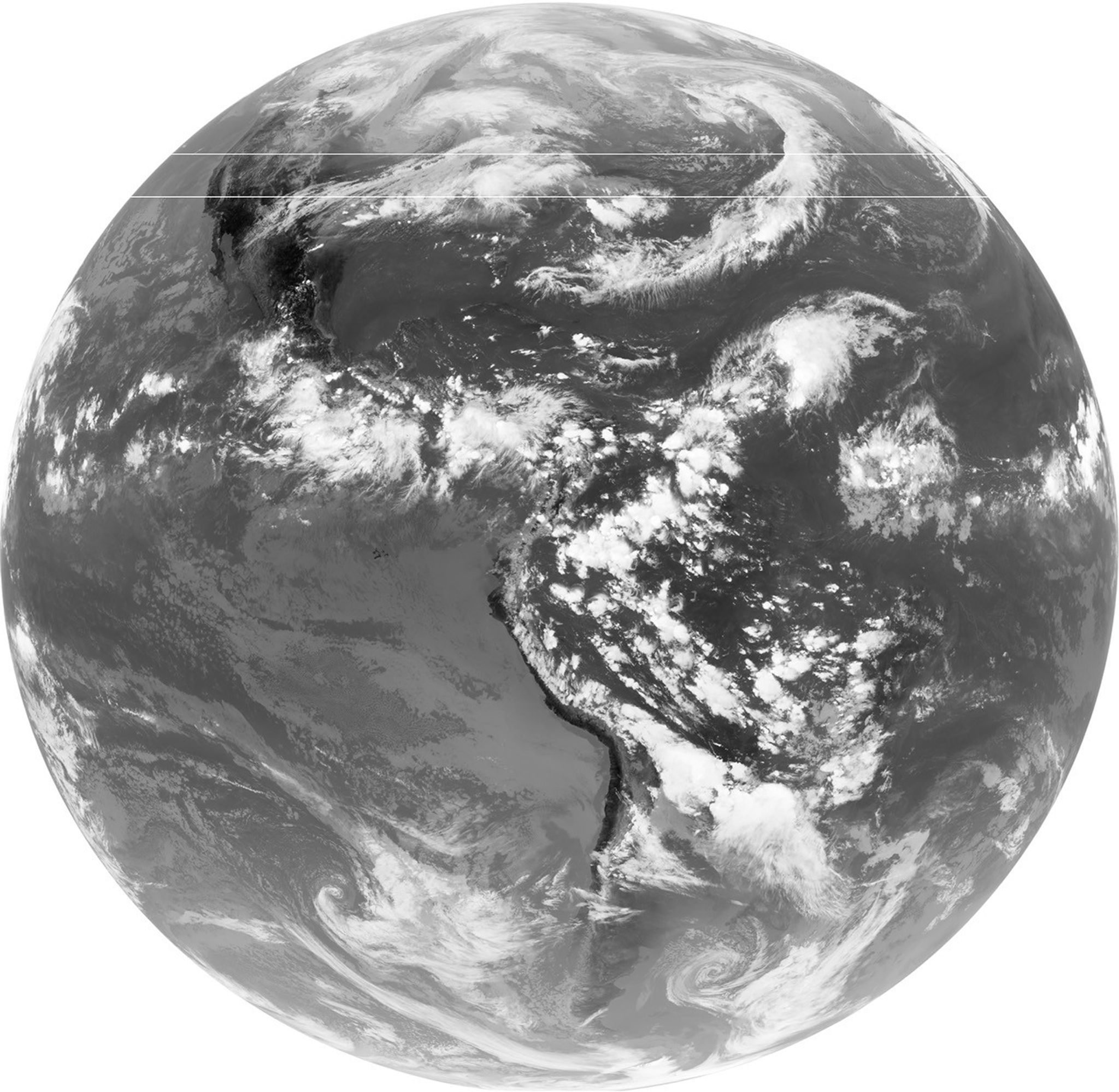
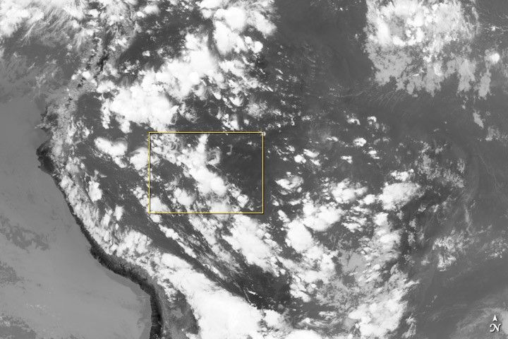
The semi-circular cloud patterns near the center of the astronaut photograph may be detected in a Geostationary Operational Environmental Satellite (GOES) infrared satellite image of the region (bottom image, yellow rectangle) acquired about 20 minutes earlier than the astronaut photograph. The distinctive circular patterns of the clouds in the astronaut photograph are likely caused by the aging of thunderstorms. Such ring structures often form during the final stages of storms’ development as their centers collapse.
Sunglint—the mirror-like reflection of sunlight off a water surface directly back to the camera onboard the ISS—is visible on the waters of the Rio Madeira and Lago Acara in the Amazon Basin. Widespread haze over the basin gives the reflected light an orange hue. The Rio Madeira flows northward and joins the Amazon River on its path to the Atlantic Ocean. A large smoke plume near the bottom center of the image may be one source of the haze.
References & Resources
Astronaut photograph ISS020-E-47807 was acquired on October 6, 2009, with a Nikon D2Xs digital camera using an effective 48mm lens (28-70 mm zoom lens), and is provided by the ISS Crew Earth Observations experiment and Image Science & Analysis Laboratory, Johnson Space Center. The astronaut photograph was taken by the Expedition 20 crew. GOES image courtesy NASA GOES Project Science and NOAA Comprehensive Large Array-Data Stewardship System. The photograph in this article has been cropped and enhanced to improve contrast. Lens artifacts have been removed. The International Space Station Program supports the laboratory to help astronauts take pictures of Earth that will be of the greatest value to scientists and the public and to make those images freely available on the Internet. Additional images taken by astronauts and cosmonauts can be viewed at the NASA/JSC Gateway to Astronaut Photography of Earth. Caption by Susan K. Runco, NASA-JSC.