


June 2, 2022
Tornado Scars Northern Michigan
Powerful tornadoes are uncommon in northern Michigan. The Great Lakes often weaken approaching thunderstorms because the cool temperatures and breezes over the water hinder storm development.
But on May 20, 2022, record-breaking warmth in the Midwest helped fuel a line of strong storms in Wisconsin that barreled across Lake Michigan without weakening significantly. One of them strengthened and transitioned into a supercell, an especially powerful type of storm with a deep and persistent rotating updraft.
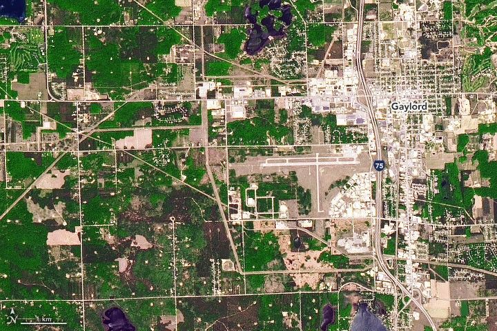
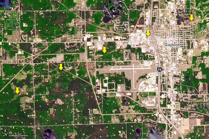
That storm spawned an EF-3 tornado bearing winds up to 150 miles (241 kilometers) per hour that ripped through the town of Gaylord. It also dropped hail the size of golf balls and baseballs as it tracked east-northeast across Michigan from the Traverse City area to Alpena.
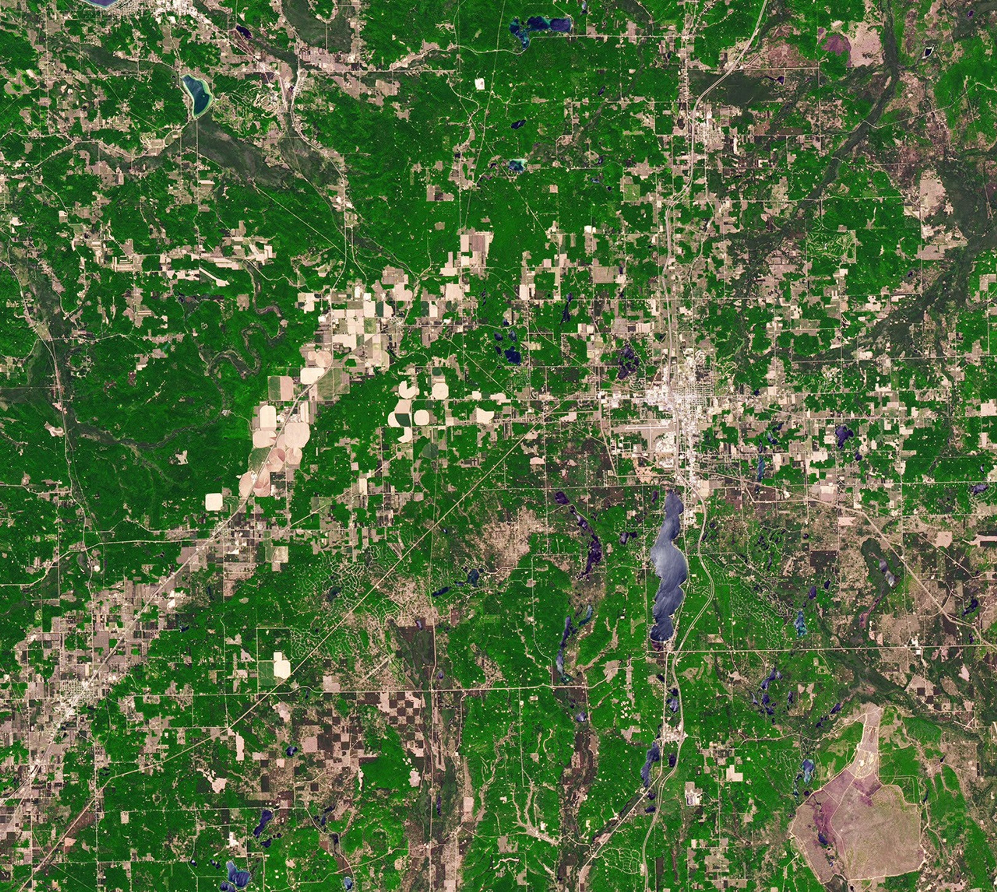
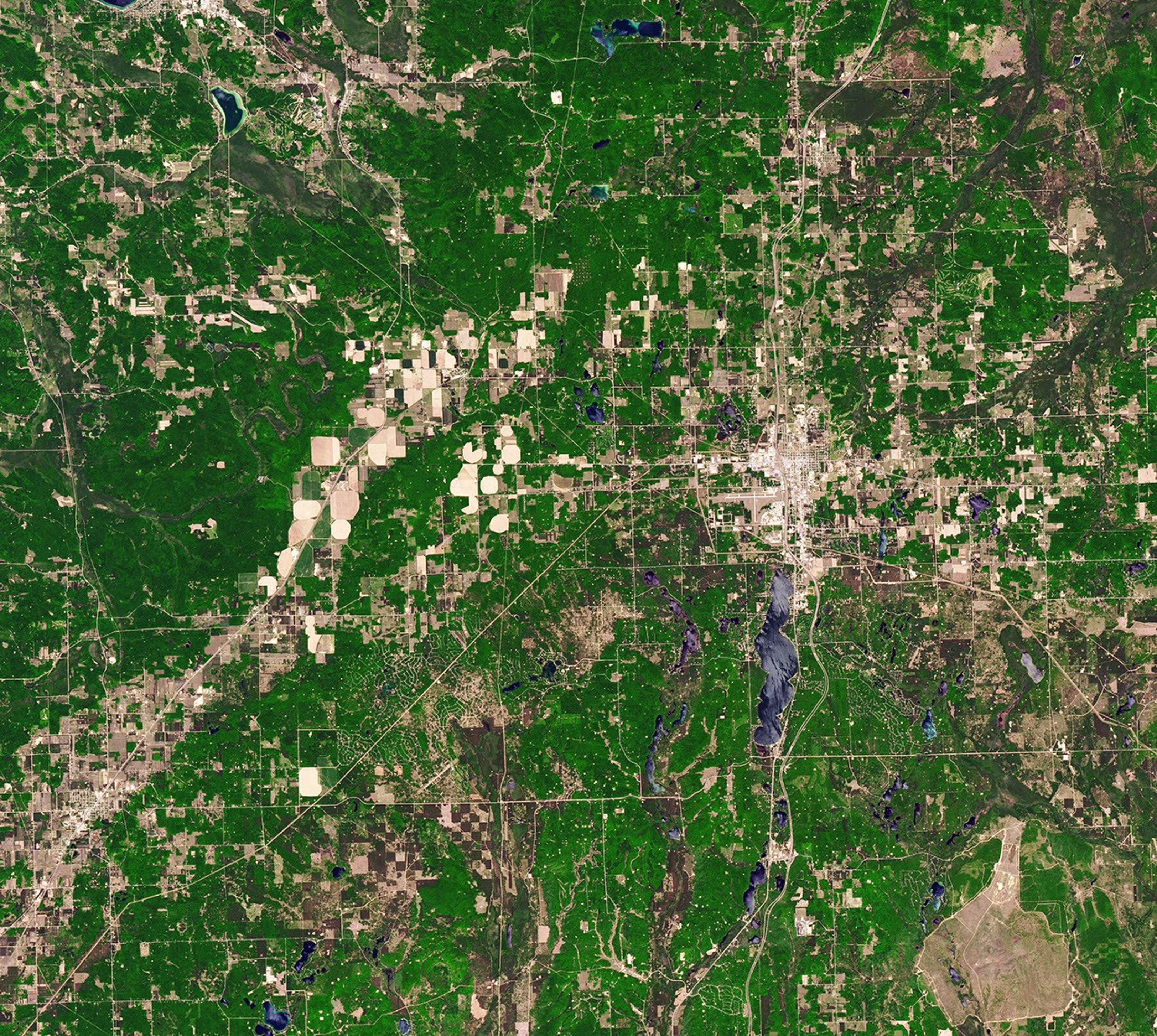
The Operational Land Imager (OLI) on Landsat 8 captured natural-color images (above) of Gaylord on June 2, 2022, and May 31, 2021. The map below is based on optical differences between those two images, with the area around the track highlighted to emphasize its location.

The line of destruction spanned 16.6 miles, cutting across forests, farmland, Gaylord’s commercial district, and residential neighborhoods. According to news reports, the tornado killed two people and injured 44 as it decimated a mobile home park, tore off roofs, and tossed vehicles. Preliminary estimates indicate that the storm caused several million dollars in damage.
Forecasters from the National Weather Service reported that weather balloon observations indicated conditions extremely favorable for tornado formation prior to the tornado touching down: strong wind shear, ample atmospheric instability, and a tendency for rising air to rotate. “It is very rare for this magnitude of all of these variables to come together at once across northern Michigan,” they noted.
Â
References & Resources
- Associated Press (2022, May 21) 2 dead; northern Michigan town cleans up from rare tornado. Accessed June 9, 2022.
- Detroit Free Press (2022, May 25) Gaylord tornado damage estimated in the millions as insurance company warns of repair delays. Accessed June 9, 2022.
- Midwestern Regional Climate Center (1950-2017) Tornado Tracks, 1950-2017. Accessed June 9, 2022.
- NOAAâs National Weather Service Tornadoes (1959-2020). Accessed June 9, 2022.
- NOAAâs National Weather Service (2022, May 20) Recap of Severe Weather: May 20th, 2022. Accessed June 9, 2022.
- WoodTV (2017, June 2) How the Great Lakes protect Michigan from severe weather. Accessed June 9, 2022.
- Yale Climate Connections (2022, May 23) At least 11 dead in wake of Michigan tornado, Canada derecho. Accessed June 9, 2022.
NASA Earth Observatory images by Joshua Stevens , using Landsat data from the U.S. Geological Survey and data from OpenStreetMap . Story by Adam Voiland .