
Animations
small animation (1.4 MB QuickTime)
large animation (2.5 MB QuickTime)
broadcast animation (105 MB QuickTime)
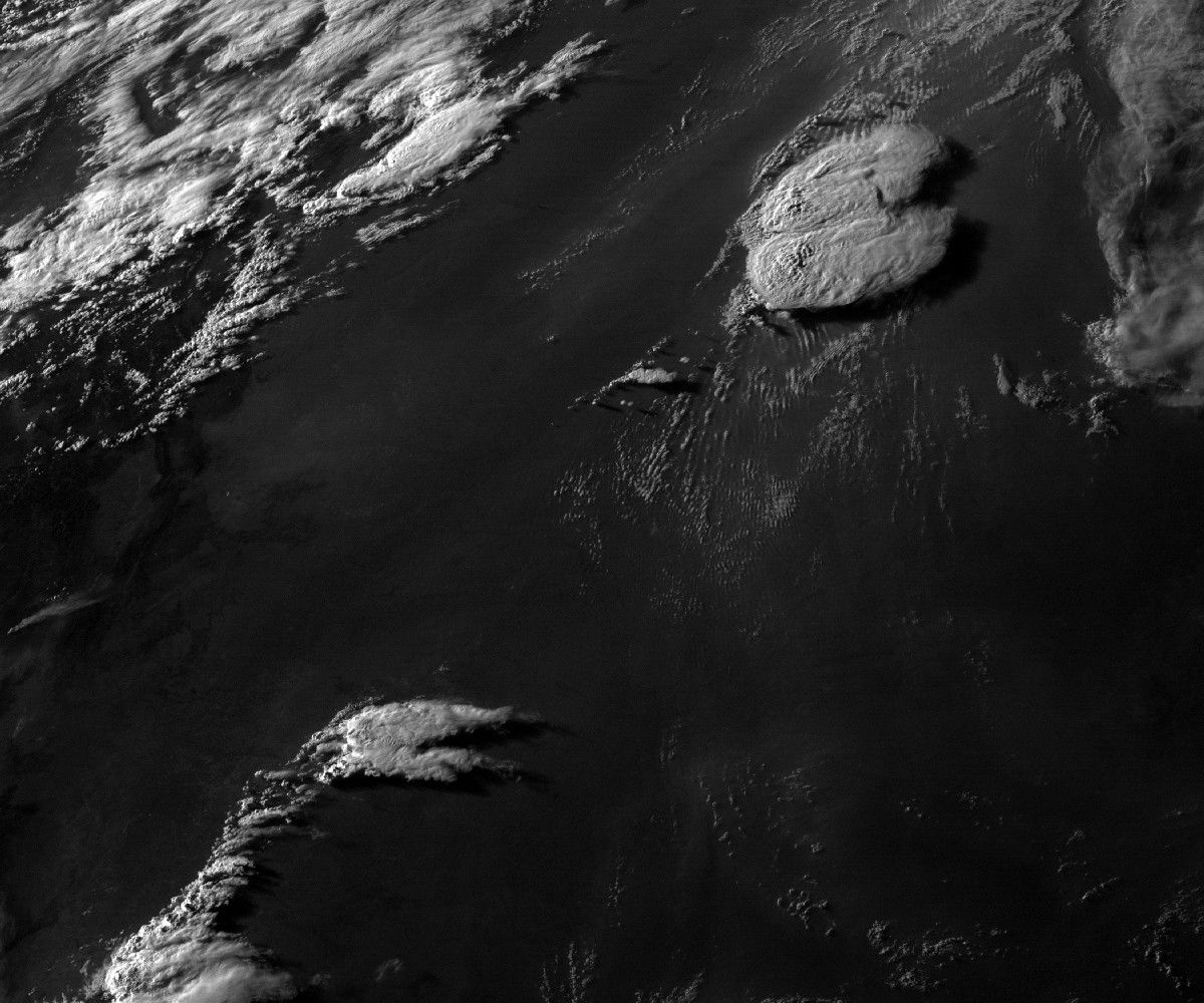
On the evening of Sunday, June 22, 2003, severe storms pounded southern Nebraska and northern Kansas with about a foot (30 cm) of rain, large hailstones, and at least seven tornadoes. The image above shows the tops of the thunderheads—with their characteristic “anvil clouds” extending eastward—at 7:15 p.m. central time.
The image above and accompanying animation were produced using NOAA Geostationary Operational Environmental Satellite (GOES) data. Shortly before this image was acquired, four tornadoes touched down around Deshler, Nebraska—a town of about 900 people located 75 miles (120 km) southwest of Lincoln. The twisters damaged or destroyed at least 100 homes and 25 businesses, according to local news reports.
References & Resources
Images courtesy NASA GOES Project Science Office. Animations by Robert Simmon.