





























CSDA Vendor - Satlantis
NASA's Commercial Satellite Data Acquisition (CSDA) program has acquired commercial datasets from Satlantis.
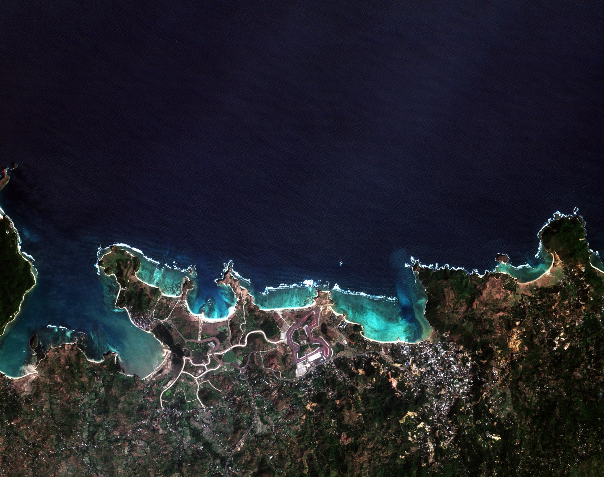
Satlantis’s GEISAT constellation, comprising the GEISAT‑P and HORACIO satellites, provides high–spatio‑temporal methane (CH₄) observations with simultaneous emitter geolocation. Each satellite simultaneously acquires co‑registered visible and near‑infrared (VNIR) and shortwave infrared (SWIR) imagery, allowing accurate attribution of detected plumes, providing straightforward identification of the emission sources.
In addition to methane detection, the synchronized VNIR–SWIR imagery supports a broad range of Earth observation applications. The constellation’s high revisit frequency and fine spatial resolution offer continuous monitoring of vegetation dynamics and land‑cover change. These measurements benefit a range of science and applications use cases including wildfire monitoring, precision agriculture, and coastal monitoring (e.g., harmful algal bloom detection) and more.
Obtaining Data
All newly awarded commercial data provider products are currently undergoing CSDA evaluation. If you have any questions about these products, please email CSDA Support.
Copyright
Data products and derivatives for imagery must contain copyright markings as specified below, where YYYY is the year of the image acquisition.
- For data products: “© Satlantis YYYY. All rights reserved.”
- For derivatives: “Includes copyrighted material of Satlantis. All rights reserved.”
- A joint copyright notice may be used as appropriate.
CSDA Acknowledgment
To help CSDA identify your publications, we request that you include the following acknowledgment when publishing work created using CSDA program data:
"This work utilized data made available through the NASA Commercial Satellite Data Acquisition (CSDA) Program."
Authorized users should send CSDA a courtesy copy of any publications that include CSDA-provided data.
Satlantis Data Available through NASA's CSDA Program
The GEISAT Constellation
| Mission Size Category | Micro (< 100 kg): The satellite is 20 centimetres wide and 40 centimetres high, with deployable solar panels and a total mass of 21 kg |
| Payload/Camera | The instrument is an iSIM 90 VNIR SWIR camera. The iSIM-90 instrument is the lightest and most compact optical payload of the iSIM family, able to provide imagery in the VNIR and SWIR spectral ranges, designed to fit 12U/16U CubeSat platforms, while keeping a high performance-to-mass ratio. iSIM 90 VNIR SWIR provides 10 spectral bands (1 panchromatic, 4 visible and near infrared, and 5 shortwave infrared), with high resolution: a resolution of 2 m in PAN and VNIR and 7 m in SWIR. |
| Ground sampling distance (nadir pointing) | PAN 2.0 m VNIR multispectral 2.0 m SWIR multispectral 7.0 m |
| Acquisition pixel pitch | 8, 12, 16 (configurable) |
| Swath width(nadir pointing) | PAN 13.0 km VNIR multispectral 13.0 km SWIR multispectral 8.3 km |
| Viewing angles | ± 30 degrees for nominal operations ±45 degrees roll for emergency operations |
| On-board Processing | Preliminary image processing performed onboard up to L1A (raw data cropped with ancillary metadata appended). The processing chain from L1A to level L2 is carried out on-ground. |
| Satellite Bus & Platform | 16U CubeSats with a total mass of 21 kg. Equipped with UHF and S-band communication transceivers, as well as an X-band transmitter. The platform includes a payload controller that interfaces between the payload and the satellite, and GaAs solar panels. Additionally, the platform features a flight computer with ADCS functionality, including a reaction wheel, magnetorquer, and GPS systems. |
| Main operational acquisition modes offered | They enable on-demand observations, including sporadic acquisitions of areas of interest, as well as systematic revisits of targets over time. |
Authorized Data Use and Users
Access to this data is governed by the CSDA End User License Agreements (EULAs). The minimum access level for data is the USG license. Depending on the specific data products provided, some or all data may also be available under higher-tier CSDA licenses, including USG‑Plus and Public licenses.
Under the applicable license tier, authorized users may include:
- U.S. Government federal employees
- State, local, territorial, and tribal government personnel
- U.S. Government contractors and subcontractors
- U.S. Government–funded researchers and academic partners
- Other users authorized under applicable CSDA license levels (USG, USG‑Plus, or Public)
All data use must comply with the terms of the EULA. All data requests must be reviewed and approved by NASA’s Commercial Satellite Data Acquisition (CSDA) program.
Top Banner Image: True-color (RGB) satellite image of the Mandalika International Street Circuit and surrounding coastal area on Lombok Island, Indonesia, acquired at 2.1-meter resolution on June 24, 2026, by Satlantis's HORACIO satellite. The image shows the circuit infrastructure, surrounding vegetation, beaches, rocky coastline, and turquoise to deep-blue waters of the Indian Ocean. Credit: © Satlantis 2026. All rights reserved.