- February 20, 2007 (3.4 MB)
- January 10, 2007 (3.5 MB)
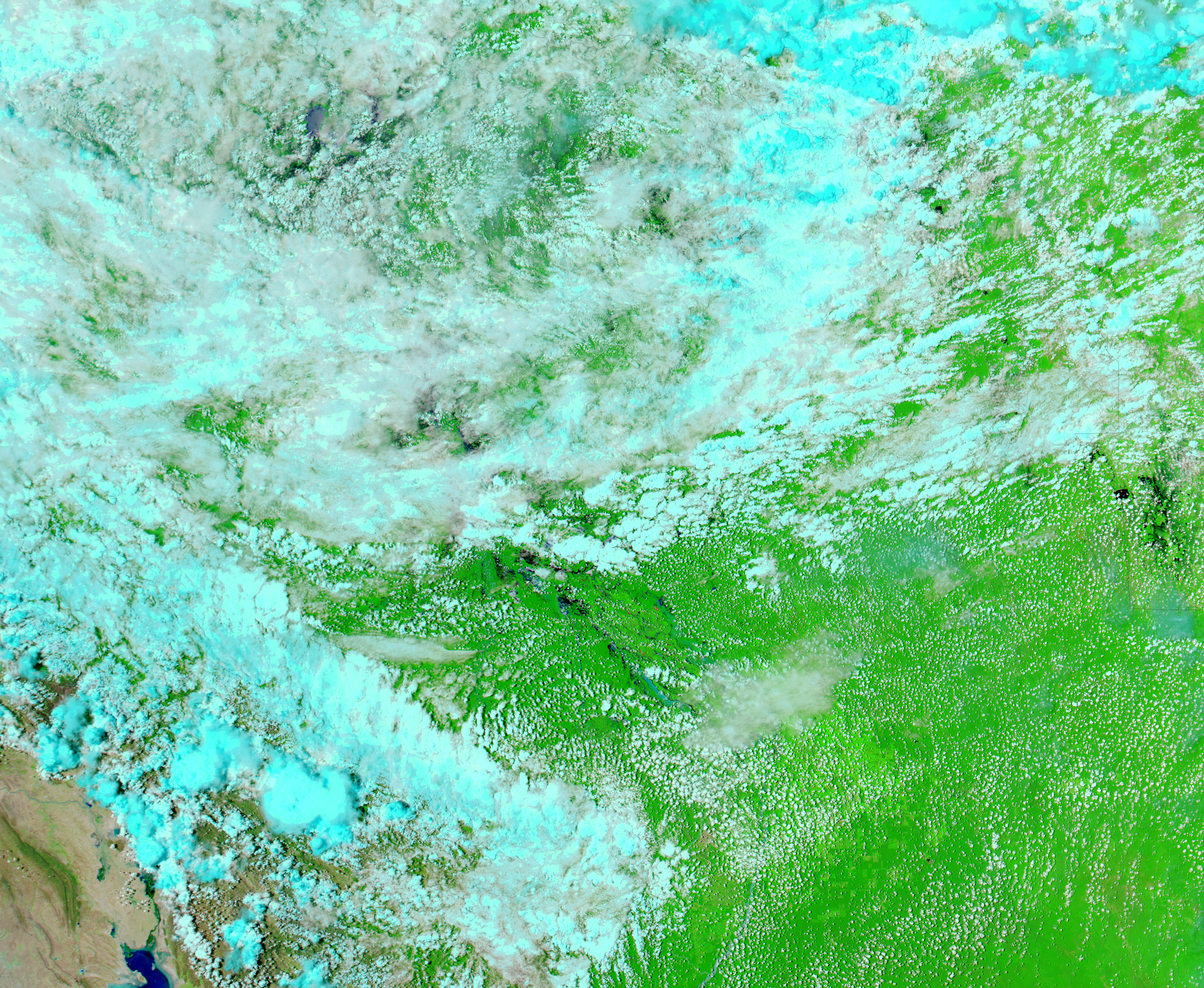
Months of unusually heavy rain, possibly related to El Niño conditions in the Pacific Ocean, brought deadly flooding to Bolivia in January and February 2007. The top image, collected by the Moderate Resolution Imaging Spectroradiometer (MODIS) on NASA’s Aqua satellite, shows swollen rivers and flooded wetlands in central Bolivia on February 20. The area shown here, near the border between the states of Beni and Santa Cruz, is among the most severely affected parts of Bolivia. The northwest-flowing rivers that run across the image feed into the Mamore River, which had been threatening to burst, reported the BBC on February 21. At least 35 people had died and 340,000 more had been affected by the floods as of February 20, said a separate BBC report.
Water ranges from black to light blue in these images, which were made with both infrared and visible light. Clear water is black, while sediment-laden water is lighter in color. Clouds are pale blue, and plant-covered land is green. Fires are outlined in red.
References & Resources
NASA images courtesy the MODIS Rapid Response Team at NASA GSFC.