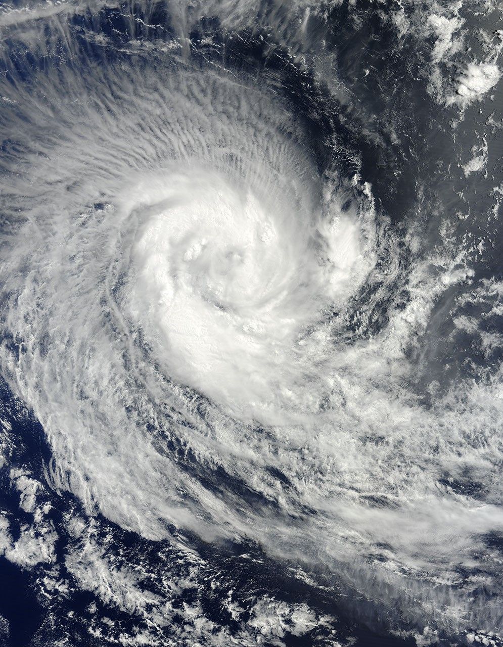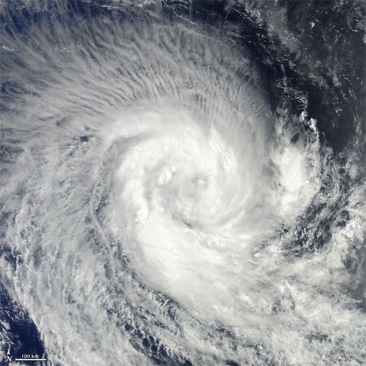
Tropical Cyclone Imani swirled over the southern Indian Ocean on March 24, 2010. The same day, the U.S. Navy’s Joint Typhoon Warning Center (JTWC) reported that the storm had maximum sustained winds of 55 knots (100 kilometers per hour) and gusts up to 70 knots (130 kilometers per hour). The storm was located roughly 745 nautical miles (1,380 kilometers) west-southwest of Cocos Island, having traveled toward the south-southwest for several hours.
The Moderate Resolution Imaging Spectroradiometer (MODIS) on NASA’s Terra satellite captured this natural-color image of the storm on March 24, 2010. Imani spans several hundred kilometers over the Southern Indian Ocean, producing thin, radial clouds on its northern margin. The storm occurs far from any major landmass.
The JTWC forecast that Imani would continue traveling toward the south-southwest until reaching mid-latitude. The storm was expected to eventually turn southward and weaken.
References & Resources
- Joint Typhoon Warning Center. (2010, March 24). Tropical Cyclone 21S (Imani) Warning. Accessed March 24, 2010.
NASA image courtesy Jeff Schmaltz, MODIS Rapid Response Team at NASA GSFC. Caption by Michon Scott.