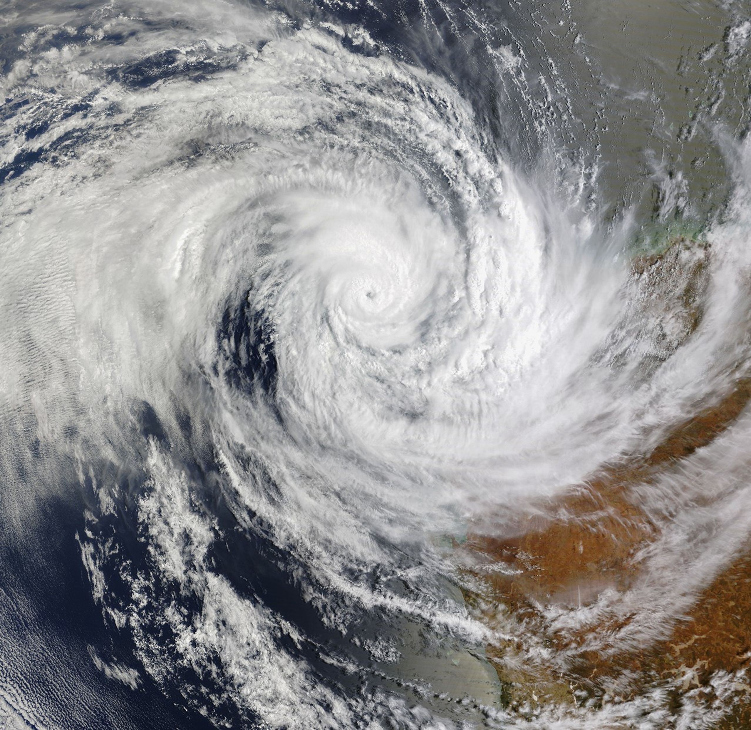


On January 17, 2025, a tropical low formed over the Indian Ocean off Western Australia. By January 19, the storm had strengthened into Tropical Cyclone Sean—the second tropical cyclone of Australia’s 2024–2025 season.
The MODIS (Moderate Resolution Imaging Spectroradiometer) on NASA’s Terra satellite acquired this image at about 10 a.m. local time (02:00 Universal Time) on January 20, 2025. Later that afternoon, the cyclone had reached its peak strength as a Category 4 storm.
The storm’s center stayed offshore as it tracked southwest over the Indian Ocean. Though Sean never made landfall, it battered the Pilbara coast with strong winds and rain. The Australian Bureau of Meteorology (BoM) reported that Karratha received 274.4 millimeters (10.8 inches) in a 24-hour period, breaking the city’s single-day rain record.
The storm flooded roads and homes, damaged power infrastructure, and prompted the closure of several ports. However, the storm also brought some relief from hot and humid conditions, according to news reports. Looking ahead, the abundant water could aid cattle station managers, allowing them to return their animals to grazing.
Australia’s tropical cyclone season runs from November through April, though storms can occur outside these months. According to the BoM, the 2024–2025 seasonal forecast called for an average number of tropical cyclones, though more of them are expected to be stronger than usual due to warm sea surface temperatures.
References & Resources
- Australian Broadcasting Corporation (2025, January 20) Rain from Tropical Cyclone Sean transforms Pilbara landscape. Accessed January 21, 2025.
- Australian Broadcasting Corporation (2025, January 19) Tropical Cyclone Sean downgraded to category three system as it moves away from WA coast. Accessed January 21, 2025.
- Australian Bureau of Meteorology (2025, January 22) Tropical Cyclone Information Bulletin. Accessed January 21, 2025.
- Australian Bureau of Meteorology (2025, January 21) Tropical Climate Update. Accessed January 21, 2025.
- Australian Bureau of Meteorology (2024, October 8) Australian tropical cyclone season long-range forecast for 2024 to 2025. Accessed January 21, 2025.
NASA Earth Observatory image by Michala Garrison, using MODIS data from NASA EOSDIS LANCE and GIBS/Worldview . Story by Kathryn Hansen.