Suggested Searches

1 min read

Tropical Storm Bonnie

Instruments:
Tropical Storm Bonnie
August 11, 2004

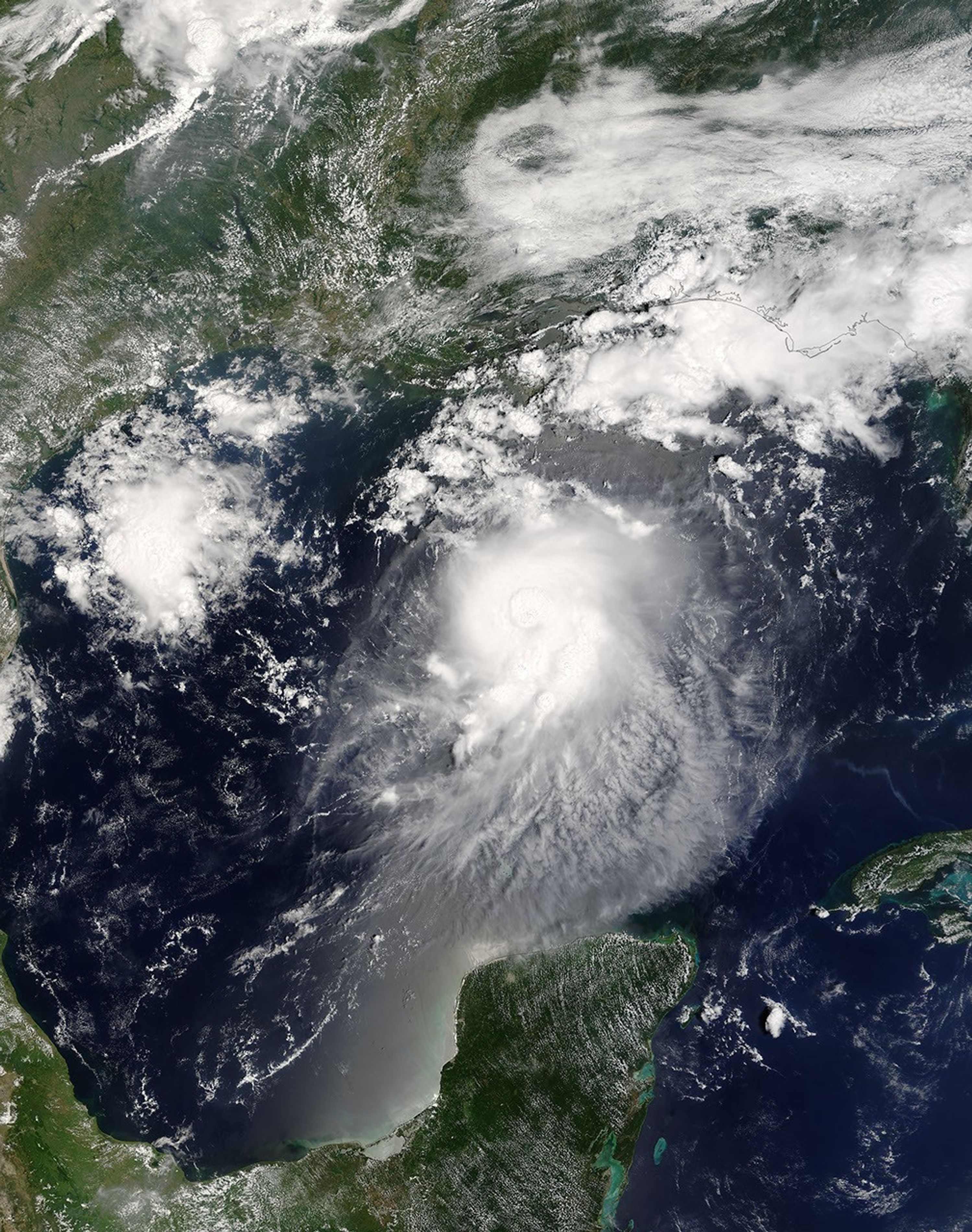
The MODIS instrument aboard NASA's Terra satellite captured this true-color image of Tropical Storm Bonnie on August 11 at 12:50 p.m. EDT. At the time this image was taken Bonnie had maximum sustained winds of 65 mph with an estimated minimum central pressure of 1000 millibars. Bonnie was expected to make landfall between Panama City and Apalachicola during the morning of August 12.

The high-resolution image provided above has a spatial resolution of 1-square-kilometer per pixel. The MODIS Rapid Response System provides this image at additional resolutions and formats.

References & Resources

Image courtesy Jacques Descloitres, MODIS Land Rapid Response Team at NASA GSFC.

You may also be interested in:

Stay up-to-date with the latest content from NASA as we explore the universe and discover more about our home planet.

Tropical Cyclone Narelle Crosses Australia
3 min read

The powerful storm lashed the northern edge of the continent with damaging winds and drenching rain as it made landfall…

Article
A Second Cyclone Slams Madagascar
3 min read

Widespread flooding affected tens of thousands of people after cyclones Fytia and Gezani drenched the island.

Article
A Glimpse of History in Benin City
3 min read

The ancient walls, ramparts, and ditches that wind through this Nigerian city are the longest known earthworks of the pre-mechanical…

Article