


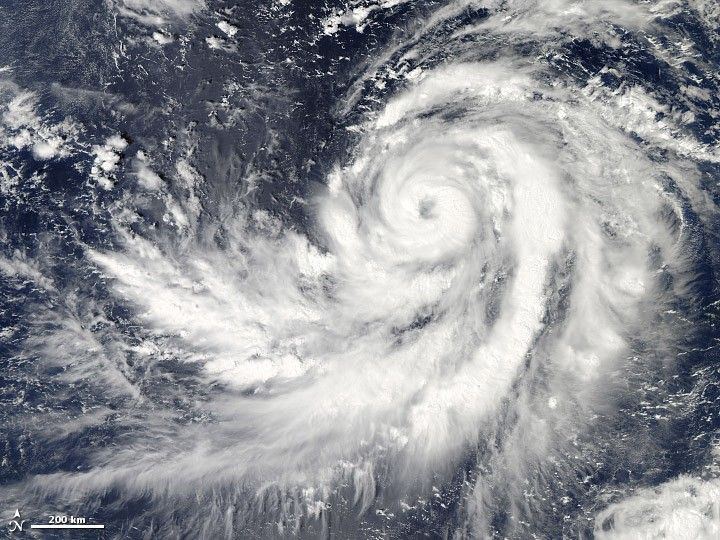
On October 17, 2013, Typhoon Francisco skirted Guam, but the storm was on a trajectory that could bring it toward Japan next week. The Moderate Resolution Imaging Spectroradiometer (MODIS) on NASA’s Aqua satellite acquired this image of the storm at 2:05 p.m. local time (4:05 UTC).
At the time, the storm had maximum sustained winds near 85 knots (157 kilometers/hour or 98 miles/hour) and was expected to strengthen. Francisco’s center was located about 147 nautical miles southwest of Guam, near 12.5° North and 143.1° East.
Weather Underground’s Jeff Masters noted that two of the best models predicted that Francisco will hit Japan on October 23-24, though model results are still quite uncertain that far into the future. This is the 27th named storm in the Pacific in 2013.
References & Resources
- AccuWeather (2013, October 17) Typhoon Francisco to Strengthen, Track Toward Japan Next Week. Accessed September 30, 2013.
- Joint Typhoon Warning Center (2013, October 17) Typhoon 26W. Accessed October 17, 2013.
- Weather Underground (2013, October 17) Category 2 Francisco Brushing Guam, and is a Long-Range Threat to Japan. Accessed October 17, 2013.
NASA images courtesy Jeff Schmaltz LANCE/EOSDIS MODIS Rapid Response Team, GSFC. Caption by Adam Voiland.


