November 25, 2003
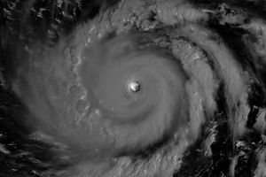
Typhoon Lupit moves through the North Pacific just east of Guam in this true-color Moderate Resolution Imaging Spectroradiometer (MODIS) image. At the time this image was taken on November 25, 2003, the storm boasted maximum sustained winds of 132 miles per hour (115 knots) with gusts up to 160 miles per hour (140 knots). The Aqua satellite recorded this image.
The high resolution image provided above is at 1 kilometer per pixel. The image is available in additional resolutions.
References & Resources
Image courtesy Jeff Schmaltz, MODIS Land Rapid Response Team at NASA GSFC